Old Maps of Hickman, Nebraska for Academic Research
Study the evolution of Hickman with 25 high-resolution historic maps. Whether you're teaching, researching, or modeling changes in land use, these maps provide essential visual documentation of urban, environmental, and geographic change.
- Analyze long-term change: Track patterns in development, transportation, and natural features.
- Ideal for environmental or urban studies: Support academic projects with primary historical map data.
- Use in the classroom or lab: Educators and researchers rely on these maps to bring historical context to life.
These maps are a powerful tool for teaching, research, and visualizing how Hickman has changed over the decades.
Hickman, NE maps
(25)- 1897 Map of Lincoln
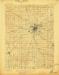 1897 Lincoln1897 Print · USGSLate-Victorian Nebraska comes into focus here as a bustling hub of steam and steel, centered on the capital. You can trace the early layouts of University Place and Bethany or locate rural landmarks like the Asylum, Lincoln Salt Lake, and the rail stop at Prairie Home.4 unique versions available
 - 1955 Map of Lincoln, 1967 Print
 1955 Lincoln1967 Print · USGSSoutheast Nebraska in the mid-fifties presents a landscape of thriving railroad towns and the expanding footprint of the capital city. Researchers can trace the legacy of the pioneer era at the Homestead National Monument of America or locate mid-century military infrastructure like Lincoln Air Force Base.5 unique versions available
 - 1957 Map of Lincoln
 1957 Lincoln1957 Print · USGSSoutheastern Nebraska at mid-century shows a landscape of thriving rail towns and expanding infrastructure centered on Lincoln. Researchers can trace the path of the Chicago Burlington and Quincy railroad through communities like Weeping Water, Fairmont, and Seward.
 - 1958 Map of Lincoln
 1958 Lincoln1958 Print · USGSSoutheast Nebraska at the end of the 1950s shows a region defined by agricultural trade and the expansion of the state capital. Genealogists can trace family footprints across the Blue Valley and locate landmarks like the Lincoln AFB or the U.S. Veterans Hospital.
 - 1964 Map of Cortland, 1965 Print
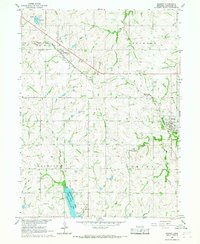
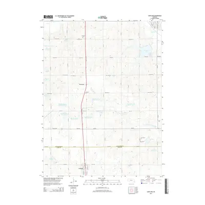
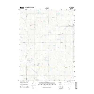
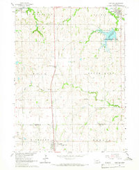 1964 Cortland1965 Print · USGSSoutheast Nebraska farmland is captured here in the mid-sixties, centered on the Union Pacific rail corridor between Hickman and Cortland. Genealogists and local historians can locate early landmarks like Stockfeldt Cem, Good Hope Sch, and the Stagecoach Lake recreation area.2 unique versions available
 - 1964 Map of Roca, 1965 Print
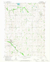
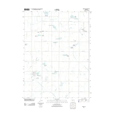
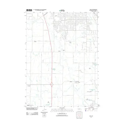
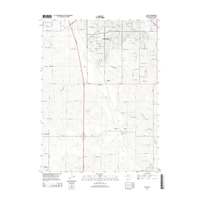
 1964 Roca1965 Print · USGSSoutheast of Lincoln in the mid-1960s, a dense network of five major railroads converges along the Salt Creek valley. Researchers can trace the heritage of local industry and education through Quarries near Roca and rural schoolhouses like Hedge Hill Sch.2 unique versions available
 - 1965 Map of Firth, 1966 Print
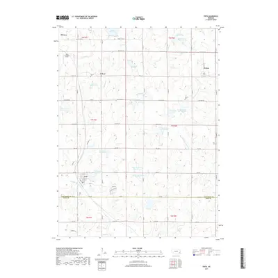
 1965 Firth1966 Print · USGSSoutheast of Lincoln in the mid-1960s, these rural townships were anchored by the rail lines and rivers that sustained local agriculture. Genealogists can locate several historic burial sites and congregations, including Pella Cem, St Johns Ch, and the settlement of Holland.
 - 1966 Map of Bennet, 1967 Print
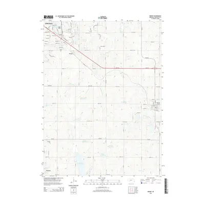
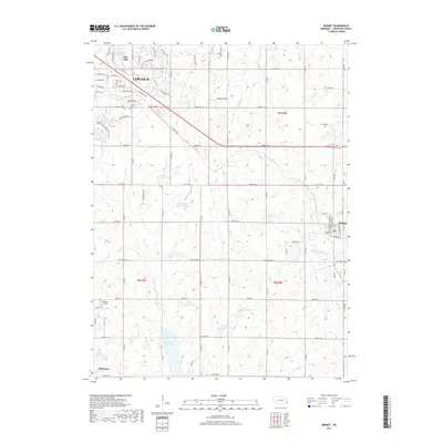
 1966 Bennet1967 Print · USGSSoutheast of Lincoln in the mid-sixties, this landscape showcases a rural rail-and-river economy centered on the Chicago Burlington and Quincy line. Researchers can trace family plots at Cheney Cem or explore the development of Wagon Train Lake.2 unique versions available
 - 1986 Map of Lincoln
 1986 Lincoln1986 Print · USGSMid-century development and the rail-and-river economy of southeastern Nebraska are clear in this 1980s survey. Researchers can trace the sprawling rail networks of the Burlington Northern and locate historic sites like Union College and the State Capitol.2 unique versions available
 - 2011 Map of Bennet, 2011 Print
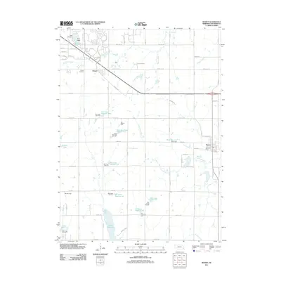 2011 Bennet2011 Print · USGSCovers Hickman, including Lincoln, Bennet, and other nearby areas
 - 2011 Map of Cortland, 2011 Print
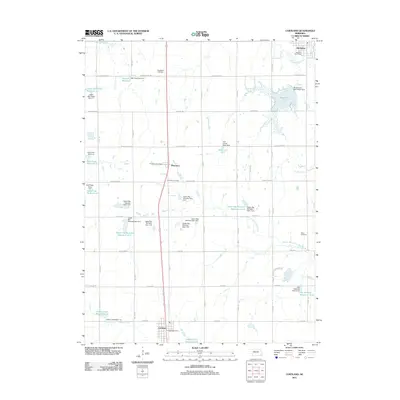 2011 Cortland2011 Print · USGSCovers Hickman, including Cortland, Sprague, and other nearby areas
 - 2011 Map of Firth, 2011 Print
 2011 Firth2011 Print · USGSCovers Hickman, including Firth, Panama, and other nearby areas
 - 2011 Map of Roca, 2011 Print
 2011 Roca2011 Print · USGSCovers Hickman, including Lincoln, Roca, and other nearby areas
 - 2014 Map of Bennet, 2014 Print
 2014 Bennet2014 Print · USGSCovers Hickman, including Lincoln, Bennet, and other nearby areas
 - 2014 Map of Cortland, 2014 Print
 2014 Cortland2014 Print · USGSCovers Hickman, including Cortland, Sprague, and other nearby areas
 - 2014 Map of Firth, 2014 Print
 2014 Firth2014 Print · USGSCovers Hickman, including Firth, Panama, and other nearby areas
 - 2014 Map of Roca, 2014 Print
 2014 Roca2014 Print · USGSCovers Hickman, including Lincoln, Roca, and other nearby areas
 - 2017 Map of Cortland, 2017 Print
 2017 Cortland2017 Print · USGSCovers Hickman, including Cortland, Sprague, and other nearby areas
 - 2017 Map of Roca, 2017 Print
 2017 Roca2017 Print · USGSCovers Hickman, including Lincoln, Roca, and other nearby areas
 - 2017 Map of Bennet, 2017 Print
 2017 Bennet2017 Print · USGSCovers Hickman, including Lincoln, Bennet, and other nearby areas
 - 2017 Map of Firth, 2017 Print
 2017 Firth2017 Print · USGSCovers Hickman, including Firth, Panama, and other nearby areas
 - 2021 Map of Bennet, 2021 Print
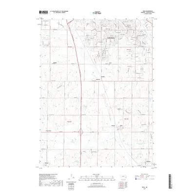
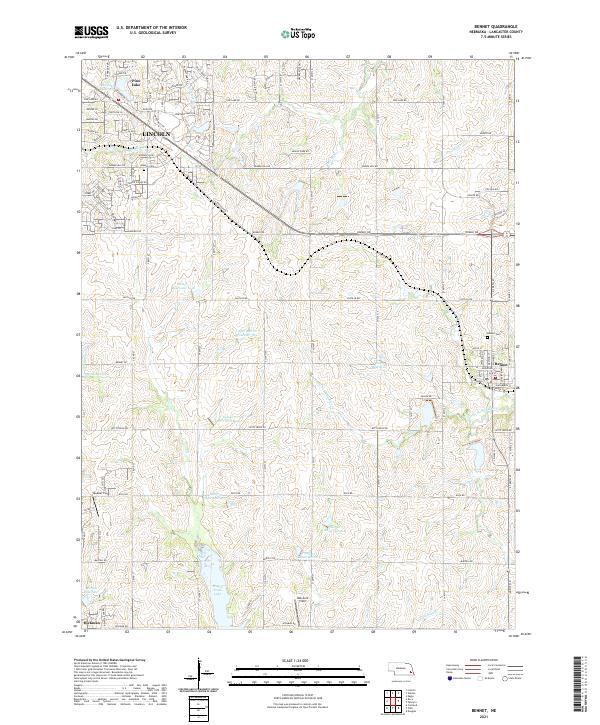 2021 Bennet2021 Print · USGSSoutheast of Lincoln in the early 2020s, this area showcases the intersection of expanding suburban streets and traditional Nebraska farmland. Genealogists and local historians can trace the vicinity of Bennet, the Cheney Cem, and recreational sites like Wagon Train Lake.
 - 2021 Map of Firth, 2021 Print
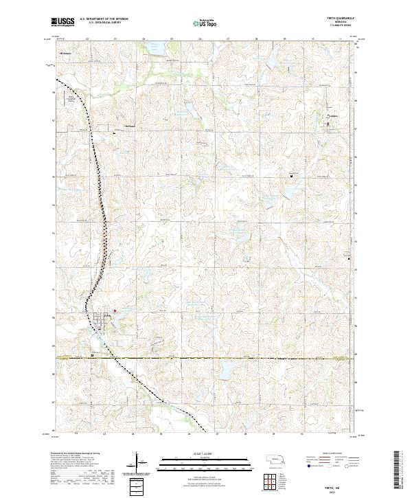 2021 Firth2021 Print · USGSAgricultural life in southern Nebraska flourishes among a network of modern reservoirs in the early 2020s. Researchers can locate family sites near Holland Cem, Panama Cem, or the Rusty Crankshaft Airport.
 - 2021 Map of Roca, 2021 Print
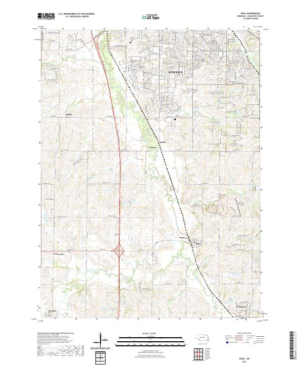 2021 Roca2021 Print · USGSSouthern Lancaster County is seen here during a period of modern growth and water management. Researchers can trace historic local sites like Simmons - Saltillo Cemetery and old settlements such as Jamaica, Saltillo, and Hanlon.
 - 2021 Map of Cortland, 2021 Print
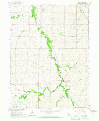
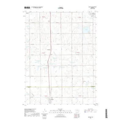
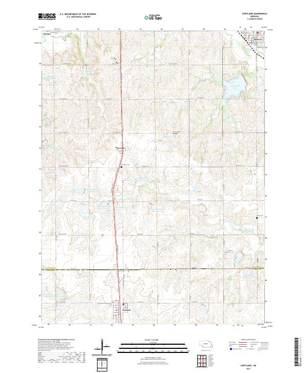 2021 Cortland2021 Print · USGSThe rural border of Lancaster and Gage Counties comes into focus in the early 2020s, centered on the growing corridor between Cortland and Hickman. Researchers can trace family history at Stockfeldt Cem or explore the extensive reservoir system including Stagecoach Lake and Salt Cr Reservoir 5-9.
End of results
Showing maps 1-25 of 25
Top cities near Hickman
- Lincoln historical maps
- Eagle historical maps
- Bennet historical maps
- Firth historical maps
- Hallam historical maps
- Cortland historical maps
See more
Frequently asked questions
- What are the different types of historical maps available for Hickman?
- What is the oldest map of Hickman?
- Where can I purchase historical maps of Hickman for my home or office?
- Where can I download high-res historical maps of Hickman?
- Are there historical topographic maps available for Hickman?
- Is there historical aerial imagery available for Hickman?
- Where are historical maps of Hickman sourced from?