1900s (20th Century) Maps of Highlands, Lincoln
Explore 8 historic maps of Highlands from the 1900s (20th Century). These maps offer a rare glimpse into what life looked like during the 1900s — showing old roads, neighborhoods, homes, and landmarks that have changed or disappeared over time.
Whether you're researching your family's past, planning a metal detecting trip, or studying how Highlands's landscape evolved across the 1900s, these high-resolution maps are a powerful tool for exploring the history of this region.
- Focus on a specific era: All maps on this page are from the 1900s, giving you a focused view of this time period.
- See what’s changed: Compare century-old streets, trails, and buildings to today's modern landscape using overlays and satellite layers.
- Research with precision: Use these maps for genealogy, historical research, land use analysis, or educational projects.
- View, download, or print: Maps are fully viewable online in high resolution, and can be downloaded or printed for your own records.
Start exploring Highlands's history through authentic maps from the 1900s. This is your window into the past.
Highlands, Lincoln maps
(8)- 1955 Map of Lincoln, 1967 Print
 1955 Lincoln1967 Print · USGSSoutheast Nebraska in the mid-fifties presents a landscape of thriving railroad towns and the expanding footprint of the capital city. Researchers can trace the legacy of the pioneer era at the Homestead National Monument of America or locate mid-century military infrastructure like Lincoln Air Force Base.5 unique versions available
 - 1957 Map of Lincoln
 1957 Lincoln1957 Print · USGSSoutheastern Nebraska at mid-century shows a landscape of thriving rail towns and expanding infrastructure centered on Lincoln. Researchers can trace the path of the Chicago Burlington and Quincy railroad through communities like Weeping Water, Fairmont, and Seward.
 - 1958 Map of Lincoln
 1958 Lincoln1958 Print · USGSSoutheast Nebraska at the end of the 1950s shows a region defined by agricultural trade and the expansion of the state capital. Genealogists can trace family footprints across the Blue Valley and locate landmarks like the Lincoln AFB or the U.S. Veterans Hospital.
 - 1964 Map of Davey, 1966 Print
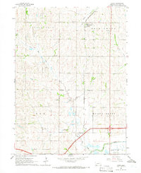 1964 Davey1966 Print · USGSNorth of Lincoln in the mid-1960s, this area of Lancaster County shows a landscape of traditional farming and rural education. Genealogists can locate family sites near Tothill Cem or trace the old rail-side life of Davey and School No 122.2 unique versions available
 - 1964 Map of Emerald, 1966 Print
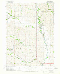
 1964 Emerald1966 Print · USGSThe western edge of the Nebraska capital was defined by military and recreational expansion in the early sixties. Researchers can trace the legacy of Lincoln Air Force Base, find local schools like School No 69, and locate St Johns Cem.3 unique versions available
 - 1964 Map of Raymond, 1966 Print
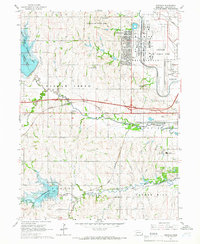
 1964 Raymond1966 Print · USGSThe area northwest of Lincoln comes alive in the mid-sixties, showing a landscape defined by meandering creek beds and vital rail connections. Researchers can trace family history through sites like St Pauls Cem or explore the footprint of Lincoln Air Force Base.2 unique versions available
 - 1964 Map of Lincoln, 1966 Print
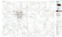
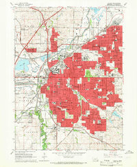 1964 Lincoln1966 Print · USGSMid-century Lincoln is captured here during a time of major institutional and military expansion. Genealogists and historians can trace the development of neighborhoods like University Place and Belmont or locate historic sites such as the State Penitentiary and Pioneers Park.3 unique versions available
 - 1986 Map of Lincoln
 1986 Lincoln1986 Print · USGSMid-century development and the rail-and-river economy of southeastern Nebraska are clear in this 1980s survey. Researchers can trace the sprawling rail networks of the Burlington Northern and locate historic sites like Union College and the State Capitol.2 unique versions available
End of results
Showing maps 1-8 of 8
Frequently asked questions
- What are the different types of historical maps available for Highlands?
- What is the oldest map of Highlands?
- Where can I purchase historical maps of Highlands for my home or office?
- Where can I download high-res historical maps of Highlands?
- Are there historical topographic maps available for Highlands?
- Is there historical aerial imagery available for Highlands?
- Where are historical maps of Highlands sourced from?