Old Maps of Avery, Bellevue for Metal Detecting
Plan your next treasure hunt with 11 historic maps of Avery. Find old homesites, ghost towns, trails, and gathering spots that may be lost to time — perfect for identifying promising metal detecting locations.
- Locate forgotten sites: Uncover places like long-lost settlements, abandoned rail lines, or gathering spots.
- Plan better hunts: Use map overlays combined with LiDAR or satellite views to narrow in on historically rich areas.
- Made for detectorists: Thousands of hobbyists use these maps to discover relics, coins, and hidden history.
Use these historic maps to boost your research and find new opportunities beneath the surface of Avery.
Avery, Bellevue maps
(11)- 1954 Map of Omaha, 1967 Print
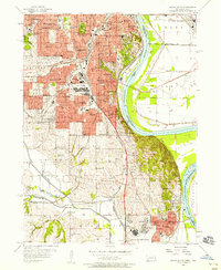
 1954 Omaha1967 Print · USGSMid-century development radiates from the river bluffs into the agricultural heartland during this period of post-war growth. Genealogists and historians can trace rail-connected towns like Atlantic and Red Oak or locate the sprawling grounds of Offutt Air Force Base and Manawa Lake.3 unique versions available
 - 1956 Map of Omaha South, 1958 Print
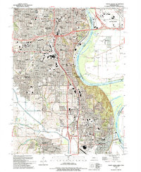
 1956 Omaha South1958 Print · USGSThe mid-century expansion of Omaha and Bellevue is captured here as neighborhoods pushed toward the Missouri River and massive rail yards. Researchers can trace family sites among dozens of landmarks like West Lawn Cemetery, Offutt Air Force Base, and South Omaha schools.6 unique versions available
 - 1957 Map of Omaha
 1957 Omaha1957 Print · USGSWestern Iowa and the Missouri River valley are seen here in the mid-fifties during the height of the rail-and-road era. Researchers can trace the sprawling rail lines of the Chicago And North Western or locate Cold War landmarks like Offutt Air Force Base.
 - 1958 Map of Omaha
 1958 Omaha1958 Print · USGSOmaha and Council Bluffs stand at the center of this mid-fifties landscape, where the Missouri River splits the urban plains of Nebraska from the rolling hills of western Iowa. Genealogists can trace the rail lines of the Wabash RR and Illinois Central RR to rural settlements like Missouri Valley and Red Oak.2 unique versions available
 - 1985 Map of Omaha
 1985 Omaha1985 Print · USGSMid-century development and heavy rail infrastructure define the Missouri River corridor between Nebraska and Iowa. Genealogists and local historians can trace the footprints of Offutt Air Force Base, Forest Lawn Cemetery, and the Iowa School for the Deaf.2 unique versions available
 - 1994 Map of Omaha South, 1995 Print
 1994 Omaha South1995 Print · USGSOmaha and Bellevue thrive along the Missouri River in the mid-nineties, showing a landscape defined by military aviation and dense neighborhood history. Researchers can trace local roots through numerous sites like St Johns Cem, Rosenblatt Stadium, and the extensive grounds of Offutt Air Force Base.
 - 2010 Map of Omaha South, 2010 Print
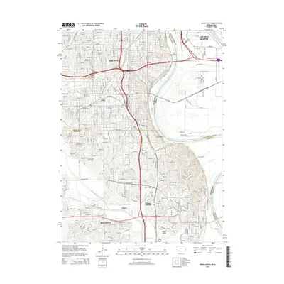
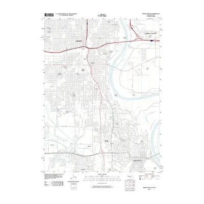 2010 Omaha South2010 Print · USGSCovers Avery, including Omaha, Council Bluffs, and other nearby areas
 - 2011 Map of Omaha South, 2011 Print
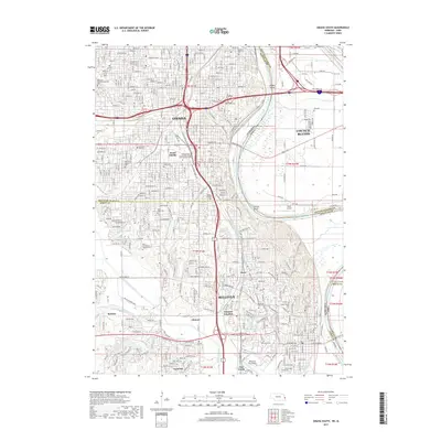
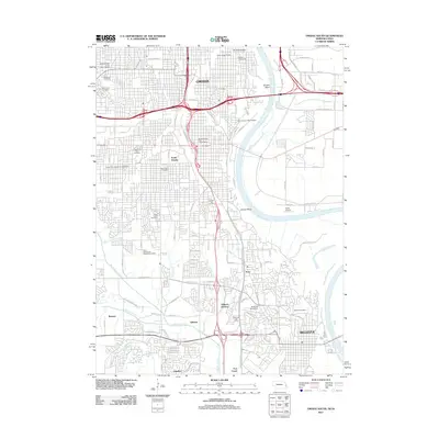 2011 Omaha South2011 Print · USGSCovers Avery, including Omaha, Council Bluffs, and other nearby areas
 - 2014 Map of Omaha South, 2014 Print
 2014 Omaha South2014 Print · USGSCovers Avery, including Omaha, Council Bluffs, and other nearby areas
 - 2017 Map of Omaha South, 2017 Print
 2017 Omaha South2017 Print · USGSCovers Avery, including Omaha, Council Bluffs, and other nearby areas
 - 2021 Map of Omaha South, 2021 Print
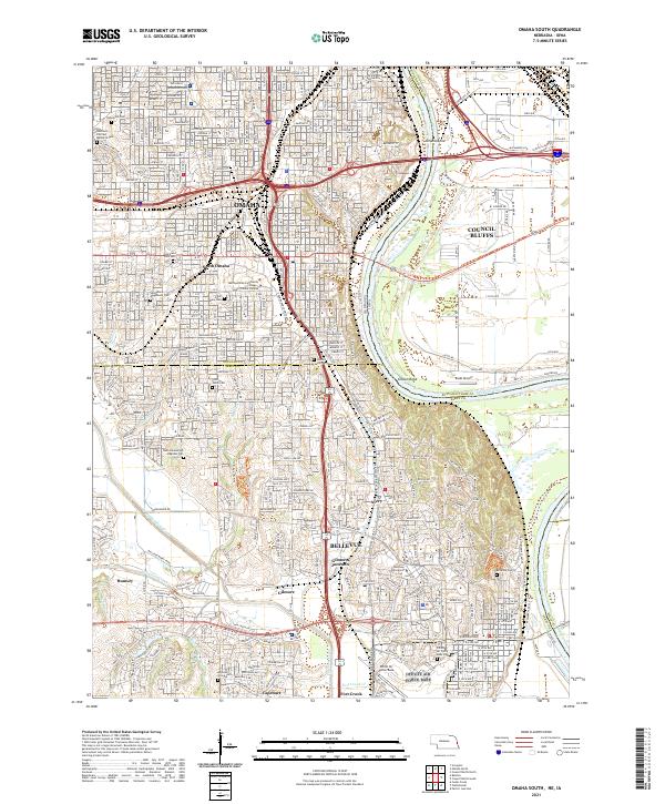 2021 Omaha South2021 Print · USGSGreater Omaha and Council Bluffs are captured here in the early twenty-first century as they span the river valley. Researchers can trace the extensive borders of Offutt Air Force Base or locate family plots in Graceland Park Cem and Bohemian Cem.
End of results
Showing maps 1-11 of 11
Frequently asked questions
- What are the different types of historical maps available for Avery?
- What is the oldest map of Avery?
- Where can I purchase historical maps of Avery for my home or office?
- Where can I download high-res historical maps of Avery?
- Are there historical topographic maps available for Avery?
- Is there historical aerial imagery available for Avery?
- Where are historical maps of Avery sourced from?