Old Maps of The Wildcat Estates, Scotts Bluff County
Explore 10 old maps of The Wildcat Estates, spanning from 1898 to today. These high-resolution historic maps reveal how streets, neighborhoods, landmarks, and natural features evolved over time — perfect for genealogy, metal detecting, research, and local history exploration.
What you can do with these maps:
- See how The Wildcat Estates changed over time: Compare historical maps to modern-day views to trace roads, homesites, rail lines & more.
- View detailed metadata: Each map includes creators, publishers, year, scale, and archive source.
- Overlay maps with satellite & LiDAR: Visualize the past alongside modern tools to explore terrain & human change.
- Trusted historical sources: Maps sourced from the USGS, Library of Congress, and other archives.
- Access maps your way: View online, download high-res files, or order prints for personal or research use.
Start exploring old maps of The Wildcat Estates to uncover forgotten places, hidden landmarks, and the deep history beneath your feet.
The Wildcat Estates, Scotts Bluff County maps
(10)- 1898 Map of Scotts Bluff
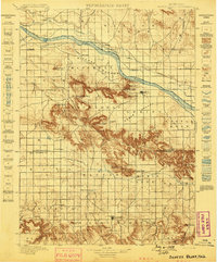 1898 Scotts Bluff1898 Print · USGSWestern Nebraska at the end of the century was a landscape of emerging irrigation and prominent landmarks. You can trace the development of early irrigation canals along the North Platte River and locate historic sites like Gering, Roubedeau Pass, and Castle Rock.5 unique versions available
 - 1954 Map of Scottsbluff, 1958 Print
 1954 Scottsbluff1958 Print · USGSThe Nebraska Panhandle's iconic landmarks and rail corridors are captured here during the mid-1950s. Researchers can trace the path of the North Platte River past Chimney Rock or locate the sprawling Sioux Ordnance Depot and the historic streets of Sidney.3 unique versions available
 - 1958 Map of Scottsbluff
 1958 Scottsbluff1958 Print · USGSThe Nebraska panhandle in the late fifties was a vital corridor of rail-and-river transport defined by the North Platte River and the Union Pacific. Genealogists and historians can trace rail stops like Reddus Station, explore the grounds of the Sioux Ordnance Depot, or locate landmarks like Chimney Rock.2 unique versions available
 - 1973 Map of Scotts Bluff 4 NW, 1974 Print
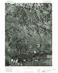 1973 Scotts Bluff 4 NW1974 Print · USGSBanner County in the early seventies is documented here through high-resolution aerial imagery rather than traditional line drawing. You can trace the path of the Fort Laramie Canal and the natural terrain around Hogback Mountain and Pumpkin Creek.
 - 1979 Map of Wildcat Mountain
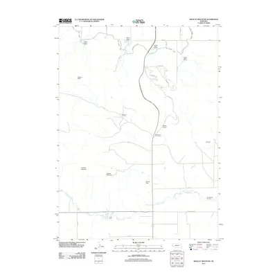
 1979 Wildcat Mountain1979 Print · USGSHigh plains ranching and energy extraction meet in the late 1970s along the Scotts Bluff and Banner County line. Trace local landmarks like Wildcat Mountain and Funnel Rock alongside the industrial footprint of the Henderson Oil Field.
 - 1985 Map of Scottsbluff, 1986 Print
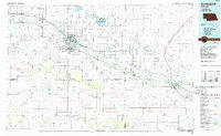 1985 Scottsbluff1986 Print · USGSThe North Platte River valley in the mid-1980s reveals a sophisticated network of irrigation and rail serving the Nebraska panhandle. Researchers can locate distinct landmarks like Chimney Rock, the campus of Nebraska Western College, and the remote settlement of Harrisburg.2 unique versions available
 - 2011 Map of Wildcat Mountain, 2011 Print
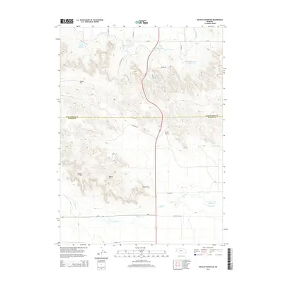
 2011 Wildcat Mountain2011 Print · USGSCovers The Wildcat Estates, including Scotts Bluff County, Banner County, and other nearby areas
 - 2014 Map of Wildcat Mountain, 2014 Print
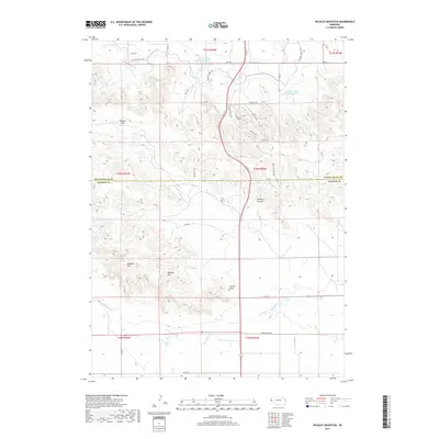
 2014 Wildcat Mountain2014 Print · USGSCovers The Wildcat Estates, including Scotts Bluff County, Banner County, and other nearby areas
 - 2017 Map of Wildcat Mountain, 2017 Print
 2017 Wildcat Mountain2017 Print · USGSCovers The Wildcat Estates, including Scotts Bluff County, Banner County, and other nearby areas
 - 2021 Map of Wildcat Mountain, 2021 Print
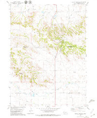
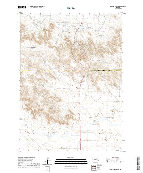 2021 Wildcat Mountain2021 Print · USGSThe high escarpments of the Nebraska Panhandle are captured here in the early twenty-first century, showing the rugged divide between the Scotts Bluff and Banner county lines. Trace historical land use and water engineering through features like the Fort Laramie Canal, Hogback Mountain, and the Gering Valley Reservoir system.
End of results
Showing maps 1-10 of 10
Frequently asked questions
- What are the different types of historical maps available for The Wildcat Estates?
- What is the oldest map of The Wildcat Estates?
- Where can I purchase historical maps of The Wildcat Estates for my home or office?
- Where can I download high-res historical maps of The Wildcat Estates?
- Are there historical topographic maps available for The Wildcat Estates?
- Is there historical aerial imagery available for The Wildcat Estates?
- Where are historical maps of The Wildcat Estates sourced from?