Old Maps of Welcome, Nevada for Academic Research
Study the evolution of Welcome with 9 high-resolution historic maps. Whether you're teaching, researching, or modeling changes in land use, these maps provide essential visual documentation of urban, environmental, and geographic change.
- Analyze long-term change: Track patterns in development, transportation, and natural features.
- Ideal for environmental or urban studies: Support academic projects with primary historical map data.
- Use in the classroom or lab: Educators and researchers rely on these maps to bring historical context to life.
These maps are a powerful tool for teaching, research, and visualizing how Welcome has changed over the decades.
Welcome, NV maps
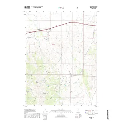
(9)- 1955 Map of Wells, 1966 Print
 1955 Wells1966 Print · USGSNortheastern Nevada's high basin-and-range country is documented here in the mid-fifties, showing a landscape of remote ranching outposts and massive federal forest lands. Researchers can locate the early mining districts at Delano Mines and trace the paths of the Southern Pacific railroad through settlements like Deeth and Cobre.4 unique versions available
 - 1958 Map of Wells
 1958 Wells1958 Print · USGSNortheastern Nevada's high desert and mountain ranges are documented here in the late fifties as the regional rail and ranching economy thrived. Genealogists and historians can trace the paths of the Southern Pacific railroad to remote stations at Cobre and Metropolis, or locate the high-altitude Delno Mines.
 - 1961 Map of Wells
 1961 Wells1961 Print · USGSNortheastern Nevada's high basin and range country is captured here during the early sixties, showing the vital rail corridors and ranching outposts. Researchers can trace the heritage of remote settlements like Metropolis, locate the Delano Mines, and follow the path of the Southern Pacific through the Pequop Mountains.
 - 1967 Map of Welcome, 1971 Print
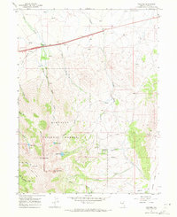 1967 Welcome1971 Print · USGSThe high Nevada desert meets the Humboldt Range during the late sixties as the interstate highway system and transcontinental railroads bisect the landscape. Researchers can trace historic routes like the Pack Trail or locate mid-century landmarks such as Angel Lake and the Powerplant on Trout Creek.2 unique versions available
 - 1981 Map of Double Mtn, 1982 Print
 1981 Double Mtn1982 Print · USGSElko County in the early eighties shows a high-desert landscape shaped by the Southern Pacific rail corridor and the basins of the Humboldt River. Genealogists and historians can trace the foundations of Metropolis or locate rural landmarks like Deeth, Welcome, and the Coal Mine in the Adobe Range.2 unique versions available
 - 2012 Map of Welcome, 2012 Print
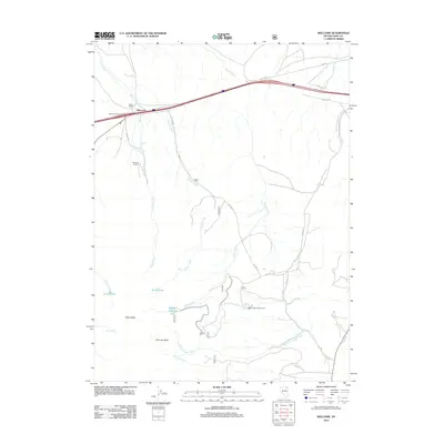 2012 Welcome2012 Print · USGSCovers Welcome, including Elko County, United States, and other nearby areas
 - 2015 Map of Welcome, 2015 Print
 2015 Welcome2015 Print · USGSCovers Welcome, including Elko County, United States, and other nearby areas
 - 2018 Map of Welcome, 2018 Print
 2018 Welcome2018 Print · USGSCovers Welcome, including Elko County, United States, and other nearby areas
 - 2021 Map of Welcome, 2021 Print
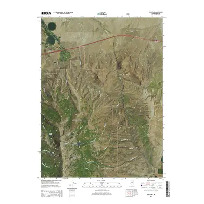
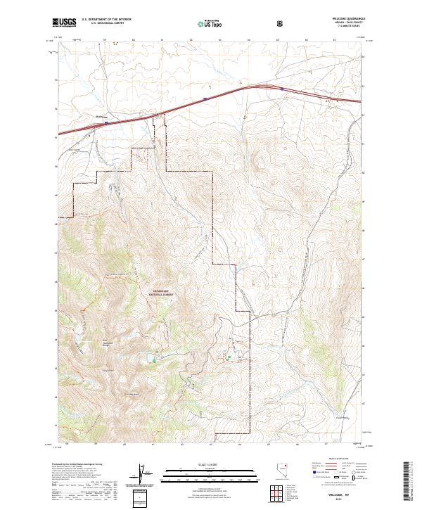 2021 Welcome2021 Print · USGSElko County at the start of the 2020s shows the dramatic rise from Starr Valley into the high East Humboldt Range. Outdoor enthusiasts and researchers can trace alpine routes like the East Humboldt Highline Trl to remote waters such as Angel Lake and Smith Lake.
End of results
Showing maps 1-9 of 9
Top cities near Welcome
Frequently asked questions
- What are the different types of historical maps available for Welcome?
- What is the oldest map of Welcome?
- Where can I purchase historical maps of Welcome for my home or office?
- Where can I download high-res historical maps of Welcome?
- Are there historical topographic maps available for Welcome?
- Is there historical aerial imagery available for Welcome?
- Where are historical maps of Welcome sourced from?