Old Maps of Galena Terrace Estates, Washoe County for Academic Research
Study the evolution of Galena Terrace Estates with 15 high-resolution historic maps. Whether you're teaching, researching, or modeling changes in land use, these maps provide essential visual documentation of urban, environmental, and geographic change.
- Analyze long-term change: Track patterns in development, transportation, and natural features.
- Ideal for environmental or urban studies: Support academic projects with primary historical map data.
- Use in the classroom or lab: Educators and researchers rely on these maps to bring historical context to life.
These maps are a powerful tool for teaching, research, and visualizing how Galena Terrace Estates has changed over the decades.
Galena Terrace Estates, Washoe County maps
(15)- 1891 Map of Carson
 1891 Carson1891 Print · USGSSilver mining and rail expansion dominate this late-century look at the Comstock Lode region, from the heights of Virginia to the capital at Carson. Researchers can trace the winding Virginia and Truckee Railroad and locate early sites like Gold Hill, Sutro, and the State Prison.
 - 1893 Map of Carson
 1893 Carson1893 Print · USGSThe Comstock Lode era is in full view here during the 1890s, centering on the silver mining centers and early rail networks of the Nevada territory. Trace the path of the Virginia and Truckee R.R. and locate historic sites like Sutro, Gold Hill, and the State Prison near Carson.9 unique versions available
 - 1950 Map of Mt. Rose, 1956 Print
 1950 Mt. Rose1956 Print · USGSMid-century Nevada comes into focus as the Reno area expands south toward the Washoe Valley and the high peaks of the Toiyabe National Forest. Genealogists and historians can trace old homesteads near Franktown, the Ophir Mill Site, and the grounds of the Bowers Mansion.3 unique versions available
 - 1952 Map of Mt. Rose
 1952 Mt. Rose1952 Print · USGSWashoe County at the start of the 1950s reveals a transition from alpine wilderness to valley ranching and early suburban growth. You can trace historical landmarks like the Ophir Mill Site, Bowers Mansion, and the winding path of the Truckee Ditch.
 - 1957 Map of Reno, 1963 Print
 1957 Reno1963 Print · USGSWestern Nevada in the early sixties is a land of sprawling desert sinks and rising mountain ranges. Genealogists and historians can trace the rail-and-river network connecting Reno, the mining legacy of Rawhide Mine, and the boundaries of the Pyramid Lake Indian Reservation.5 unique versions available
 - 1959 Map of Reno
 1959 Reno1959 Print · USGSWestern Nevada in the late fifties was a land of expanding military airbases and high-desert irrigation projects. You can trace the lineage of the Comstock era through Carson City, locate the Pony Express Monument, or study the rail networks of the Southern Pacific RR.
 - 1960 Map of Reno
 1960 Reno1960 Print · USGSThe high desert of western Nevada comes alive in this mid-century survey of the Reno-Tahoe region. Genealogists and historians can trace rail lines like the Southern Pacific RR and locate remote outposts such as Olinghouse, Nixon, and the Olinghouse Mine.2 unique versions available
 - 1968 Map of Washoe City, 1972 Print
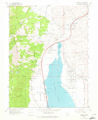 1968 Washoe City1972 Print · USGSWashoe Valley in the late sixties shows the evolving landscape of western Nevada between the forest and the desert basins. Researchers can trace early settlements and industry through the Ophir Mill Hist Marker, Union Mine, and the historic Franktown area.4 unique versions available
 - 1974 Map of Washoe City, 1977 Print
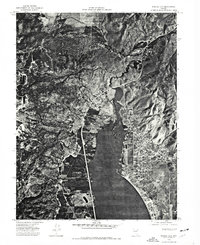 1974 Washoe City1977 Print · USGSWashoe Valley in the mid-1970s is seen here in sharp detail through aerial photography, showing the region's development between Reno and Carson City. Trace the residential layout of New Washoe City along the shores of Washoe Lake and the original site of Washoe City.
 - 1979 Map of Carson City, 1980 Print
 1979 Carson City1980 Print · USGSWestern Nevada in the late seventies reveals a landscape of historic mining districts and expanding mountain communities. Researchers can trace the Comstock Lode through Virginia City, locate the Stewart Indian School, or explore the shores of Lake Tahoe near Incline Village.2 unique versions available
 - 1994 Map of Washoe City
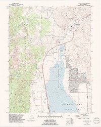 1994 Washoe City1994 Print · USGSThe Washoe Valley in the mid-nineties shows the balance between Comstock-era ruins and new suburban growth. Researchers can trace historic sites like the Ophir Mill Hist Marker and Union Mine or locate family plots in Franktown Cem and Whispering Pines Cem.2 unique versions available
 - 2012 Map of Washoe City, 2012 Print
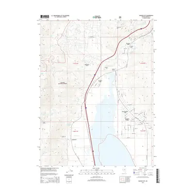
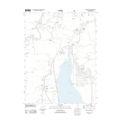 2012 Washoe City2012 Print · USGSCovers Galena Terrace Estates, including New Washoe City, Pleasant Valley, and other nearby areas
 - 2014 Map of Washoe City, 2014 Print
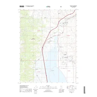
 2014 Washoe City2014 Print · USGSCovers Galena Terrace Estates, including New Washoe City, Pleasant Valley, and other nearby areas
 - 2018 Map of Washoe City, 2018 Print
 2018 Washoe City2018 Print · USGSCovers Galena Terrace Estates, including New Washoe City, Pleasant Valley, and other nearby areas
 - 2021 Map of Washoe City, 2021 Print
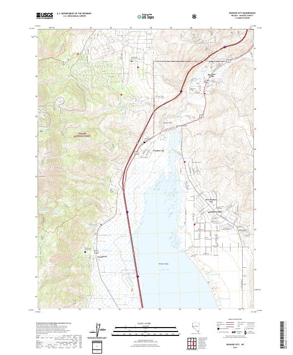 2021 Washoe City2021 Print · USGSWashoe Valley and the eastern Sierra foothills come into focus in this recent study of Nevada's high-desert settlements. Genealogists can trace family sites near Washoe City Cemetery and Franktown, or locate landmarks like Bowers Mansion Hot Spring.
End of results
Showing maps 1-15 of 15
Frequently asked questions
- What are the different types of historical maps available for Galena Terrace Estates?
- What is the oldest map of Galena Terrace Estates?
- Where can I purchase historical maps of Galena Terrace Estates for my home or office?
- Where can I download high-res historical maps of Galena Terrace Estates?
- Are there historical topographic maps available for Galena Terrace Estates?
- Is there historical aerial imagery available for Galena Terrace Estates?
- Where are historical maps of Galena Terrace Estates sourced from?