1990s Maps of Shelburne, New Hampshire
Explore 4 historic maps of Shelburne from the 1990s. These maps offer a rare glimpse into what life looked like during the 1990s — showing old roads, neighborhoods, homes, and landmarks that have changed or disappeared over time.
Whether you're researching your family's past, planning a metal detecting trip, or studying how Shelburne's landscape evolved across the 1990s, these high-resolution maps are a powerful tool for exploring the history of this region.
- Focus on a specific era: All maps on this page are from the 1990s, giving you a focused view of this time period.
- See what’s changed: Compare century-old streets, trails, and buildings to today's modern landscape using overlays and satellite layers.
- Research with precision: Use these maps for genealogy, historical research, land use analysis, or educational projects.
- View, download, or print: Maps are fully viewable online in high resolution, and can be downloaded or printed for your own records.
Start exploring Shelburne's history through authentic maps from the 1990s. This is your window into the past.
Shelburne, NH maps
(4)- 1995 Map of Carter Dome, 2000 Print
 1995 Carter Dome2000 Print · USGSThe high peaks and forest grants of the White Mountains are shown here in the mid-nineties, capturing a landscape of alpine recreation and timber-era boundaries. Researchers can trace the Appalachian National Scenic Trail past the Carter Notch Hut and locate historical landmarks like Glen House.
 - 1995 Map of Wild River, 2000 Print
 1995 Wild River2000 Print · USGSThe White Mountains come alive in the 1990s as this map traces the intricate trail networks and wilderness reaches across the New Hampshire and Maine state line. Researchers can locate remote landmarks like the Brickett Place or trace the Appalachian Trail as it passes Middle Moriah Mountain.
 - 1995 Map of Shelburne, 2001 Print
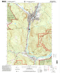
 1995 Shelburne2001 Print · USGSThe northern New Hampshire border and the Wild River territory come alive in the mid-1990s as the Androscoggin River valley meets the high peaks. Hikers and historians can trace the Appalachian Scenic Trail past Gentian Pond and locate the historic Hazelton Cem near Shelburne.
 - 1995 Map of Berlin, 2001 Print
 1995 Berlin2001 Print · USGSThe industrial corridor of the North Country comes into sharp focus during the 1990s as the Androscoggin River winds through the mill towns. Genealogists and local historians can trace the foundations of these communities through landmarks like Notre Dame High Sch, City Cemetery, and the St Lawrence and Atlantic RR.
End of results
Showing maps 1-4 of 4
Top cities near Shelburne
- Berlin historical maps
- Gorham historical maps
- Bethel historical maps
- Milan historical maps
- Lovell historical maps
- Jackson historical maps
See more
Frequently asked questions
- What are the different types of historical maps available for Shelburne?
- What is the oldest map of Shelburne?
- Where can I purchase historical maps of Shelburne for my home or office?
- Where can I download high-res historical maps of Shelburne?
- Are there historical topographic maps available for Shelburne?
- Is there historical aerial imagery available for Shelburne?
- Where are historical maps of Shelburne sourced from?