Old Maps of Stewartstown, New Hampshire for Genealogy
Trace your family roots with 50 historic maps of Stewartstown. These high-res maps reveal old neighborhoods, homesites, landmarks, and streets — helping you uncover where your ancestors lived and how the area evolved over time.
- Explore historic neighborhoods: Identify where your relatives may have lived in the 1800s or 1900s.
- Compare maps over time: Trace the changes in streets, buildings, and landmarks for multi-generational research.
- Perfect for genealogy & ancestry research: Used by family historians and researchers to map out lineage and migration.
These maps are an incredible resource for exploring your personal connection to Stewartstown's past.
Stewartstown, NH maps
(50)- 1925 Map of Indian Stream
 1925 Indian Stream1925 Print · USGSThe northern tip of New Hampshire is captured here in the mid-1920s, showing a rugged territory of logging camps and border schools. Researchers can trace the lineage of remote settlements through Indian Stream School, Greeleys Camp, and the community at Happy Corner.
 - 1926 Map of Indian Stream
 1926 Indian Stream1926 Print · USGSUpper Coos County at the Canadian border comes alive in this survey of northern New Hampshire's timberlands and early settlements. Genealogists and historians can trace rural schoolhouses like Wheeler School and Indian Stream School, or locate old camps such as Happy Corner and Depot Camp.4 unique versions available
 - 1927 Map of Indian Stream
 1927 Indian Stream1927 Print · USGSThe northern reaches of Coos County are captured here in the mid-1920s, showing the remote borderlands between New Hampshire and Canada. Genealogists and historians can locate rural landmarks like the Clarksville Town Hall, the Wheeler School, and numerous timber camps like Varney Camp.5 unique versions available
 - 1929 Map of Averill
 1929 Averill1929 Print · USGSThe northern borderlands of Vermont and New Hampshire appear here during the peak of the region's timber era. Trace the industrial landscape of the Maine Central RR and early logging outposts like Camp No 10 and Buzzell Dam.5 unique versions available
 - 1930 Map of Dixville, 1954 Print
 1930 Dixville1954 Print · USGSNorthern New Hampshire at the start of the 1930s reveals a landscape of isolated hill farms and small timber towns. Genealogists can locate family-named landmarks like Piper Hill Cem and numerous district schools including Cedar Brook Sch and Forbes Sch.5 unique versions available
 - 1933 Map of Dixville
 1933 Dixville1933 Print · USGSCoos County's rugged North Country is captured in the early 1930s, documenting a landscape of remote timber camps and hillside schoolhouses. Genealogists can trace family landmarks like the East Colebrook Ch, Bungy, and over a dozen named schools including Bear Rock Sch.2 unique versions available
 - 1934 Map of Dixville
 1934 Dixville1934 Print · USGSThe White Mountains of Coos County appear here in the early 1930s, showing a landscape defined by timber camps and rural school districts. Genealogists can trace family roots through landmarks like Stewartstown Hollow, East Columbia Ch, and several mountain camps including Carr Camp.2 unique versions available
 - 1949 Map of Jackman
 1949 Jackman1949 Print · USGSThe Quebec and Maine borderlands are shown in great detail during the late 1940s, highlighting the industrial and natural geography of the region. Trace old rail lines like the Canadian Pacific and locate settlements from Sherbrooke to Scotstown.2 unique versions available
 - 1950 Map of Lewiston
 1950 Lewiston1950 Print · USGSThe Maine and New Hampshire borderlands come alive in this post-war survey of the White Mountains and Androscoggin valley. Genealogists and historians can trace rail lines like the Maine Central Railroad and find high-altitude landmarks from Mount Washington to Bretton Woods.2 unique versions available
 - 1953 Map of Averill, 1954 Print
 1953 Averill1954 Print · USGSThe northern edge of Vermont and New Hampshire meets the Quebec border in this mid-century portrait of a river-and-rail economy. Researchers can trace family sites from the Alice Hunt Cemetery to the crossing at Columbia Bridge and the logging camps of Lemington.5 unique versions available
 - 1956 Map of Lewiston, 1975 Print
 1956 Lewiston1975 Print · USGSThe Northern New England interior is documented here in the mid-fifties, from the industrial Androscoggin River to the high peaks of the White Mountains. Trace the Grand Trunk Railway through mountain passes or locate family landmarks near Sabbathday Lake and Bretton Woods.
 - 1961 Map of Lewiston
 1961 Lewiston1961 Print · USGSWestern Maine and the White Mountains appear here during the early sixties, showing the industrial river towns and vast timberlands before the modern interstate era. Genealogists and historians can trace the Grand Trunk RR through Berlin or locate landmarks like Old Speck Mountain and Elephant Mountain.
 - 1962 Map of Lewiston
 1962 Lewiston1962 Print · USGSThe industrial river valleys and high peaks of Maine and New Hampshire define the region in the early sixties. Trace the rail-and-river network from Lewiston to the White Mountains, passing through mill towns like Berlin and Rumford.
 - 1963 Map of Jackman
 1963 Jackman1963 Print · USGSThe international borderlands of Maine and Quebec come alive in the mid-twentieth century, showing a landscape of timber towns and rail connections. Genealogists and historians can trace the paths of the Canadian Pacific Railway through Jackman or locate families in Sherbrooke and Megantic.
 - 1966 Map of Sherbrooke
 1966 Sherbrooke1966 Print · USGSThe borderlands of Quebec and Maine come alive in the mid-1960s, documenting the industrial towns and deep woods of the Northeast. Genealogists can trace family lines through Sherbrooke and Coaticook, or locate remote logging outposts along the Moose River and Flagstaff Lake.
 - 1969 Map of Lewiston
 1969 Lewiston1969 Print · USGSThe northern New England highlands come into focus during the mid-fifties, showing the vital rail and river networks connecting industrial centers to the deep woods. Researchers can trace the path of the Grand Trunk RR or locate landmarks like Mt Washington and Rangeley Lake.
 - 1976 Map of Sherbrooke
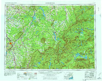 1976 Sherbrooke1976 Print · USGSThe northern Maine woods and Quebec’s Eastern Townships meet in this mid-century survey of the rugged international borderlands. Genealogists and historians can trace rail-and-river connections through Thetford Mines, follow the Dead River to Flagstaff Lake, or locate small border crossings at Stanhope and Beecher Falls.2 unique versions available
 - 1986 Map of Groveton
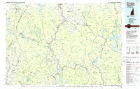 1986 Groveton1986 Print · USGSThe North Country's rugged borderlands come into focus in the mid-1980s, tracing the river-and-rail corridors of the Connecticut River valley. Genealogists and historians can locate family landmarks in North Stratford, Groveton, and Guildhall or trace the Canadian National RR.2 unique versions available
 - 1986 Map of Sherbrooke
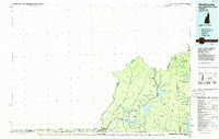 1986 Sherbrooke1986 Print · USGSThe Great North Woods of the mid-eighties appear in detail across this survey of the New Hampshire and Canadian borderlands. Researchers can trace the entire chain of the First Connecticut Lake through the fourth, alongside remote settlements like Pittsburg and Beecher Falls.2 unique versions available
 - 1989 Map of Pittsburg
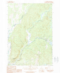 1989 Pittsburg1989 Print · USGSNorthern New Hampshire's river-border country is captured here during the late eighties, showing the headwaters of the Connecticut River. Researchers can trace the varied terrain of Tabor Notch, the infrastructure of Lake Francis, and remote settlements like Pittsburg and Clarksville.3 unique versions available
 - 1989 Map of Diamond Pond
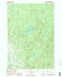 1989 Diamond Pond1989 Print · USGSCoos County’s high timberlands and headwaters are captured here in the late eighties, showing a landscape shaped by forestry and northern recreation. Researchers can trace remote camps and early settlements like Felton Camp, Upper Kidderville, and Old Ramsay Camp among the peaks of Tumble Dick Mountain.2 unique versions available
 - 1989 Map of Monadnock Mountain
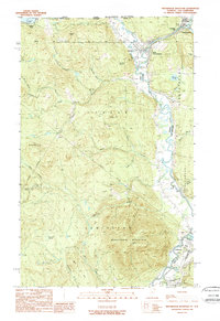 1989 Monadnock Mountain1989 Print · USGSThe northern borderlands of Vermont and New Hampshire come into focus in the late eighties, centered on the Connecticut River valley. Genealogists can trace the rural layout of Beecher Falls, Stewartstown, and Canaan near the Canada line.
 - 1989 Map of Lovering Mountain
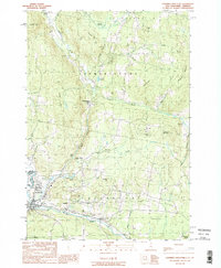 1989 Lovering Mountain1989 Print · USGSThe northern reaches of the Connecticut River valley are captured here in the late eighties as they cross from New Hampshire into Vermont. Researchers can trace local landmarks like Beaver Brook Falls, the Mohawk River, and the settlement of Stewartstown Hollow.2 unique versions available
 - 1996 Map of Lovering Mountain, 2000 Print
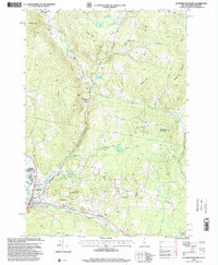 1996 Lovering Mountain2000 Print · USGSNorthern Coos County is shown in the mid-1990s as the regional landscape supported both forest management and recreation. Researchers can trace the layout of Colebrook, find the Fish Hatchery, and locate local landmarks such as Stewartstown Hollow or Beaver Brook Falls.
 - 1996 Map of Diamond Pond, 2000 Print
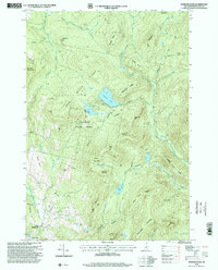 1996 Diamond Pond2000 Print · USGSCoos County at the close of the twentieth century shows a landscape of mountain ridges and remote forest camps. Genealogists and outdoor historians can trace the paths between Kidderville, the recreational reaches of Coleman State Park, and family landmarks like Ramsay Camp.
Showing maps 1-25 of 50
Top cities near Stewartstown
- Colebrook historical maps
- Pittsburg historical maps
- Stratford historical maps
- Columbia historical maps
- Canaan historical maps
- Errol historical maps
See more
Top neighborhoods of Stewartstown
Frequently asked questions
- What are the different types of historical maps available for Stewartstown?
- What is the oldest map of Stewartstown?
- Where can I purchase historical maps of Stewartstown for my home or office?
- Where can I download high-res historical maps of Stewartstown?
- Are there historical topographic maps available for Stewartstown?
- Is there historical aerial imagery available for Stewartstown?
- Where are historical maps of Stewartstown sourced from?