Old Maps of King's Grant, Lebanon for Metal Detecting
Plan your next treasure hunt with 14 historic maps of King's Grant. Find old homesites, ghost towns, trails, and gathering spots that may be lost to time — perfect for identifying promising metal detecting locations.
- Locate forgotten sites: Uncover places like long-lost settlements, abandoned rail lines, or gathering spots.
- Plan better hunts: Use map overlays combined with LiDAR or satellite views to narrow in on historically rich areas.
- Made for detectorists: Thousands of hobbyists use these maps to discover relics, coins, and hidden history.
Use these historic maps to boost your research and find new opportunities beneath the surface of King's Grant.
King's Grant, Lebanon maps
(14)- 1906 Map of Hanover, 1956 Print
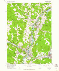
 1906 Hanover1956 Print · USGSThe Upper Connecticut River Valley at the turn of the century is a hub of rail activity and collegiate life. Researchers can trace the early footprints of Dartmouth College or locate vanished rail infrastructure at White River Junction and Deweys Mills.2 unique versions available
 - 1908 Map of Hanover
 1908 Hanover1908 Print · USGSThe Upper Valley at the dawn of the twentieth century was a vital junction of Vermont and New Hampshire rail lines and river commerce. Researchers can trace the early layout of Dartmouth College, the rail yards of White River Junction, and numerous rural schoolhouses like Podunk School.7 unique versions available
 - 1950 Map of Glens Falls
 1950 Glens Falls1950 Print · USGSThe Adirondacks and the Green Mountains meet in this mid-century survey of the New York and Vermont borderlands. Researchers can trace the industrial rail corridors of the Rutland RR and Delaware & Hudson RR connecting Glens Falls, Rutland, and the shores of Lake George.
 - 1956 Map of Glens Falls, 1968 Print
 1956 Glens Falls1968 Print · USGSUpper New York and the Vermont mountains are captured here in the mid-fifties, showing the rugged rail-and-river network of the Northeast. Researchers can trace the paths of the Delaware and Hudson RR and Rutland RR as they wind through valley towns like Poultney and Whitehall.3 unique versions available
 - 1959 Map of Glens Falls
 1959 Glens Falls1959 Print · USGSUpper New York and Vermont are captured here during the late 1950s, a period of transition for these mountain communities. Researchers can trace the legacy of the region's river-and-rail economy through landmarks like Lake George, Saratoga Springs, and Killington Peak.2 unique versions available
 - 1959 Map of Hanover, 1961 Print
 1959 Hanover1961 Print · USGSThe Upper Valley at the close of the fifties reveals a landscape defined by the Connecticut River and the halls of Dartmouth College. Genealogists and researchers can locate family plots in Hillside Cem or trace the early rail paths of the Central Vermont through White River Junction.5 unique versions available
 - 1964 Map of Glens Falls
 1964 Glens Falls1964 Print · USGSThe tri-state borderlands of New York, Vermont, and New Hampshire appear here in the mid-1960s. Researchers can trace the rail routes of the Rutland RR and find historic sites like Ticonderoga and Saratoga National Historical Park.
 - 1985 Map of Rutland, 1988 Print
 1985 Rutland1988 Print · USGSThe Upper Valley of the mid-1980s comes to life along the winding Connecticut River as it divides the Green Mountain and Granite states. Historians can trace the industrial rail hubs of White River Junction and the paths of the Appalachian Trail and Long Trail.
 - 1996 Map of Hanover, 2001 Print
 1996 Hanover2001 Print · USGSThe Upper Valley comes to life in the late nineties, centered on the historic academic and industrial hubs along the Connecticut River. Researchers can trace the winding Appalachian Scenic Trail or locate family roots at Hillside Cemetery and St Barnabas Ch.
 - 2012 Map of Hanover, 2012 Print
 2012 Hanover2012 Print · USGSCovers King's Grant, including Lebanon, Hanover, and other nearby areas
 - 2015 Map of Hanover, 2015 Print
 2015 Hanover2015 Print · USGSCovers King's Grant, including Lebanon, Hanover, and other nearby areas
 - 2018 Map of Hanover, 2018 Print
 2018 Hanover2018 Print · USGSCovers King's Grant, including Lebanon, Hanover, and other nearby areas
 - 2021 Map of Hanover, 2021 Print
 2021 Hanover2021 Print · USGSCovers King's Grant, including Lebanon, Hanover, and other nearby areas
 - 2024 Map of Hanover, 2024 Print
 2024 Hanover2024 Print · USGSThe Upper Connecticut River Valley comes into focus in this modern survey of the New Hampshire and Vermont border. Genealogists and local historians can trace the foundations of Hanover and Lebanon, locating historic sites like Dartmouth College, White River Junction, and Christian Street Cem.
End of results
Showing maps 1-14 of 14
Frequently asked questions
- What are the different types of historical maps available for King's Grant?
- What is the oldest map of King's Grant?
- Where can I purchase historical maps of King's Grant for my home or office?
- Where can I download high-res historical maps of King's Grant?
- Are there historical topographic maps available for King's Grant?
- Is there historical aerial imagery available for King's Grant?
- Where are historical maps of King's Grant sourced from?