Old Maps of North Woodstock, Woodstock for Academic Research
Study the evolution of North Woodstock with 16 high-resolution historic maps. Whether you're teaching, researching, or modeling changes in land use, these maps provide essential visual documentation of urban, environmental, and geographic change.
- Analyze long-term change: Track patterns in development, transportation, and natural features.
- Ideal for environmental or urban studies: Support academic projects with primary historical map data.
- Use in the classroom or lab: Educators and researchers rely on these maps to bring historical context to life.
These maps are a powerful tool for teaching, research, and visualizing how North Woodstock has changed over the decades.
North Woodstock, Woodstock maps
(16)- 1929 Map of Franconia, 1963 Print
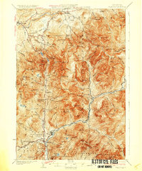
 1929 Franconia1963 Print · USGSThe White Mountains come alive in the late 1920s, showing the early infrastructure of logging and tourism before modern highway expansions. Trace the Boston and Maine RR into Lincoln, or locate local landmarks like The Profile and the Profile Golf Club.2 unique versions available
 - 1932 Map of Franconia
 1932 Franconia1932 Print · USGSThe White Mountains in the early 1930s reveal a landscape caught between industrial timbering and the rise of mountain tourism. Researchers can trace the path of the Logging RR or locate family landmarks like the Russell Farm and Fairview.5 unique versions available
 - 1950 Map of Lewiston
 1950 Lewiston1950 Print · USGSThe Maine and New Hampshire borderlands come alive in this post-war survey of the White Mountains and Androscoggin valley. Genealogists and historians can trace rail lines like the Maine Central Railroad and find high-altitude landmarks from Mount Washington to Bretton Woods.2 unique versions available
 - 1956 Map of Lewiston, 1975 Print
 1956 Lewiston1975 Print · USGSThe Northern New England interior is documented here in the mid-fifties, from the industrial Androscoggin River to the high peaks of the White Mountains. Trace the Grand Trunk Railway through mountain passes or locate family landmarks near Sabbathday Lake and Bretton Woods.
 - 1961 Map of Lewiston
 1961 Lewiston1961 Print · USGSWestern Maine and the White Mountains appear here during the early sixties, showing the industrial river towns and vast timberlands before the modern interstate era. Genealogists and historians can trace the Grand Trunk RR through Berlin or locate landmarks like Old Speck Mountain and Elephant Mountain.
 - 1962 Map of Lewiston
 1962 Lewiston1962 Print · USGSThe industrial river valleys and high peaks of Maine and New Hampshire define the region in the early sixties. Trace the rail-and-river network from Lewiston to the White Mountains, passing through mill towns like Berlin and Rumford.
 - 1967 Map of Lincoln, 1972 Print
 1967 Lincoln1972 Print · USGSGrafton County's mountainous heart is captured here in the late sixties, showing the growth of Lincoln as a mountain gateway. Researchers can trace historic paths like the Appalachian Trail or locate local landmarks including Riverside Cem and the Drive-in Theater.4 unique versions available
 - 1969 Map of Lewiston
 1969 Lewiston1969 Print · USGSThe northern New England highlands come into focus during the mid-fifties, showing the vital rail and river networks connecting industrial centers to the deep woods. Researchers can trace the path of the Grand Trunk RR or locate landmarks like Mt Washington and Rangeley Lake.
 - 1986 Map of Mount Washington
 1986 Mount Washington1986 Print · USGSThe northern New England highlands are shown here in the mid-eighties, centered on the high peaks and river valleys of the New Hampshire borderlands. Researchers can trace historic transportation lines like the Mount Washington Cog Railway and the Maine Central Railroad near Gorham and Lancaster.
 - 1988 Map of Mount Washington, 1989 Print
 1988 Mount Washington1989 Print · USGSThe New Hampshire high country in the late 1980s is defined by its iconic peaks and the legacy of mountain tourism. Trace the routes of the historic Mount Washington Cog Railway and the Maine Central RR through the gaps of Crawford Notch State Park.
 - 1995 Map of Lincoln, 2000 Print
 1995 Lincoln2000 Print · USGSGrafton County during the late twentieth century was a landscape shaped by wilderness preservation and alpine recreation. Researchers can locate community landmarks like Lin-Wood High School, Riverside Cem, and the iconic Covered Bridge near the town of Lincoln.
 - 2012 Map of Lincoln, 2012 Print
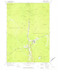
 2012 Lincoln2012 Print · USGSCovers North Woodstock, including Thornton, Woodstock, and other nearby areas
 - 2015 Map of Lincoln, 2015 Print
 2015 Lincoln2015 Print · USGSCovers North Woodstock, including Thornton, Woodstock, and other nearby areas
 - 2018 Map of Lincoln, 2018 Print
 2018 Lincoln2018 Print · USGSCovers North Woodstock, including Thornton, Woodstock, and other nearby areas
 - 2021 Map of Lincoln, 2021 Print
 2021 Lincoln2021 Print · USGSCovers North Woodstock, including Thornton, Woodstock, and other nearby areas
 - 2024 Map of Lincoln, 2024 Print
 2024 Lincoln2024 Print · USGSGrafton County's mountain corridor is captured here in the contemporary era, where the Pemigewasset River meets the hiking hubs of Lincoln and North Woodstock. Genealogists and hikers can trace local roots at Jackman Cem or follow the Appalachian National Scenic Trail past The Flume.
End of results
Showing maps 1-16 of 16
Top cities near North Woodstock
- Campton historical maps
- Thornton historical maps
- Lisbon historical maps
- Rumney historical maps
- Sandwich historical maps
- Woodstock historical maps
See more
Frequently asked questions
- What are the different types of historical maps available for North Woodstock?
- What is the oldest map of North Woodstock?
- Where can I purchase historical maps of North Woodstock for my home or office?
- Where can I download high-res historical maps of North Woodstock?
- Are there historical topographic maps available for North Woodstock?
- Is there historical aerial imagery available for North Woodstock?
- Where are historical maps of North Woodstock sourced from?