Old Maps of Derry, New Hampshire
Explore 27 old maps of Derry, spanning from 1888 to today. These high-resolution historic maps reveal how streets, neighborhoods, landmarks, and natural features evolved over time — perfect for genealogy, metal detecting, research, and local history exploration.
What you can do with these maps:
- See how Derry changed over time: Compare historical maps to modern-day views to trace roads, homesites, rail lines & more.
- View detailed metadata: Each map includes creators, publishers, year, scale, and archive source.
- Overlay maps with satellite & LiDAR: Visualize the past alongside modern tools to explore terrain & human change.
- Trusted historical sources: Maps sourced from the USGS, Library of Congress, and other archives.
- Access maps your way: View online, download high-res files, or order prints for personal or research use.
Start exploring old maps of Derry to uncover forgotten places, hidden landmarks, and the deep history beneath your feet.
Derry, NH maps
(27)- 1888 Map of Haverhill
 1888 Haverhill1888 Print · USGSCovers Derry, including Haverhill, Methuen, and other nearby areas
 - 1890 Map of Haverhill
 1890 Haverhill1890 Print · USGSCovers Derry, including Haverhill, Methuen, and other nearby areas
 - 1893 Map of Haverhill
 1893 Haverhill1893 Print · USGSCovers Derry, including Haverhill, Methuen, and other nearby areas7 unique versions available
 - 1905 Map of Manchester
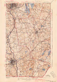
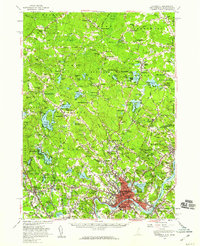
 1905 Manchester1905 Print · USGSCovers Derry, including Manchester, Nashua, and other nearby areas4 unique versions available
 - 1935 Map of Haverhill
 1935 Haverhill1935 Print · USGSCovers Derry, including Haverhill, Methuen, and other nearby areas5 unique versions available
 - 1941 Map of Manchester
 1941 Manchester1941 Print · USGSCovers Derry, including Manchester, Nashua, and other nearby areas3 unique versions available
 - 1943 Map of Lowell
 1943 Lowell1943 Print · USGSCovers Derry, including Manchester, Lowell, and other nearby areas
 - 1943 Map of Ayers Village
 1943 Ayers Village1943 Print · USGSCovers Derry, including Haverhill, Methuen, and other nearby areas2 unique versions available
 - 1948 Map of Boston
 1948 Boston1948 Print · USGSCovers Derry, including Boston, Worcester, and other nearby areas2 unique versions available
 - 1952 Map of Ayers Village, 1953 Print
 1952 Ayers Village1953 Print · USGSCovers Derry, including Haverhill, Methuen, and other nearby areas
 - 1953 Map of Windham, 1956 Print
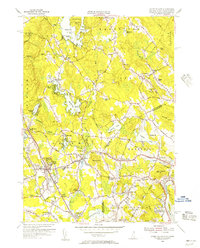
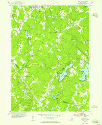 1953 Windham1956 Print · USGSCovers Derry, including Salem, Londonderry, and other nearby areas5 unique versions available
 - 1953 Map of Manchester, 1958 Print
 1953 Manchester1958 Print · USGSCovers Derry, including Manchester, Nashua, and other nearby areas4 unique versions available
 - 1955 Map of Ayers Village, 1956 Print
 1955 Ayers Village1956 Print · USGSCovers Derry, including Haverhill, Methuen, and other nearby areas3 unique versions available
 - 1956 Map of Haverhill, 1959 Print
 1956 Haverhill1959 Print · USGSCovers Derry, including Haverhill, Methuen, and other nearby areas3 unique versions available
 - 1956 Map of Boston, 1967 Print
 1956 Boston1967 Print · USGSCovers Derry, including Boston, Worcester, and other nearby areas6 unique versions available
 - 1958 Map of Boston
 1958 Boston1958 Print · USGSCovers Derry, including Boston, Worcester, and other nearby areas2 unique versions available
 - 1961 Map of Boston
 1961 Boston1961 Print · USGSCovers Derry, including Boston, Worcester, and other nearby areas2 unique versions available
 - 1968 Map of Salem Depot, 1970 Print
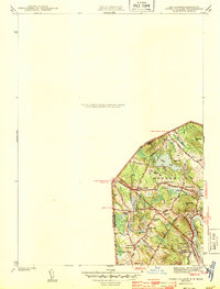
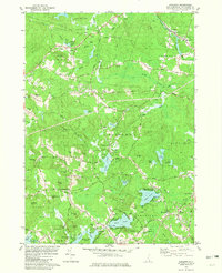
 1968 Salem Depot1970 Print · USGSCovers Derry, including Haverhill, Methuen, and other nearby areas4 unique versions available
 - 1968 Map of Derry, 1971 Print
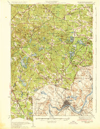
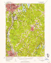
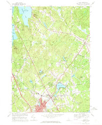 1968 Derry1971 Print · USGSCovers Derry, including Londonderry, Auburn, and other nearby areas3 unique versions available
 - 1977 Map of Salem Depot, 1981 Print
 1977 Salem Depot1981 Print · USGSCovers Derry, including Haverhill, Methuen, and other nearby areas
 - 1977 Map of Derry, 1981 Print
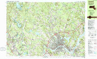
 1977 Derry1981 Print · USGSCovers Derry, including Londonderry, Auburn, and other nearby areas
 - 1977 Map of Windham, 1981 Print
 1977 Windham1981 Print · USGSCovers Derry, including Salem, Londonderry, and other nearby areas
 - 1981 Map of Sandown
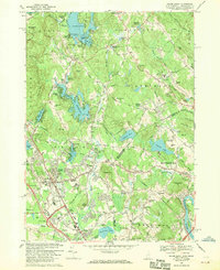
 1981 Sandown1981 Print · USGSCovers Derry, including Hampstead, Plaistow, and other nearby areas3 unique versions available
 - 1984 Map of Lowell
 1984 Lowell1984 Print · USGSCovers Derry, including Manchester, Lowell, and other nearby areas
 - 1985 Map of Haverhill, 1986 Print
 1985 Haverhill1986 Print · USGSCovers Derry, including Haverhill, Methuen, and other nearby areas
Showing maps 1-25 of 27
Top cities near Derry
- Manchester historical maps
- Lowell historical maps
- Nashua historical maps
- Lawrence historical maps
- Haverhill historical maps
- Methuen historical maps
See more
Top neighborhoods of Derry
- Peppermint Corner historical maps
- Hubbard historical maps
- Chases Grove historical maps
- Collettes Grove historical maps
- East Derry historical maps
- Howards Grove historical maps
See more
Frequently asked questions
- What are the different types of historical maps available for Derry?
- What is the oldest map of Derry?
- Where can I purchase historical maps of Derry for my home or office?
- Where can I download high-res historical maps of Derry?
- Are there historical topographic maps available for Derry?
- Is there historical aerial imagery available for Derry?
- Where are historical maps of Derry sourced from?