Old Maps of Gosport, Rye for Metal Detecting
Plan your next treasure hunt with 13 historic maps of Gosport. Find old homesites, ghost towns, trails, and gathering spots that may be lost to time — perfect for identifying promising metal detecting locations.
- Locate forgotten sites: Uncover places like long-lost settlements, abandoned rail lines, or gathering spots.
- Plan better hunts: Use map overlays combined with LiDAR or satellite views to narrow in on historically rich areas.
- Made for detectorists: Thousands of hobbyists use these maps to discover relics, coins, and hidden history.
Use these historic maps to boost your research and find new opportunities beneath the surface of Gosport.
Gosport, Rye maps
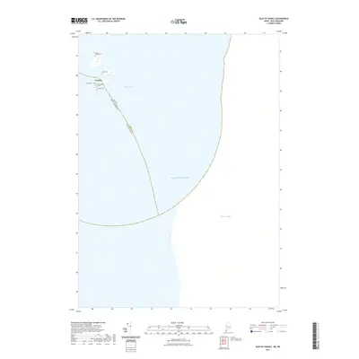
(13)- 1943 Map of Cape Ann
 1943 Cape Ann1943 Print · USGSCoastal Massachusetts and New Hampshire appear here during the wartime era, showing the maritime and rail infrastructure that defined the North Shore. Genealogists can trace family names across Asbury Grove, Merrimacport, and the Boston & Maine RR rail corridor.
 - 1948 Map of Boston
 1948 Boston1948 Print · USGSEastern Massachusetts and southern New Hampshire appear at an industrial peak in the late 1940s, just as suburban growth began to accelerate. Genealogists and historians can trace rail lines like the Boston and Albany RR or locate coastal landmarks like Graves Lighthouse and Fort Devens.2 unique versions available
 - 1956 Map of Isles Of Shoals, 1957 Print
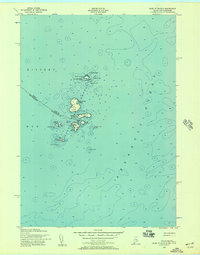 1956 Isles Of Shoals1957 Print · USGSThe offshore islands of York County and Rockingham County are captured in this mid-century maritime survey. Genealogists and historians can trace the settlement of Gosport on Star Island and locate landmarks like the White Island Lighthouse and the ledges of Duck Island.2 unique versions available
 - 1956 Map of Isles of Shoals, 1964 Print
 1956 Isles of Shoals1964 Print · USGSThe Isles of Shoals are captured here in the mid-1950s, detailing the maritime boundary between Maine and New Hampshire. Researchers can locate island landmarks such as Tucke Mon, the Lighthouse on White Island, and the settlement at Appledore.
 - 1956 Map of Boston, 1967 Print
 1956 Boston1967 Print · USGSThe Massachusetts coastline and industrial interior are seen here during the mid-century peak of suburban and highway expansion. Researchers can trace historic harbor defenses like Fort Revere, local landmarks such as Faneuil Hall, and the vast Parker River National Wildlife Refuge.6 unique versions available
 - 1958 Map of Boston
 1958 Boston1958 Print · USGSEastern Massachusetts and southern New Hampshire are shown at the height of the industrial era, before the full expansion of the interstate system. Trace coastal defenses at Fort Warren, historic rail lines like the Boston and Maine, and the development of the Mass. 128 corridor.2 unique versions available
 - 1961 Map of Boston
 1961 Boston1961 Print · USGSThe Massachusetts coastline and its industrial interior are detailed here in the mid-twentieth century, from the Monadnock highlands to Cape Cod. Researchers can trace the rail routes of the Boston and Maine or locate landmarks like Fort Devens and the Wachusett Reservoir.2 unique versions available
 - 1984 Map of Gloucester
 1984 Gloucester1984 Print · USGSCoastal Massachusetts and the New Hampshire borderlands are shown here in the mid-eighties, from the granite shores of Cape Ann to the Merrimack River. Researchers can trace the legacy of maritime trade and higher education at Salem State College or follow the Boston and Maine rail lines through Ipswich and Beverly.
 - 2011 Map of Isles of Shoals, 2011 Print
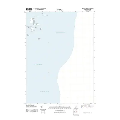 2011 Isles of Shoals2011 Print · USGSCovers Gosport, including Kittery, Rye, and other nearby areas
 - 2014 Map of Isles of Shoals, 2014 Print
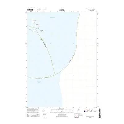 2014 Isles of Shoals2014 Print · USGSCovers Gosport, including Kittery, Rye, and other nearby areas
 - 2018 Map of Isles of Shoals, 2018 Print
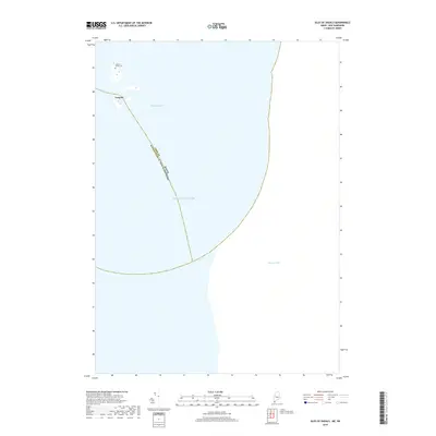 2018 Isles of Shoals2018 Print · USGSCovers Gosport, including Kittery, Rye, and other nearby areas
 - 2021 Map of Isles of Shoals, 2021 Print
 2021 Isles of Shoals2021 Print · USGSCovers Gosport, including Kittery, Rye, and other nearby areas
 - 2024 Map of Isles of Shoals, 2024 Print
 2024 Isles of Shoals2024 Print · USGSThe Isles of Shoals are captured here at the maritime border of Maine and New Hampshire in this recent survey. Genealogists and historians can locate specific family burial sites like Laighton Thaxter Cem and the settlement at Gosport.
End of results
Showing maps 1-13 of 13
Top cities near Gosport
- Dover historical maps
- Portsmouth historical maps
- Newburyport historical maps
- Hampton historical maps
- York historical maps
- Ipswich historical maps
See more
Frequently asked questions
- What are the different types of historical maps available for Gosport?
- What is the oldest map of Gosport?
- Where can I purchase historical maps of Gosport for my home or office?
- Where can I download high-res historical maps of Gosport?
- Are there historical topographic maps available for Gosport?
- Is there historical aerial imagery available for Gosport?
- Where are historical maps of Gosport sourced from?