Old Maps of Radburn, Fair Lawn for Metal Detecting
Plan your next treasure hunt with 21 historic maps of Radburn. Find old homesites, ghost towns, trails, and gathering spots that may be lost to time — perfect for identifying promising metal detecting locations.
- Locate forgotten sites: Uncover places like long-lost settlements, abandoned rail lines, or gathering spots.
- Plan better hunts: Use map overlays combined with LiDAR or satellite views to narrow in on historically rich areas.
- Made for detectorists: Thousands of hobbyists use these maps to discover relics, coins, and hidden history.
Use these historic maps to boost your research and find new opportunities beneath the surface of Radburn.
Radburn, Fair Lawn maps
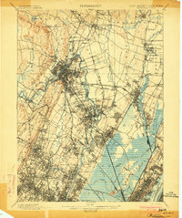
(21)- 1888 Map of Paterson
 1888 Paterson1888 Print · USGSCovers Radburn, including New York, Newark, and other nearby areas
 - 1892 Map of Paterson
 1892 Paterson1892 Print · USGSCovers Radburn, including New York, Newark, and other nearby areas
 - 1898 Map of Paterson
 1898 Paterson1898 Print · USGSCovers Radburn, including New York, Newark, and other nearby areas
 - 1900 Map of Passaic
 1900 Passaic1900 Print · USGSCovers Radburn, including New York, Newark, and other nearby areas
 - 1900 Map of Paterson
 1900 Paterson1900 Print · USGSCovers Radburn, including New York, Newark, and other nearby areas
 - 1903 Map of Paterson
 1903 Paterson1903 Print · USGSCovers Radburn, including New York, Newark, and other nearby areas8 unique versions available
 - 1905 Map of Passaic
 1905 Passaic1905 Print · USGSCovers Radburn, including New York, Newark, and other nearby areas4 unique versions available
 - 1934 Map of Hackensack
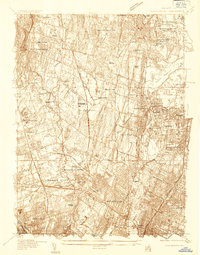 1934 Hackensack1934 Print · USGSCovers Radburn, including Clifton, Passaic, and other nearby areas
 - 1940 Map of Hackensack
 1940 Hackensack1940 Print · USGSCovers Radburn, including Clifton, Passaic, and other nearby areas3 unique versions available
 - 1942 Map of Passaic
 1942 Passaic1942 Print · USGSCovers Radburn, including New York, Newark, and other nearby areas
 - 1944 Map of Newark, 1971 Print
 1944 Newark1971 Print · USGSCovers Radburn, including New York, Philadelphia, and other nearby areas5 unique versions available
 - 1949 Map of Newark
 1949 Newark1949 Print · USGSCovers Radburn, including New York, Philadelphia, and other nearby areas2 unique versions available
 - 1955 Map of Hackensack, 1958 Print
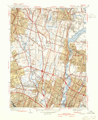
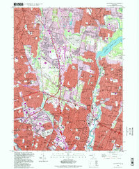
 1955 Hackensack1958 Print · USGSCovers Radburn, including Clifton, Passaic, and other nearby areas5 unique versions available
 - 1956 Map of Newark
 1956 Newark1956 Print · USGSCovers Radburn, including New York, Philadelphia, and other nearby areas2 unique versions available
 - 1957 Map of Newark
 1957 Newark1957 Print · USGSCovers Radburn, including New York, Philadelphia, and other nearby areas
 - 1960 Map of Newark
 1960 Newark1960 Print · USGSCovers Radburn, including New York, Philadelphia, and other nearby areas3 unique versions available
 - 1964 Map of Newark
 1964 Newark1964 Print · USGSCovers Radburn, including New York, Philadelphia, and other nearby areas2 unique versions available
 - 1984 Map of Newark, 1985 Print
 1984 Newark1985 Print · USGSCovers Radburn, including New York, Newark, and other nearby areas
 - 1986 Map of Newark, 1987 Print
 1986 Newark1987 Print · USGSCovers Radburn, including New York, Newark, and other nearby areas
 - 1997 Map of Hackensack, 1998 Print
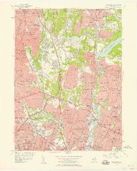
 1997 Hackensack1998 Print · USGSCovers Radburn, including Clifton, Passaic, and other nearby areas
 - 2023 Map of Hackensack, 2023 Print
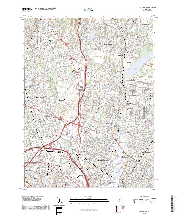 2023 Hackensack2023 Print · USGSCovers Radburn, including Clifton, Passaic, and other nearby areas
End of results
Showing maps 1-21 of 21
Frequently asked questions
- What are the different types of historical maps available for Radburn?
- What is the oldest map of Radburn?
- Where can I purchase historical maps of Radburn for my home or office?
- Where can I download high-res historical maps of Radburn?
- Are there historical topographic maps available for Radburn?
- Is there historical aerial imagery available for Radburn?
- Where are historical maps of Radburn sourced from?