Old Maps of Medford Township, New Jersey for Hiking & Exploration
Hike through history with 27 historic maps of Medford Township. Explore old trails, ghost towns, and forgotten backroads — perfect for outdoor adventurers and local explorers.
- Rediscover forgotten places: Map out old mining camps, roads, and footpaths that no longer exist on modern maps.
- Layer with modern tools: Combine with LiDAR or satellite views to plan hikes through historical terrain.
- Made for exploration: Popular among hikers, overlanders, and local history lovers.
Use these maps to find adventure and explore the hidden past of Medford Township.
Medford Township, NJ maps
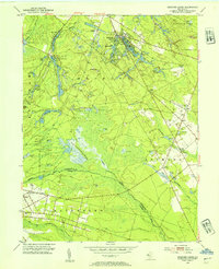
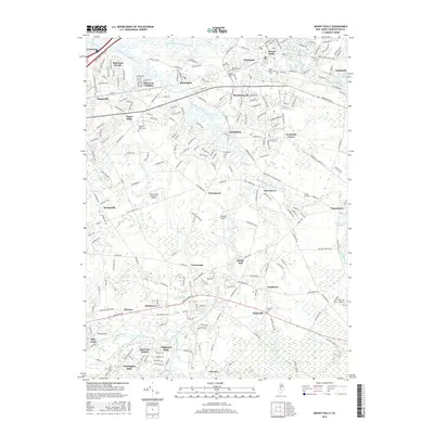
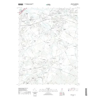
(27)- 1888 Map of Mount Holly
 1888 Mount Holly1888 Print · USGSBurlington County thrives in the late nineteenth century as a hub of rail-driven trade and water-powered industry. Genealogists and historians can trace the foundations of local commerce through family sites like Jennings Mill, Ballinger's Mill, and the early junctions at Berlin.
 - 1894 Map of Mount Holly
 1894 Mount Holly1894 Print · USGSBurlington County enters the late nineteenth century as a thriving network of rail-connected agricultural towns and waterway mills. You can trace early family settlements and industrial sites like Smithville, Marlton, and the West Jersey Cranberry Meadow.
 - 1898 Map of Mount Holly
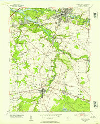
 1898 Mount Holly1898 Print · USGSSouth Jersey at the end of the Victorian era was a land of expanding rail lines and established farming hamlets. Trace the early footprints of Moorestown and Berlin, and find the locations of long-standing crossroads like Fellowship and Colemantown.5 unique versions available
 - 1900 Map of Rancocas
 1900 Rancocas1900 Print · USGSSouthern New Jersey at the turn of the century reveals a land of timber, mills, and emerging rail junctions. Genealogists and historians can trace the locations of family-owned landmarks like Jennings Mill, Ballingers Mill, and early settlements such as Colemantown and Fellowship.2 unique versions available
 - 1919 Map of Mount Holly, 1921 Print
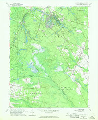
 1919 Mount Holly1921 Print · USGSThe Burlington and Camden County interior appears here at a peak of rail-driven commerce during the early twentieth century. Genealogists and historians can trace family-named industrial sites like Kirby's Mill and old bog operations at the West Jersey Cranberry Meadow.
 - 1942 Map of Mount Holly
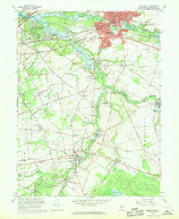
 1942 Mount Holly1942 Print · USGSSouth-central New Jersey during the early war years is defined here by its intricate network of mill streams and small agricultural crossroads. Genealogists and historians can trace family-named sites like Braddock Mill, Newbolds Corner, and the extensive West Jersey Cranberry Meadow.
 - 1946 Map of Wilmington, 1948 Print
 1946 Wilmington1948 Print · USGSThe Delaware Valley and Jersey Shore emerge in this mid-century portrait of a region defined by river commerce and seaside growth. Genealogists and historians can trace the rail networks of the Pennsylvania Railroad, locate early airfields like Dover Airpark, and find river defenses at Fort Delaware.2 unique versions available
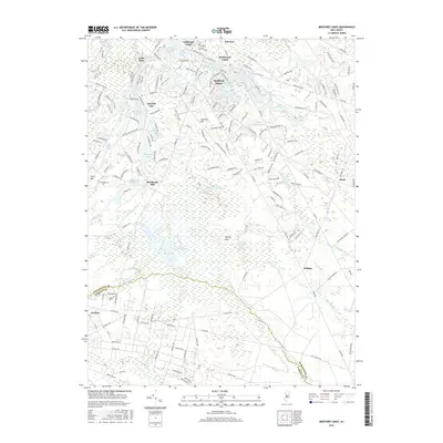
 - 1953 Map of Medford Lakes, 1954 Print
 1953 Medford Lakes1954 Print · USGSThe Pine Barrens of Burlington and Camden Counties appear in detail in the early fifties, showing the region's unique cranberry-based economy. Researchers can trace rural school locations like Louden Sch and agricultural landmarks such as West Jersey Cranberry Meadow.2 unique versions available
 - 1953 Map of Mount Holly, 1954 Print
 1953 Mount Holly1954 Print · USGSMid-century Burlington County comes alive in this survey of the river-laced corridor between MOUNT HOLLY and Medford. Trace the ancestral roots of the region through family landmarks like Kirbys Mill, Peacock Cem, and the historic Cranberry Bogs.2 unique versions available
 - 1955 Map of Wilmington
 1955 Wilmington1955 Print · USGSThe Delaware Valley and Jersey Shore are seen here during the mid-fifties era of rapid suburban expansion and highway development. You can trace the path of the New Jersey Turnpike, locate the Fort Dix Military Reservation, or explore the rail networks of the Pennsylvania Railroad.
 - 1957 Map of Wilmington
 1957 Wilmington1957 Print · USGSThe mid-Atlantic coastal plain comes alive in the mid-fifties as the New Jersey Turnpike and Garden State Parkway redefine travel. Researchers can trace the rail-to-road transition and find landmarks like Ship John Shoal Light and the Fort Dix Military Reservation.2 unique versions available
 - 1959 Map of Wilmington
 1959 Wilmington1959 Print · USGSThe Delaware Valley and Jersey Shore are seen here in the late fifties, during a period of massive suburban and highway expansion. Researchers can trace mid-century infrastructure like the N J Turnpike or locate coastal landmarks from Barnegat Bay to the Maurice River.3 unique versions available
 - 1966 Map of Wilmington, 1968 Print
 1966 Wilmington1968 Print · USGSThe Delaware Valley and Jersey Shore are seen here in the mid-1960s, documenting a landscape of dense industrial cities and emerging coastal resorts. Researchers can trace the sprawling rail networks of the Pennsylvania Railroad or locate landmarks like Fort Dix Military Reservation and Elk Neck State Park.4 unique versions available
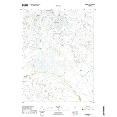
 - 1967 Map of Medford Lakes, 1968 Print
 1967 Medford Lakes1968 Print · USGSThe Jersey Pine Barrens and its burgeoning lake communities are detailed in this late sixties survey of Burlington and Camden counties. Trace the evolution of specialized agriculture and local recreation at West Jersey Cranberry Meadows, Atco Dragway, and Camp Kettle Run.4 unique versions available
 - 1967 Map of Mount Holly, 1969 Print
 1967 Mount Holly1969 Print · USGSBurlington County thrives in the late sixties as suburban neighborhoods expand alongside traditional creek-side mill towns. Genealogists and historians can trace family sites at Eastern Union Cem, Kirbys Mill, and the many parish churches of Mount Holly.2 unique versions available
 - 1972 Map of Wilmington, 1976 Print
 1972 Wilmington1976 Print · USGSThe Delaware Valley and Jersey Shore are seen here in the 1970s, showcasing the region's dense transport networks and vast state forests. Trace early coastal development near Atlantic City or locate rural landmarks like Mount Holly and Dover Air Force Base.2 unique versions available
 - 1984 Map of Hammonton, 1986 Print
 1984 Hammonton1986 Print · USGSSouthern New Jersey is captured in the mid-eighties as suburban growth pressed against the vast Pinelands. Researchers can trace the development of the Atlantic City Expressway corridor and locate landmarks like Ancora Psychiatric Hospital and the sprawling Wharton State Forest.3 unique versions available
 - 2011 Map of Medford Lakes, 2011 Print
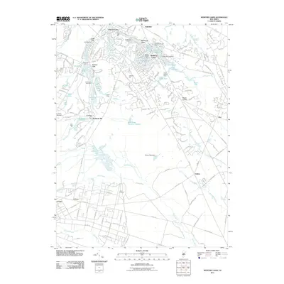 2011 Medford Lakes2011 Print · USGSCovers Medford Township, including Southampton Township, Tabernacle Township, and other nearby areas
 - 2011 Map of Mount Holly, 2011 Print
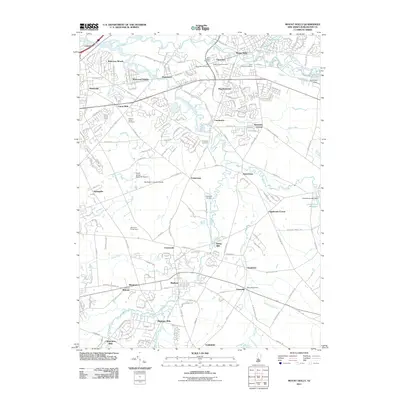 2011 Mount Holly2011 Print · USGSCovers Medford Township, including Mount Laurel Township, Willingboro Township, and other nearby areas
 - 2014 Map of Mount Holly, 2014 Print
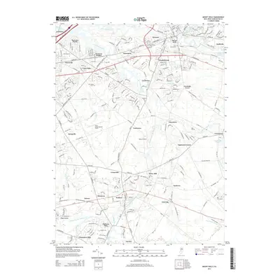 2014 Mount Holly2014 Print · USGSCovers Medford Township, including Mount Laurel Township, Willingboro Township, and other nearby areas
 - 2014 Map of Medford Lakes, 2014 Print
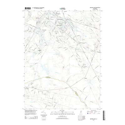 2014 Medford Lakes2014 Print · USGSCovers Medford Township, including Southampton Township, Tabernacle Township, and other nearby areas
 - 2016 Map of Mount Holly, 2016 Print
 2016 Mount Holly2016 Print · USGSCovers Medford Township, including Mount Laurel Township, Willingboro Township, and other nearby areas
 - 2016 Map of Medford Lakes, 2016 Print
 2016 Medford Lakes2016 Print · USGSCovers Medford Township, including Southampton Township, Tabernacle Township, and other nearby areas
 - 2019 Map of Medford Lakes, 2019 Print
 2019 Medford Lakes2019 Print · USGSCovers Medford Township, including Southampton Township, Tabernacle Township, and other nearby areas
 - 2019 Map of Mount Holly, 2019 Print
 2019 Mount Holly2019 Print · USGSCovers Medford Township, including Mount Laurel Township, Willingboro Township, and other nearby areas
Showing maps 1-25 of 27
Top cities near Medford Township
- Philadelphia historical maps
- Cherry Hill Township historical maps
- Bensalem Township historical maps
- Washington Township historical maps
- Sicklerville historical maps
- Mount Laurel Township historical maps
See more
Top neighborhoods of Medford Township
- Lake Pine historical maps
- Taunton Lake historical maps
- Oliphants Mills historical maps
- Shinntown historical maps
- Kirbys Mill historical maps
- Braddocks Mill historical maps
See more
Frequently asked questions
- What are the different types of historical maps available for Medford Township?
- What is the oldest map of Medford Township?
- Where can I purchase historical maps of Medford Township for my home or office?
- Where can I download high-res historical maps of Medford Township?
- Are there historical topographic maps available for Medford Township?
- Is there historical aerial imagery available for Medford Township?
- Where are historical maps of Medford Township sourced from?