Old Maps of Waterford Township, New Jersey for Academic Research
Study the evolution of Waterford Township with 59 high-resolution historic maps. Whether you're teaching, researching, or modeling changes in land use, these maps provide essential visual documentation of urban, environmental, and geographic change.
- Analyze long-term change: Track patterns in development, transportation, and natural features.
- Ideal for environmental or urban studies: Support academic projects with primary historical map data.
- Use in the classroom or lab: Educators and researchers rely on these maps to bring historical context to life.
These maps are a powerful tool for teaching, research, and visualizing how Waterford Township has changed over the decades.
Waterford Township, NJ maps
(59)- 1888 Map of Mount Holly
 1888 Mount Holly1888 Print · USGSBurlington County thrives in the late nineteenth century as a hub of rail-driven trade and water-powered industry. Genealogists and historians can trace the foundations of local commerce through family sites like Jennings Mill, Ballinger's Mill, and the early junctions at Berlin.
 - 1890 Map of Hammonton
 1890 Hammonton1890 Print · USGSThe South Jersey Pine Barrens emerge in the late nineteenth century as a complex network of rail lines and agrarian outposts. Genealogists and local historians can trace the foundations of Hammonton, Williamstown, and vanished stops like Banzard Station and New Germany.
 - 1890 Map of Mullica
 1890 Mullica1890 Print · USGSThe Mullica River valley and the New Jersey Pine Barrens are captured here during the late 1800s, when water-powered industry still shaped the landscape. Researchers can trace the early rail corridors and vanished industrial sites like Batsto, Harrisville, and Atsion.
 - 1894 Map of Hammonton
 1894 Hammonton1894 Print · USGSHammonton and the surrounding Pine Barrens appear here in the late nineteenth century as a thriving agricultural and railroad crossroads. Genealogists and historians can trace early property hubs like the Fruit Growers Union, industrial sites such as Pancoast Mill, and the rail junctions at Winslow Junction.
 - 1894 Map of Mount Holly
 1894 Mount Holly1894 Print · USGSBurlington County enters the late nineteenth century as a thriving network of rail-connected agricultural towns and waterway mills. You can trace early family settlements and industrial sites like Smithville, Marlton, and the West Jersey Cranberry Meadow.
 - 1894 Map of Mullica
 1894 Mullica1894 Print · USGSCoastal New Jersey in the late nineteenth century was a landscape of tide-water marshes and industrial hamlets. Researchers can trace the early rail corridors of the Camden and Atlantic Railroad and locate vanished nodes like Batsto and Harrisville.
 - 1898 Map of Mount Holly
 1898 Mount Holly1898 Print · USGSSouth Jersey at the end of the Victorian era was a land of expanding rail lines and established farming hamlets. Trace the early footprints of Moorestown and Berlin, and find the locations of long-standing crossroads like Fellowship and Colemantown.5 unique versions available
 - 1898 Map of Mullica
 1898 Mullica1898 Print · USGSThe Mullica River valley of the late nineteenth century shows a landscape transitioning from colonial-era industry to a rail-connected economy. Genealogists and historians can trace old Pine Barrens settlements like Batsto, Quaker Bridge, and Crowleytown before modern development changed the region.4 unique versions available
 - 1898 Map of Hammonton
 1898 Hammonton1898 Print · USGSAtlantic and Camden counties are captured here in the late nineteenth century as the Pine Barrens were transformed by fruit farming and a massive rail network. Researchers can trace the legacy of early industry and transport at Fruit Growers Union, Winslow Junction, and the historic Waterford Works.3 unique versions available
 - 1900 Map of Rancocas
 1900 Rancocas1900 Print · USGSSouthern New Jersey at the turn of the century reveals a land of timber, mills, and emerging rail junctions. Genealogists and historians can trace the locations of family-owned landmarks like Jennings Mill, Ballingers Mill, and early settlements such as Colemantown and Fellowship.2 unique versions available
 - 1919 Map of Hammonton
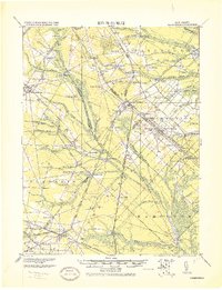 1919 Hammonton1919 Print · USGSThe Pine Barrens of the early twentieth century are defined here by a massive web of competing railroads and small mill settlements. Researchers can trace historic family landmarks and transit hubs like Winslow Junction, Iron Mills, and Pestletown during the region's peak agricultural era.
 - 1919 Map of Mount Holly, 1921 Print
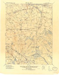 1919 Mount Holly1921 Print · USGSThe Burlington and Camden County interior appears here at a peak of rail-driven commerce during the early twentieth century. Genealogists and historians can trace family-named industrial sites like Kirby's Mill and old bog operations at the West Jersey Cranberry Meadow.
 - 1919 Map of Mullica, 1921 Print
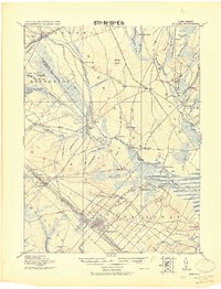 1919 Mullica1921 Print · USGSCoastal New Jersey's Pine Barrens and river landings are captured here in the early 1900s during a period of transition between water-based commerce and expanding rail lines. Researchers can trace the legacy of iron and agriculture through sites like Batsto, Harris Ville, and the Tranquility Bogs.
 - 1942 Map of Mount Holly
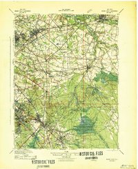 1942 Mount Holly1942 Print · USGSSouth-central New Jersey during the early war years is defined here by its intricate network of mill streams and small agricultural crossroads. Genealogists and historians can trace family-named sites like Braddock Mill, Newbolds Corner, and the extensive West Jersey Cranberry Meadow.
 - 1942 Map of Hammonton
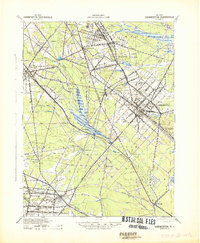 1942 Hammonton1942 Print · USGSAtlantic and Camden counties come alive in the early 1940s, showing the South Jersey Pinelands just as the modern highway system began to overlap the old rail networks. Trace historical property lines and local hubs like Winslow Junction, Blue Anchor, and the waters of Hammonton Lake.
 - 1942 Map of Egg Harbor
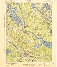 1942 Egg Harbor1942 Print · USGSSouth Jersey's Pine Barrens were a mix of industrial remnants and early military footprints during the Second World War. Researchers can trace the layout of the Abandoned World War Cantonment or explore old glass and iron centers like Batsto and Harrisville.
 - 1946 Map of Wilmington, 1948 Print
 1946 Wilmington1948 Print · USGSThe Delaware Valley and Jersey Shore emerge in this mid-century portrait of a region defined by river commerce and seaside growth. Genealogists and historians can trace the rail networks of the Pennsylvania Railroad, locate early airfields like Dover Airpark, and find river defenses at Fort Delaware.2 unique versions available
 - 1948 Map of Hammonton
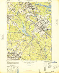 1948 Hammonton1948 Print · USGSPost-war South Jersey is defined here by the meeting of rail and road, as the White Horse Pike cuts through the Pinelands. Trace the development of communities like Hammonton and the critical rail hub at Winslow Junction.2 unique versions available
 - 1953 Map of Clementon, 1954 Print
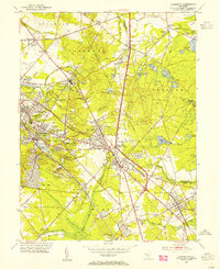 1953 Clementon1954 Print · USGSCamden County was a landscape of rail-linked towns and cranberry bogs in the early fifties. Genealogists and local historians can trace the foundations of Berlin, Gibbsboro, and Atco along the Pennsylvania-Reading Seashore Lines.3 unique versions available
 - 1953 Map of Atsion, 1954 Print
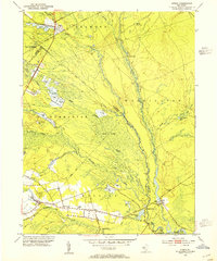 1953 Atsion1954 Print · USGSThe New Jersey Pine Barrens in the early fifties reveal a landscape shaped by water and iron history. Trace the legacy of early settlements and agriculture through the Central Railroad of New Jersey, the sprawling Cranberry Bogs, and historic river crossings at Quaker Bridge.6 unique versions available
 - 1953 Map of Medford Lakes, 1954 Print
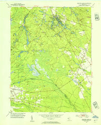 1953 Medford Lakes1954 Print · USGSThe Pine Barrens of Burlington and Camden Counties appear in detail in the early fifties, showing the region's unique cranberry-based economy. Researchers can trace rural school locations like Louden Sch and agricultural landmarks such as West Jersey Cranberry Meadow.2 unique versions available
 - 1953 Map of Williamstown, 1954 Print
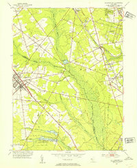 1953 Williamstown1954 Print · USGSThe Pine Barrens of South Jersey meet the growing hubs of Gloucester and Camden counties in the early fifties. Researchers can trace family sites at Hopewell Cem, follow the PENNSYLVANIA-READING SEASHORE LINES, or locate vanished rail infrastructure like Taggart Siding.
 - 1953 Map of Hammonton, 1954 Print
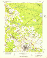 1953 Hammonton1954 Print · USGSThe Hammonton area in the early fifties shows the New Jersey Pinelands as a vital hub of rail commerce and cranberry cultivation. Genealogists and historians can trace family locations through sites like Bates Mill Cem, Chesilhurst Sta, and Winslow Junction.2 unique versions available
 - 1955 Map of Wilmington
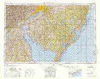 1955 Wilmington1955 Print · USGSThe Delaware Valley and Jersey Shore are seen here during the mid-fifties era of rapid suburban expansion and highway development. You can trace the path of the New Jersey Turnpike, locate the Fort Dix Military Reservation, or explore the rail networks of the Pennsylvania Railroad.
 - 1957 Map of Wilmington
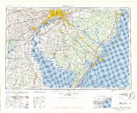 1957 Wilmington1957 Print · USGSThe mid-Atlantic coastal plain comes alive in the mid-fifties as the New Jersey Turnpike and Garden State Parkway redefine travel. Researchers can trace the rail-to-road transition and find landmarks like Ship John Shoal Light and the Fort Dix Military Reservation.2 unique versions available
Showing maps 1-25 of 59
Top cities near Waterford Township
- Philadelphia historical maps
- Cherry Hill Township historical maps
- Vineland historical maps
- Washington Township historical maps
- Sicklerville historical maps
- Mount Laurel Township historical maps
See more
Top neighborhoods of Waterford Township
- Parkdale historical maps
- Jackson historical maps
- Bishops historical maps
- Dunbarton historical maps
- Pestletown historical maps
- Louden historical maps
See more
Frequently asked questions
- What are the different types of historical maps available for Waterford Township?
- What is the oldest map of Waterford Township?
- Where can I purchase historical maps of Waterford Township for my home or office?
- Where can I download high-res historical maps of Waterford Township?
- Are there historical topographic maps available for Waterford Township?
- Is there historical aerial imagery available for Waterford Township?
- Where are historical maps of Waterford Township sourced from?