Old Maps of Paulsboro, New Jersey
Explore 38 old maps of Paulsboro, spanning from 1891 to today. These high-resolution historic maps reveal how streets, neighborhoods, landmarks, and natural features evolved over time — perfect for genealogy, metal detecting, research, and local history exploration.
What you can do with these maps:
- See how Paulsboro changed over time: Compare historical maps to modern-day views to trace roads, homesites, rail lines & more.
- View detailed metadata: Each map includes creators, publishers, year, scale, and archive source.
- Overlay maps with satellite & LiDAR: Visualize the past alongside modern tools to explore terrain & human change.
- Trusted historical sources: Maps sourced from the USGS, Library of Congress, and other archives.
- Access maps your way: View online, download high-res files, or order prints for personal or research use.
Start exploring old maps of Paulsboro to uncover forgotten places, hidden landmarks, and the deep history beneath your feet.
Paulsboro, NJ maps
(38)- 1891 Map of Philadelphia
 1891 Philadelphia1891 Print · USGSPhiladelphia and its New Jersey neighbors are captured in the late Victorian era as rail and river commerce defined the region. Genealogists and historians can trace family-named sites and vanished river features like Windmill Island, Haddonfield, and the U.S. Navy Yard.
 - 1894 Map of Chester, 1954 Print
 1894 Chester1954 Print · USGSThe Delaware River corridor near Chester was a hive of rail activity and water-powered industry at the close of the century. Genealogists and historians can trace family-named mills such as Llewellyn Mills or visit the campus of the Williamson School and the borough of Media.2 unique versions available
 - 1894 Map of Philadelphia, 1958 Print
 1894 Philadelphia1958 Print · USGSPhiladelphia and Camden are shown at the height of the Victorian era, characterized by dense rail corridors and a bustling maritime waterfront. Genealogists and researchers can trace 19th-century neighborhoods and landmarks like Fort Mifflin, Paschallville, and the Alms House.
 - 1896 Map of Philadelphia
 1896 Philadelphia1896 Print · USGSPhiladelphia and its South Jersey neighbors appear at a peak of late-nineteenth-century industrial and maritime expansion. Genealogists and historians can trace the early layouts of Woodbury and Gloucester, or locate landmarks like Fort Mifflin and the U.S. Navy Yard along the riverfront.
 - 1896 Map of Chester
 1896 Chester1896 Print · USGSThe industrial corridor along the Delaware River thrives at the close of the nineteenth century as railroads and mills reshape the landscape. Genealogists can trace early homesteads and institutions like the Williamson School, Sharon Academy, and Sycamore Mills.
 - 1898 Map of Chester
 1898 Chester1898 Print · USGSThe Delaware River shoreline at the end of the nineteenth century reveals a landscape of industrial riverfronts and emerging mill towns. Genealogists and historians can trace family roots through numerous small settlements and institutions like Village Green, Booth Corner, and the Williamson School.10 unique versions available
 - 1898 Map of Philadelphia
 1898 Philadelphia1898 Print · USGSPhiladelphia and Camden emerge as a Victorian-era industrial powerhouse at the turn of the century, knit together by ferry and rail. Researchers can trace ancestral roots in vanished neighborhoods like Paschallville or locate landmarks like the Alms House and Fort Mifflin.9 unique versions available
 - 1901 Map of Camden
 1901 Camden1901 Print · USGSThe Delaware River valley at the turn of the century shows a bustling corridor of early industrial growth and established mill towns. Researchers can trace the heritage of local industry at Sycamore Mills or locate early settlements like Penns Grove and Village Green.3 unique versions available
 - 1920 Map of Philadelphia
 1920 Philadelphia1920 Print · USGSPhiladelphia and its New Jersey neighbors are captured here just after the Great War, showing a landscape defined by massive riverfront industry and a dense rail network. Genealogists can trace family footprints through numerous small communities and stations like Blenheim Station, Woodbury Heights, and the grounds of the Alms House.
 - 1940 Map of Bridgeport
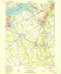
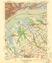 1940 Bridgeport1940 Print · USGSThe industrial Delaware River waterfront and the rural truck farms of Gloucester County meet at the start of the 1940s. Researchers can trace family sites at Oaklawn Cem, follow the rail lines to Repaupo Sta, and see the footprint of the Locomotive Works.
 - 1941 Map of Bridgeport
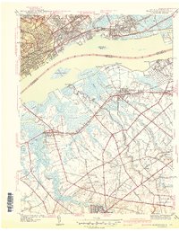 1941 Bridgeport1941 Print · USGSThe Delaware River waterfront near Chester and Bridgeport was a hub of transit and industry in the early 1940s. Genealogists and historians can trace family locations through St Michael Cem, Oak Grove Sch, and the residential blocks of Westinghouse Village.
 - 1942 Map of Camden
 1942 Camden1942 Print · USGSThe Philadelphia and Camden metropolitan corridor is captured here at the height of the Second World War. Genealogists and historians can trace rail networks like the Reading R.R. and locate communities from Swedesboro to Merchantville.
 - 1943 Map of Philadelphia
 1943 Philadelphia1943 Print · USGSPhiladelphia and Camden are shown at their wartime peak, anchored by the industrial activity of the Delaware River waterfront. Genealogists and historians can trace rail-connected neighborhoods and landmarks like the U. S. Navy Yard, Fort Mifflin, and the Alms House.
 - 1944 Map of Bridgeport
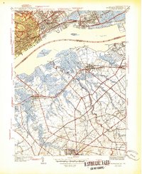 1944 Bridgeport1944 Print · USGSDuring the mid-1940s, the Delaware River waterfront between Pennsylvania and New Jersey served as a vital hub for manufacturing and transit. Genealogists and historians can locate family landmarks such as St Michael Cem, Oak Grove Sch, and industrial sites like the Locomotive Works.2 unique versions available
 - 1946 Map of Wilmington, 1948 Print
 1946 Wilmington1948 Print · USGSThe Delaware Valley and Jersey Shore emerge in this mid-century portrait of a region defined by river commerce and seaside growth. Genealogists and historians can trace the rail networks of the Pennsylvania Railroad, locate early airfields like Dover Airpark, and find river defenses at Fort Delaware.2 unique versions available
 - 1949 Map of Woodbury, 1954 Print
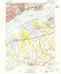
 1949 Woodbury1954 Print · USGSGloucester County during the post-war era shows a landscape transitioning from the industrial riverfront of the Delaware River to growing inland communities. Researchers can trace historical sites like the Hog Island Shipyard (Abandoned), Red Bank Battlefield, and the rail corridors of the Reading Seashore Lines.2 unique versions available
 - 1951 Map of Woodbury
 1951 Woodbury1951 Print · USGSGloucester County at the start of the fifties shows a landscape of busy rail corridors and riverfront industry. Trace the Pennsylvania-Reading Seashore Lines through Woodbury and locate the Hog Island Shipyard (Abandoned) or Fort Mifflin along the Delaware.
 - 1953 Map of Bridgeport, 1955 Print
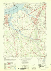
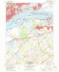
 1953 Bridgeport1955 Print · USGSThe industrial riverfront and tidal marshlands of the Delaware Valley are captured here in the early fifties during a period of significant coastal development. Researchers can trace the sprawling Pennsylvania Railroad network, institutional grounds like Crozier Seminary, and local landmarks from Thompson Point to Warrington Millpond.2 unique versions available
 - 1955 Map of Wilmington
 1955 Wilmington1955 Print · USGSThe Delaware Valley and Jersey Shore are seen here during the mid-fifties era of rapid suburban expansion and highway development. You can trace the path of the New Jersey Turnpike, locate the Fort Dix Military Reservation, or explore the rail networks of the Pennsylvania Railroad.
 - 1957 Map of Wilmington
 1957 Wilmington1957 Print · USGSThe mid-Atlantic coastal plain comes alive in the mid-fifties as the New Jersey Turnpike and Garden State Parkway redefine travel. Researchers can trace the rail-to-road transition and find landmarks like Ship John Shoal Light and the Fort Dix Military Reservation.2 unique versions available
 - 1959 Map of Wilmington
 1959 Wilmington1959 Print · USGSThe Delaware Valley and Jersey Shore are seen here in the late fifties, during a period of massive suburban and highway expansion. Researchers can trace mid-century infrastructure like the N J Turnpike or locate coastal landmarks from Barnegat Bay to the Maurice River.3 unique versions available
 - 1966 Map of Wilmington, 1968 Print
 1966 Wilmington1968 Print · USGSThe Delaware Valley and Jersey Shore are seen here in the mid-1960s, documenting a landscape of dense industrial cities and emerging coastal resorts. Researchers can trace the sprawling rail networks of the Pennsylvania Railroad or locate landmarks like Fort Dix Military Reservation and Elk Neck State Park.4 unique versions available
 - 1967 Map of Bridgeport, 1969 Print
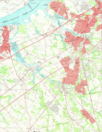
 1967 Bridgeport1969 Print · USGSIndustrial Pennsylvania meets rural New Jersey across the Delaware River in the late sixties. Genealogists and local historians can trace legacy sites like Crozer Seminary, St Josephs Cem, and the old Repaupo Station.4 unique versions available
 - 1967 Map of Woodbury, 1969 Print
 1967 Woodbury1969 Print · USGSGloucester County during the late sixties shows a landscape of growing suburbs and riverfront industry tied together by the Pennsylvania Reading Seashore Lines. Genealogists can locate family landmarks like Eglington Cemetery, Underwood Hospital, and the County Institution.4 unique versions available
 - 1972 Map of Wilmington, 1976 Print
 1972 Wilmington1976 Print · USGSThe Delaware Valley and Jersey Shore are seen here in the 1970s, showcasing the region's dense transport networks and vast state forests. Trace early coastal development near Atlantic City or locate rural landmarks like Mount Holly and Dover Air Force Base.2 unique versions available
Showing maps 1-25 of 38
Top cities near Paulsboro
- Philadelphia historical maps
- Upper Darby historical maps
- Camden historical maps
- Cherry Hill Township historical maps
- Washington Township historical maps
- Winslow Township historical maps
See more
Top neighborhoods of Paulsboro
Frequently asked questions
- What are the different types of historical maps available for Paulsboro?
- What is the oldest map of Paulsboro?
- Where can I purchase historical maps of Paulsboro for my home or office?
- Where can I download high-res historical maps of Paulsboro?
- Are there historical topographic maps available for Paulsboro?
- Is there historical aerial imagery available for Paulsboro?
- Where are historical maps of Paulsboro sourced from?