Old Maps of The Manor at Wayside, Ocean Township for Hiking & Exploration
Hike through history with 15 historic maps of The Manor at Wayside. Explore old trails, ghost towns, and forgotten backroads — perfect for outdoor adventurers and local explorers.
- Rediscover forgotten places: Map out old mining camps, roads, and footpaths that no longer exist on modern maps.
- Layer with modern tools: Combine with LiDAR or satellite views to plan hikes through historical terrain.
- Made for exploration: Popular among hikers, overlanders, and local history lovers.
Use these maps to find adventure and explore the hidden past of The Manor at Wayside.
The Manor at Wayside, Ocean Township maps
(15)- 1888 Map of Sandy Hook
 1888 Sandy Hook1888 Print · USGSCovers The Manor at Wayside, including New York, Middletown Township, and other nearby areas
 - 1893 Map of Sandy Hook
 1893 Sandy Hook1893 Print · USGSCovers The Manor at Wayside, including New York, Middletown Township, and other nearby areas2 unique versions available
 - 1901 Map of Sandy Hook
 1901 Sandy Hook1901 Print · USGSCovers The Manor at Wayside, including New York, Middletown Township, and other nearby areas6 unique versions available
 - 1902 Map of Navesink
 1902 Navesink1902 Print · USGSCovers The Manor at Wayside, including New York, Edison, and other nearby areas3 unique versions available
 - 1918 Map of Sandy Hook, 1921 Print
 1918 Sandy Hook1921 Print · USGSCovers The Manor at Wayside, including New York, Middletown Township, and other nearby areas
 - 1944 Map of Newark, 1971 Print
 1944 Newark1971 Print · USGSCovers The Manor at Wayside, including New York, Philadelphia, and other nearby areas5 unique versions available
 - 1949 Map of Newark
 1949 Newark1949 Print · USGSCovers The Manor at Wayside, including New York, Philadelphia, and other nearby areas2 unique versions available
 - 1954 Map of Long Branch, 1956 Print
 1954 Long Branch1956 Print · USGSCovers The Manor at Wayside, including Middletown Township, Long Branch, and other nearby areas5 unique versions available
 - 1956 Map of Newark
 1956 Newark1956 Print · USGSCovers The Manor at Wayside, including New York, Philadelphia, and other nearby areas2 unique versions available
 - 1957 Map of Newark
 1957 Newark1957 Print · USGSCovers The Manor at Wayside, including New York, Philadelphia, and other nearby areas
 - 1960 Map of Newark
 1960 Newark1960 Print · USGSCovers The Manor at Wayside, including New York, Philadelphia, and other nearby areas3 unique versions available
 - 1964 Map of Newark
 1964 Newark1964 Print · USGSCovers The Manor at Wayside, including New York, Philadelphia, and other nearby areas2 unique versions available
 - 1982 Map of Trenton, 1983 Print
 1982 Trenton1983 Print · USGSCovers The Manor at Wayside, including New York, Philadelphia, and other nearby areas
 - 1986 Map of Trenton, 1987 Print
 1986 Trenton1987 Print · USGSCovers The Manor at Wayside, including New York, Philadelphia, and other nearby areas
 - 2023 Map of Long Branch West, 2023 Print
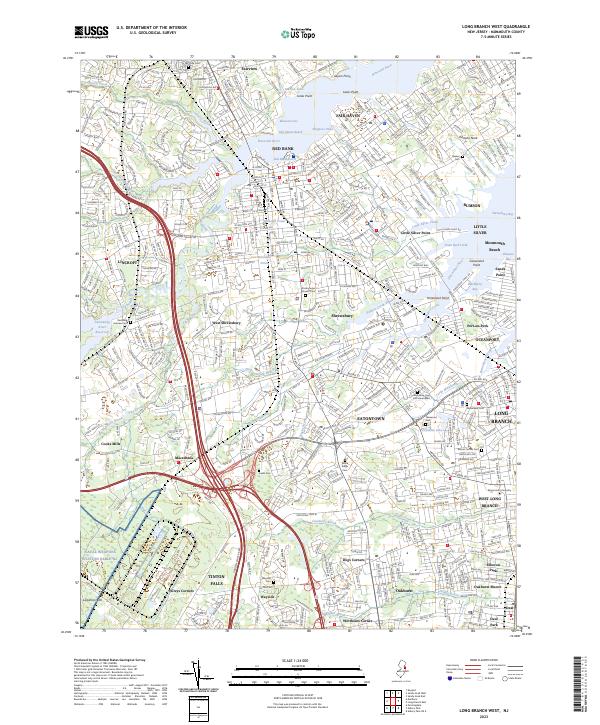 2023 Long Branch West2023 Print · USGSCovers The Manor at Wayside, including Middletown Township, Long Branch, and other nearby areas
End of results
Showing maps 1-15 of 15
Frequently asked questions
- What are the different types of historical maps available for The Manor at Wayside?
- What is the oldest map of The Manor at Wayside?
- Where can I purchase historical maps of The Manor at Wayside for my home or office?
- Where can I download high-res historical maps of The Manor at Wayside?
- Are there historical topographic maps available for The Manor at Wayside?
- Is there historical aerial imagery available for The Manor at Wayside?
- Where are historical maps of The Manor at Wayside sourced from?