Old Maps of Tinton Pines, Tinton Falls for Genealogy
Trace your family roots with 18 historic maps of Tinton Pines. These high-res maps reveal old neighborhoods, homesites, landmarks, and streets — helping you uncover where your ancestors lived and how the area evolved over time.
- Explore historic neighborhoods: Identify where your relatives may have lived in the 1800s or 1900s.
- Compare maps over time: Trace the changes in streets, buildings, and landmarks for multi-generational research.
- Perfect for genealogy & ancestry research: Used by family historians and researchers to map out lineage and migration.
These maps are an incredible resource for exploring your personal connection to Tinton Pines's past.
Tinton Pines, Tinton Falls maps
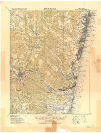
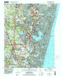
(18)- 1888 Map of Asbury Park
 1888 Asbury Park1888 Print · USGSCovers Tinton Pines, including Toms River, Lakewood Township, and other nearby areas
 - 1893 Map of Asbury Park
 1893 Asbury Park1893 Print · USGSCovers Tinton Pines, including Toms River, Lakewood Township, and other nearby areas2 unique versions available
 - 1901 Map of Asbury Park
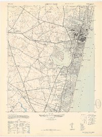
 1901 Asbury Park1901 Print · USGSCovers Tinton Pines, including Toms River, Lakewood Township, and other nearby areas5 unique versions available
 - 1902 Map of Navesink
 1902 Navesink1902 Print · USGSCovers Tinton Pines, including New York, Edison, and other nearby areas3 unique versions available
 - 1919 Map of Asbury Park, 1921 Print
 1919 Asbury Park1921 Print · USGSCovers Tinton Pines, including Toms River, Lakewood Township, and other nearby areas
 - 1944 Map of Newark, 1971 Print
 1944 Newark1971 Print · USGSCovers Tinton Pines, including New York, Philadelphia, and other nearby areas5 unique versions available
 - 1947 Map of Asbury Park
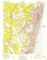
 1947 Asbury Park1947 Print · USGSCovers Tinton Pines, including Brick Township, Neptune Township, and other nearby areas
 - 1949 Map of Newark
 1949 Newark1949 Print · USGSCovers Tinton Pines, including New York, Philadelphia, and other nearby areas2 unique versions available
 - 1954 Map of Asbury Park, 1956 Print
 1954 Asbury Park1956 Print · USGSCovers Tinton Pines, including Brick Township, Neptune Township, and other nearby areas5 unique versions available
 - 1956 Map of Newark
 1956 Newark1956 Print · USGSCovers Tinton Pines, including New York, Philadelphia, and other nearby areas2 unique versions available
 - 1957 Map of Newark
 1957 Newark1957 Print · USGSCovers Tinton Pines, including New York, Philadelphia, and other nearby areas
 - 1960 Map of Newark
 1960 Newark1960 Print · USGSCovers Tinton Pines, including New York, Philadelphia, and other nearby areas3 unique versions available
 - 1964 Map of Newark
 1964 Newark1964 Print · USGSCovers Tinton Pines, including New York, Philadelphia, and other nearby areas2 unique versions available
 - 1982 Map of Trenton, 1983 Print
 1982 Trenton1983 Print · USGSCovers Tinton Pines, including New York, Philadelphia, and other nearby areas
 - 1986 Map of Trenton, 1987 Print
 1986 Trenton1987 Print · USGSCovers Tinton Pines, including New York, Philadelphia, and other nearby areas
 - 1989 Map of Asbury Park
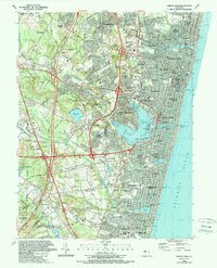 1989 Asbury Park1989 Print · USGSCovers Tinton Pines, including Brick Township, Neptune Township, and other nearby areas
 - 1995 Map of Asbury Park, 2001 Print
 1995 Asbury Park2001 Print · USGSCovers Tinton Pines, including Brick Township, Neptune Township, and other nearby areas
 - 2023 Map of Asbury Park, 2023 Print
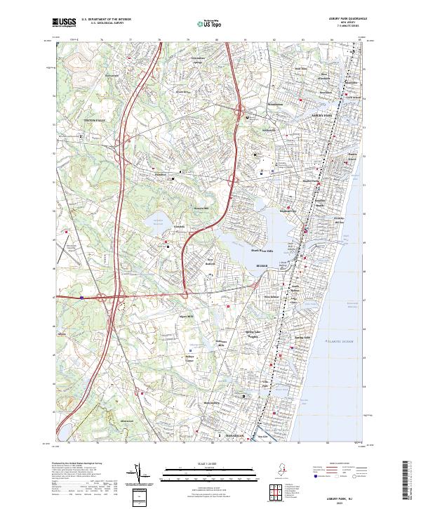 2023 Asbury Park2023 Print · USGSCovers Tinton Pines, including Brick Township, Neptune Township, and other nearby areas
End of results
Showing maps 1-18 of 18
Frequently asked questions
- What are the different types of historical maps available for Tinton Pines?
- What is the oldest map of Tinton Pines?
- Where can I purchase historical maps of Tinton Pines for my home or office?
- Where can I download high-res historical maps of Tinton Pines?
- Are there historical topographic maps available for Tinton Pines?
- Is there historical aerial imagery available for Tinton Pines?
- Where are historical maps of Tinton Pines sourced from?