Old Maps of Kinnelon, New Jersey
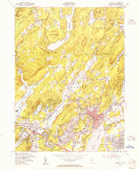
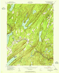
Explore 38 old maps of Kinnelon, spanning from 1888 to today. These high-resolution historic maps reveal how streets, neighborhoods, landmarks, and natural features evolved over time — perfect for genealogy, metal detecting, research, and local history exploration.
What you can do with these maps:
- See how Kinnelon changed over time: Compare historical maps to modern-day views to trace roads, homesites, rail lines & more.
- View detailed metadata: Each map includes creators, publishers, year, scale, and archive source.
- Overlay maps with satellite & LiDAR: Visualize the past alongside modern tools to explore terrain & human change.
- Trusted historical sources: Maps sourced from the USGS, Library of Congress, and other archives.
- Access maps your way: View online, download high-res files, or order prints for personal or research use.
Start exploring old maps of Kinnelon to uncover forgotten places, hidden landmarks, and the deep history beneath your feet.
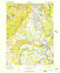
Kinnelon, NJ maps
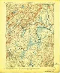
(38)- 1888 Map of Morristown
 1888 Morristown1888 Print · USGSCovers Kinnelon, including Wayne, Parsippany-Troy Hills, and other nearby areas
 - 1891 Map of Greenwood Lake
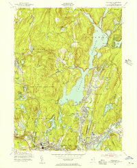
 1891 Greenwood Lake1891 Print · USGSCovers Kinnelon, including Wayne, Warwick, and other nearby areas
 - 1893 Map of Greenwood Lake
 1893 Greenwood Lake1893 Print · USGSCovers Kinnelon, including Wayne, Warwick, and other nearby areas6 unique versions available
 - 1894 Map of Morristown
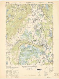
 1894 Morristown1894 Print · USGSCovers Kinnelon, including Wayne, Parsippany-Troy Hills, and other nearby areas
 - 1898 Map of Morristown
 1898 Morristown1898 Print · USGSCovers Kinnelon, including Wayne, Parsippany-Troy Hills, and other nearby areas2 unique versions available
 - 1900 Map of Passaic
 1900 Passaic1900 Print · USGSCovers Kinnelon, including New York, Newark, and other nearby areas
 - 1903 Map of Greenwood Lake, 1909 Print
 1903 Greenwood Lake1909 Print · USGSCovers Kinnelon, including Wayne, Warwick, and other nearby areas
 - 1905 Map of Passaic
 1905 Passaic1905 Print · USGSCovers Kinnelon, including New York, Newark, and other nearby areas4 unique versions available
 - 1906 Map of Morristown
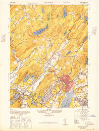
 1906 Morristown1906 Print · USGSCovers Kinnelon, including Wayne, Parsippany-Troy Hills, and other nearby areas6 unique versions available
 - 1910 Map of Greenwood Lake
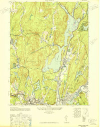
 1910 Greenwood Lake1910 Print · USGSCovers Kinnelon, including Wayne, Warwick, and other nearby areas9 unique versions available
 - 1942 Map of Passaic
 1942 Passaic1942 Print · USGSCovers Kinnelon, including New York, Newark, and other nearby areas
 - 1943 Map of Newfoundland
 1943 Newfoundland1943 Print · USGSCovers Kinnelon, including West Milford, Vernon Township, and other nearby areas
 - 1943 Map of Pompton Plains, 1947 Print
 1943 Pompton Plains1947 Print · USGSCovers Kinnelon, including Wayne, Parsippany-Troy Hills, and other nearby areas
 - 1944 Map of Newark, 1971 Print
 1944 Newark1971 Print · USGSCovers Kinnelon, including New York, Philadelphia, and other nearby areas5 unique versions available
 - 1947 Map of Boonton
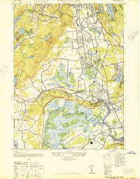
 1947 Boonton1947 Print · USGSCovers Kinnelon, including Parsippany-Troy Hills, Rockaway Township, and other nearby areas
 - 1947 Map of Pompton Plains
 1947 Pompton Plains1947 Print · USGSCovers Kinnelon, including Wayne, Parsippany-Troy Hills, and other nearby areas2 unique versions available
 - 1948 Map of Wanaque
 1948 Wanaque1948 Print · USGSCovers Kinnelon, including Wayne, West Milford, and other nearby areas2 unique versions available
 - 1949 Map of Newark
 1949 Newark1949 Print · USGSCovers Kinnelon, including New York, Philadelphia, and other nearby areas3 unique versions available
 - 1950 Map of Scranton, 1952 Print
 1950 Scranton1952 Print · USGSCovers Kinnelon, including Ramapo, Clarkstown, and other nearby areas
 - 1953 Map of Scranton
 1953 Scranton1953 Print · USGSCovers Kinnelon, including Ramapo, Clarkstown, and other nearby areas
 - 1954 Map of Boonton, 1955 Print
 1954 Boonton1955 Print · USGSCovers Kinnelon, including Parsippany-Troy Hills, Rockaway Township, and other nearby areas6 unique versions available
 - 1954 Map of Newfoundland, 1955 Print
 1954 Newfoundland1955 Print · USGSCovers Kinnelon, including West Milford, Vernon Township, and other nearby areas6 unique versions available
 - 1954 Map of Wanaque, 1956 Print
 1954 Wanaque1956 Print · USGSCovers Kinnelon, including Wayne, West Milford, and other nearby areas4 unique versions available
 - 1955 Map of Pompton Plains, 1956 Print
 1955 Pompton Plains1956 Print · USGSCovers Kinnelon, including Wayne, Parsippany-Troy Hills, and other nearby areas6 unique versions available
 - 1956 Map of Newark
 1956 Newark1956 Print · USGSCovers Kinnelon, including New York, Philadelphia, and other nearby areas2 unique versions available
Showing maps 1-25 of 38
Top cities near Kinnelon
- New York historical maps
- Newark historical maps
- Ramapo historical maps
- Paterson historical maps
- Clifton historical maps
- East Orange historical maps
See more
Top neighborhoods of Kinnelon
- Brook Valley historical maps
- Fayson Lakes historical maps
- Green Pond Junction historical maps
- Jacksonville historical maps
- Smoke Rise historical maps
- Kinnelon Ridge historical maps
Frequently asked questions
- What are the different types of historical maps available for Kinnelon?
- What is the oldest map of Kinnelon?
- Where can I purchase historical maps of Kinnelon for my home or office?
- Where can I download high-res historical maps of Kinnelon?
- Are there historical topographic maps available for Kinnelon?
- Is there historical aerial imagery available for Kinnelon?
- Where are historical maps of Kinnelon sourced from?