Old Maps of Kinnelon, New Jersey for Academic Research
Study the evolution of Kinnelon with 58 high-resolution historic maps. Whether you're teaching, researching, or modeling changes in land use, these maps provide essential visual documentation of urban, environmental, and geographic change.
- Analyze long-term change: Track patterns in development, transportation, and natural features.
- Ideal for environmental or urban studies: Support academic projects with primary historical map data.
- Use in the classroom or lab: Educators and researchers rely on these maps to bring historical context to life.
These maps are a powerful tool for teaching, research, and visualizing how Kinnelon has changed over the decades.
Kinnelon, NJ maps
(58)- 1888 Map of Morristown
 1888 Morristown1888 Print · USGSNorthern New Jersey's transition from an industrial mining hub to a rail-connected suburb is evident in the late 1880s. Genealogists and historians can locate the Hibernia Mine, trace the Morris Canal Feeder, and find old river crossings like Columbia Bridge.
 - 1891 Map of Greenwood Lake
 1891 Greenwood Lake1891 Print · USGSThe Highlands of New York and New Jersey are captured here in the late nineteenth century during a peak era of iron mining and rail expansion. Researchers can trace the industrial footprint of the Sterling Furnace, locate family-named mines like Carey Mine, and follow the historic routes of the New York Susquehanna and Western Railroad.
 - 1893 Map of Greenwood Lake
 1893 Greenwood Lake1893 Print · USGSThe iron-rich highlands of the New York-New Jersey border come to life in this late-century survey of the lakes and ridges between Passaic and Orange counties. Genealogists and industrial historians can trace the paths of the Sterling Mountain Railroad and find long-established sites like Sterling Furnace or the Layton Mines.6 unique versions available
 - 1894 Map of Morristown
 1894 Morristown1894 Print · USGSNorthern New Jersey was a landscape of iron and water in the late nineteenth century, as the canal era gave way to steam power. Trace the winding Morris Canal, the mining works at Hibernia, and historic river crossings like Horse Neck Bridge.
 - 1898 Map of Morristown
 1898 Morristown1898 Print · USGSMorris and Essex counties at the turn of the century show a complex landscape of early industrial rail lines and historic water routes. Researchers can trace the path of the Morris Canal and find vanished local landmarks like Malapardis, Beach Glen, and Swinefield Bridge.2 unique versions available
 - 1900 Map of Passaic
 1900 Passaic1900 Print · USGSNorthern New Jersey and the New York Harbor are captured here at the close of the nineteenth century, showing a landscape defined by rail, river, and coastal defense. Researchers can trace the original path of the Morris Canal, locate Seton Hall College, and explore the batteries at Fort Wadsworth.
 - 1903 Map of Greenwood Lake, 1909 Print
 1903 Greenwood Lake1909 Print · USGSThe Highlands of New York and New Jersey are captured here at the height of their industrial era, showing a landscape of iron mines and mountain railroads. Genealogists and historians can locate heritage sites like Sterling Furnace, Dayton Mines, and the rural community of New Newfoundland.
 - 1905 Map of Passaic
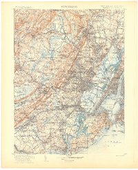 1905 Passaic1905 Print · USGSNorthern New Jersey and Staten Island appear here at a pivotal moment of early 20th-century growth and industrialization. Researchers can trace the development of transit hubs like Convent Sta. or locate legacy landmarks including Hillside Cemetery and the Moravian Cemetery.4 unique versions available
 - 1906 Map of Morristown
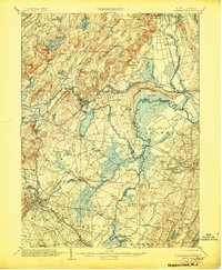 1906 Morristown1906 Print · USGSNorthern New Jersey's transition from industrial highlands to riverine lowlands is captured here just after the turn of the century. Genealogists can trace family roots in Hibernia or Boonton and locate historic crossings like Columbia Bridge and the Morris Canal.6 unique versions available
 - 1910 Map of Greenwood Lake
 1910 Greenwood Lake1910 Print · USGSThe Highlands of northern New Jersey and southern New York are shown here during a peak era of iron mining and rail expansion. Genealogists and industrial historians can trace the foundations of Sterling Furnace, Charlotteburg Mine, and the New Milford Sta. along the Erie Railroad.9 unique versions available
 - 1942 Map of Passaic
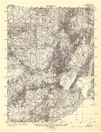 1942 Passaic1942 Print · USGSNorthern New Jersey and New York harbor appear in detail at the start of the war, showing a landscape of burgeoning suburbs and vital industry. Trace family roots and local history across the Passaic River valley, from Paterson to the Watchung Mountains.
 - 1943 Map of Newfoundland
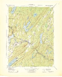 1943 Newfoundland1943 Print · USGSThe Pequannock River valley and its surrounding ridges are captured here during the Second World War. Researchers can trace the New York Susquehanna and Western rail line through Newfoundland or locate landmarks like the Fire House and West Milford School.
 - 1943 Map of Pompton Plains, 1947 Print
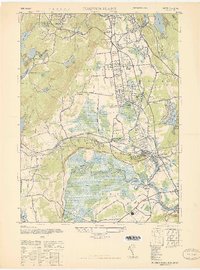 1943 Pompton Plains1947 Print · USGSIn the New Jersey valley of the Passaic, these mid-century Morris County communities are shown just before postwar suburbanization. Researchers can trace the junction of the Erie RR and Lackawanna RR or locate early airfields like North Jersey Airport and Murchia Airport.
 - 1944 Map of Newark, 1971 Print
 1944 Newark1971 Print · USGSThe industrial corridor from Philadelphia to New York was in a period of massive transition during the mid-forties. Genealogists and researchers can trace the rail lines of the Lehigh Valley RR, locate military installations like Picatinny Arsenal, and explore the early sprawl near Levittown.5 unique versions available
 - 1947 Map of Boonton
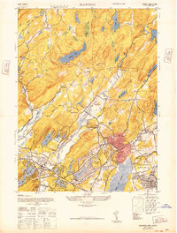 1947 Boonton1947 Print · USGSPost-war Morris County is captured here as a landscape of massive reservoirs, iron mining roots, and growing suburban lake communities. Genealogists and historians can trace the industrial footprint of the Hibernia Mine or locate early aviation sites like the Aircraft Radio Corporation Airport.
 - 1947 Map of Pompton Plains
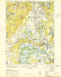 1947 Pompton Plains1947 Print · USGSNorth Jersey was a hub of early aviation and rail travel in the late 1940s, where small airfields and major rail lines intersected. You can trace historic routes through Pompton Plains, locate North Jersey Airport, and follow the Erie RR through the valley.2 unique versions available
 - 1948 Map of Wanaque
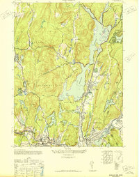 1948 Wanaque1948 Print · USGSNorthern New Jersey's Highlands were entering a period of significant post-war growth when this survey recorded the communities around the Wanaque Reservoir. Genealogists and local historians can trace family roots in Haskell, Bloomingdale, and Midvale, or locate landmarks like the Aquehonga Sch.2 unique versions available
 - 1949 Map of Newark
 1949 Newark1949 Print · USGSThe industrial corridor between Philadelphia and New York comes alive in this post-war survey. Genealogists and historians can trace the massive rail networks of the Reading Railroad and locate major installations like Fort Dix or Picatinny Arsenal.2 unique versions available
 - 1950 Map of Scranton, 1952 Print
 1950 Scranton1952 Print · USGSMid-century Northeast Pennsylvania and the Hudson Valley come alive in this survey of the tri-state region. Genealogists and historians can trace the dense rail networks of the Erie RR and DL&W RR between industrial hubs like Scranton and Wilkes-Barre.
 - 1953 Map of Scranton
 1953 Scranton1953 Print · USGSNortheastern Pennsylvania and the Catskills are shown in great detail during the early fifties, a time when rail lines and river valleys dictated the region's growth. Genealogists and historians can trace the industrial hearts of Scranton and Wilkes-Barre or locate remote landmarks like High Point and Lake Wallenpaupack.
 - 1954 Map of Boonton, 1955 Print
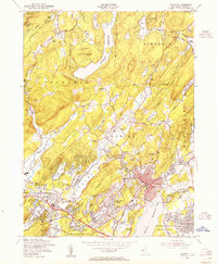 1954 Boonton1955 Print · USGSMid-century Morris County is defined here by industrial military sites and sprawling lakeside developments during a period of suburban expansion. Trace the rail lines of the Wharton and Northern or locate local landmarks like Trinity Ch and Hibernia Cem.6 unique versions available
 - 1954 Map of Newfoundland, 1955 Print
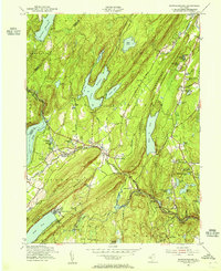 1954 Newfoundland1955 Print · USGSThe Highlands of northern New Jersey appear here in the mid-fifties, dominated by the massive reservoirs and ridge-lines of the Pequannock watershed. Genealogists and local historians can trace the New York Susquehanna and Western RR through Newfoundland and locate landmarks like Vreeland Cem and Postville.6 unique versions available
 - 1954 Map of Wanaque, 1956 Print
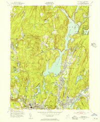 1954 Wanaque1956 Print · USGSMid-century Passaic County is defined by the massive Wanaque Reservoir and the busy rail lines serving the valley. Genealogists and local historians can trace the foundations of Bloomingdale, Butler, and Erskine, finding schools like Eleanor Hewitt Sch and the industrial remnants at Smiths Mills.4 unique versions available
 - 1955 Map of Pompton Plains, 1956 Print
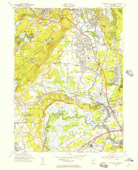 1955 Pompton Plains1956 Print · USGSNorth Jersey at the mid-century shows a landscape of suburban growth and aviation hubs set against the massive Passaic River wetlands. Locate old family plots and parish schools like Mount Calvary Cem and St Joseph Sch, or trace the paths of the Erie RR and Lincoln Park Airport.6 unique versions available
 - 1956 Map of Newark
 1956 Newark1956 Print · USGSThe industrial heart of the Mid-Atlantic is captured here at the dawn of the highway era, tracing the dense corridors between Newark and Philadelphia. Genealogists and local historians can map the rail networks of the Reading RR or locate mid-century military life at Fort Dix Military Reservation.2 unique versions available
Showing maps 1-25 of 58
Top cities near Kinnelon
- New York historical maps
- Newark historical maps
- Ramapo historical maps
- Paterson historical maps
- Clifton historical maps
- East Orange historical maps
See more
Top neighborhoods of Kinnelon
- Brook Valley historical maps
- Jacksonville historical maps
- Fayson Lakes historical maps
- Green Pond Junction historical maps
- Smoke Rise historical maps
- Kinnelon Ridge historical maps
Frequently asked questions
- What are the different types of historical maps available for Kinnelon?
- What is the oldest map of Kinnelon?
- Where can I purchase historical maps of Kinnelon for my home or office?
- Where can I download high-res historical maps of Kinnelon?
- Are there historical topographic maps available for Kinnelon?
- Is there historical aerial imagery available for Kinnelon?
- Where are historical maps of Kinnelon sourced from?