Old Maps of Holiday City at Berkeley, Berkeley Township for Academic Research
Study the evolution of Holiday City at Berkeley with 24 high-resolution historic maps. Whether you're teaching, researching, or modeling changes in land use, these maps provide essential visual documentation of urban, environmental, and geographic change.
- Analyze long-term change: Track patterns in development, transportation, and natural features.
- Ideal for environmental or urban studies: Support academic projects with primary historical map data.
- Use in the classroom or lab: Educators and researchers rely on these maps to bring historical context to life.
These maps are a powerful tool for teaching, research, and visualizing how Holiday City at Berkeley has changed over the decades.
Holiday City at Berkeley, Berkeley Township maps
(24)- 1884 Map of Whitings
 1884 Whitings1884 Print · USGSCovers Holiday City at Berkeley, including Toms River, Jackson Township, and other nearby areas
 - 1888 Map of Barnegat
 1888 Barnegat1888 Print · USGSCovers Holiday City at Berkeley, including Toms River, Manchester Township, and other nearby areas
 - 1888 Map of Whitings, 1900 Print
 1888 Whitings1900 Print · USGSCovers Holiday City at Berkeley, including Toms River, Jackson Township, and other nearby areas3 unique versions available
 - 1893 Map of Barnegat
 1893 Barnegat1893 Print · USGSCovers Holiday City at Berkeley, including Toms River, Manchester Township, and other nearby areas2 unique versions available
 - 1898 Map of Barnegat, 1904 Print
 1898 Barnegat1904 Print · USGSCovers Holiday City at Berkeley, including Toms River, Manchester Township, and other nearby areas5 unique versions available
 - 1919 Map of Barnegat, 1921 Print
 1919 Barnegat1921 Print · USGSCovers Holiday City at Berkeley, including Toms River, Manchester Township, and other nearby areas
 - 1941 Map of Toms River
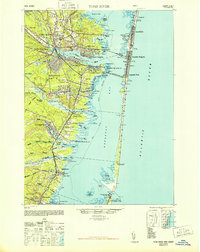
 1941 Toms River1941 Print · USGSCovers Holiday City at Berkeley, including Toms River, Manchester Township, and other nearby areas2 unique versions available
 - 1942 Map of Whiting
 1942 Whiting1942 Print · USGSCovers Holiday City at Berkeley, including Toms River, Jackson Township, and other nearby areas2 unique versions available
 - 1946 Map of Wilmington, 1948 Print
 1946 Wilmington1948 Print · USGSCovers Holiday City at Berkeley, including Philadelphia, Toms River, and other nearby areas2 unique versions available
 - 1948 Map of Toms River
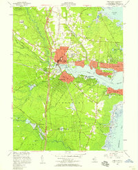
 1948 Toms River1948 Print · USGSCovers Holiday City at Berkeley, including Toms River, Manchester Township, and other nearby areas6 unique versions available
 - 1949 Map of Whiting, 1954 Print
 1949 Whiting1954 Print · USGSCovers Holiday City at Berkeley, including Toms River, Jackson Township, and other nearby areas3 unique versions available
 - 1951 Map of Keswick Grove
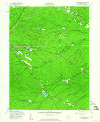
 1951 Keswick Grove1951 Print · USGSCovers Holiday City at Berkeley, including Toms River, Manchester Township, and other nearby areas
 - 1953 Map of Toms River, 1958 Print
 1953 Toms River1958 Print · USGSCovers Holiday City at Berkeley, including Toms River, Manchester Township, and other nearby areas3 unique versions available
 - 1955 Map of Wilmington
 1955 Wilmington1955 Print · USGSCovers Holiday City at Berkeley, including Philadelphia, Toms River, and other nearby areas
 - 1957 Map of Wilmington
 1957 Wilmington1957 Print · USGSCovers Holiday City at Berkeley, including Philadelphia, Toms River, and other nearby areas2 unique versions available
 - 1957 Map of Keswick Grove, 1961 Print
 1957 Keswick Grove1961 Print · USGSCovers Holiday City at Berkeley, including Toms River, Manchester Township, and other nearby areas3 unique versions available
 - 1959 Map of Wilmington
 1959 Wilmington1959 Print · USGSCovers Holiday City at Berkeley, including Philadelphia, Toms River, and other nearby areas3 unique versions available
 - 1966 Map of Wilmington, 1968 Print
 1966 Wilmington1968 Print · USGSCovers Holiday City at Berkeley, including Philadelphia, Toms River, and other nearby areas4 unique versions available
 - 1972 Map of Wilmington, 1976 Print
 1972 Wilmington1976 Print · USGSCovers Holiday City at Berkeley, including Philadelphia, Toms River, and other nearby areas2 unique versions available
 - 1984 Map of Hammonton, 1986 Print
 1984 Hammonton1986 Print · USGSCovers Holiday City at Berkeley, including Toms River, Cherry Hill Township, and other nearby areas3 unique versions available
 - 1989 Map of Toms River
 1989 Toms River1989 Print · USGSCovers Holiday City at Berkeley, including Toms River, Manchester Township, and other nearby areas
 - 1995 Map of Toms River, 2001 Print
 1995 Toms River2001 Print · USGSCovers Holiday City at Berkeley, including Toms River, Manchester Township, and other nearby areas
 - 2023 Map of Toms River, 2023 Print
 2023 Toms River2023 Print · USGSCovers Holiday City at Berkeley, including Toms River, Manchester Township, and other nearby areas
 - 2023 Map of Keswick Grove, 2023 Print
 2023 Keswick Grove2023 Print · USGSCovers Holiday City at Berkeley, including Toms River, Manchester Township, and other nearby areas
End of results
Showing maps 1-24 of 24
Frequently asked questions
- What are the different types of historical maps available for Holiday City at Berkeley?
- What is the oldest map of Holiday City at Berkeley?
- Where can I purchase historical maps of Holiday City at Berkeley for my home or office?
- Where can I download high-res historical maps of Holiday City at Berkeley?
- Are there historical topographic maps available for Holiday City at Berkeley?
- Is there historical aerial imagery available for Holiday City at Berkeley?
- Where are historical maps of Holiday City at Berkeley sourced from?