Old Maps of Coventry Square, Lakewood Township for Genealogy
Trace your family roots with 22 historic maps of Coventry Square. These high-res maps reveal old neighborhoods, homesites, landmarks, and streets — helping you uncover where your ancestors lived and how the area evolved over time.
- Explore historic neighborhoods: Identify where your relatives may have lived in the 1800s or 1900s.
- Compare maps over time: Trace the changes in streets, buildings, and landmarks for multi-generational research.
- Perfect for genealogy & ancestry research: Used by family historians and researchers to map out lineage and migration.
These maps are an incredible resource for exploring your personal connection to Coventry Square's past.
Coventry Square, Lakewood Township maps
(22)- 1888 Map of Asbury Park
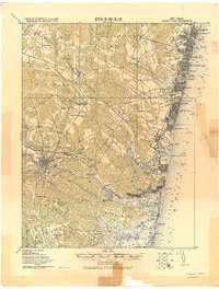
 1888 Asbury Park1888 Print · USGSCoastal Monmouth and Ocean counties are shown in the late nineteenth century as Victorian-era resorts began to transform the New Jersey shoreline. Genealogists and historians can trace the early rail networks of the Long Branch Railroad and locate vanished station stops like Fairfield Station or Shark River Station.
 - 1893 Map of Asbury Park
 1893 Asbury Park1893 Print · USGSThe Jersey Shore was booming in the late nineteenth century as coastal resorts and life-saving stations rose along the Atlantic. Trace early rail travel and maritime safety through L.S. Station Bay Head, Point Pleasant, and the New York and Long Branch Railroad.2 unique versions available
 - 1901 Map of Asbury Park
 1901 Asbury Park1901 Print · USGSThe Jersey Shore at the turn of the century reveals a landscape of growing coastal resorts and busy railroad junctions. Genealogists can trace family roots in old hamlets like Allaire, Seven Stars, and Farmingdale as they appeared before suburbanization.5 unique versions available
 - 1902 Map of Navesink
 1902 Navesink1902 Print · USGSCoastal New Jersey and the Raritan valley are shown here at the turn of the century, when industrial hubs and maritime defenses defined the shoreline. Genealogists can trace family roots through settlements like Old Bridge and Milltown, or locate local landmarks like the State Reform School.3 unique versions available
 - 1919 Map of Asbury Park, 1921 Print
 1919 Asbury Park1921 Print · USGSCoastal Monmouth and Ocean Counties come alive in the early twentieth century, showing the rapid growth of beach resorts alongside quiet pineland settlements. Researchers can trace the early rail corridors of the Pennsylvania Railroad and locate maritime landmarks like L.S. Station Manasquan Beach and Point Pleasant.
 - 1944 Map of Newark, 1971 Print
 1944 Newark1971 Print · USGSThe industrial corridor from Philadelphia to New York was in a period of massive transition during the mid-forties. Genealogists and researchers can trace the rail lines of the Lehigh Valley RR, locate military installations like Picatinny Arsenal, and explore the early sprawl near Levittown.5 unique versions available
 - 1947 Map of Lakewood
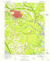
 1947 Lakewood1947 Print · USGSCoastal Ocean County in the late 1940s shows a mix of growing townships and pine-lined waterways just as the regional highway system expanded. Genealogists and historians can trace old residential grids in Lakewood, locate family plots at Evergreen Cem, or follow the Central Railroad of New Jersey.
 - 1949 Map of Newark
 1949 Newark1949 Print · USGSThe industrial corridor between Philadelphia and New York comes alive in this post-war survey. Genealogists and historians can trace the massive rail networks of the Reading Railroad and locate major installations like Fort Dix or Picatinny Arsenal.2 unique versions available
 - 1954 Map of Lakewood, 1956 Print
 1954 Lakewood1956 Print · USGSMid-century Ocean County is captured during a period of growth, centered on the historic resort community of Lakewood and its surrounding townships. Researchers can trace family sites and local institutions through landmarks like Georgian Court College, Seven Stars, and the Mt Sinai Cem.3 unique versions available
 - 1956 Map of Newark
 1956 Newark1956 Print · USGSThe industrial heart of the Mid-Atlantic is captured here at the dawn of the highway era, tracing the dense corridors between Newark and Philadelphia. Genealogists and local historians can map the rail networks of the Reading RR or locate mid-century military life at Fort Dix Military Reservation.2 unique versions available
 - 1957 Map of Newark
 1957 Newark1957 Print · USGSThe industrial and military heart of the Mid-Atlantic is mapped during its post-war suburban boom. Genealogists and historians can trace the intricate rail corridors of the Reading Railroad and locate key landmarks from Princeton University to Fort Hancock.
 - 1960 Map of Newark
 1960 Newark1960 Print · USGSThe industrial heart of the Mid-Atlantic is shown at mid-century, stretching from the dense urban centers of Newark and Philadelphia to the Blue Mountain ridges. Researchers can trace historic rail lines, coastal defenses at Fort Hancock, and the riverfront growth of Trenton and Easton.3 unique versions available
 - 1964 Map of Newark
 1964 Newark1964 Print · USGSGreater New Jersey and eastern Pennsylvania appear at the peak of their industrial and rail-centered development in the mid-sixties. Genealogists and historians can trace the paths of the Pennsylvania RR, identify mid-century landmarks like CAMP KILMER, or follow the Schuylkill River through READING.2 unique versions available
 - 1982 Map of Trenton, 1983 Print
 1982 Trenton1983 Print · USGSCentral New Jersey and the Delaware River valley are captured in the early eighties during a time of major highway expansion and suburban maturation. Researchers can trace the grounds of Princeton University, the historic Monmouth Battlefield, and the sprawling Fort Dix.
 - 1986 Map of Trenton, 1987 Print
 1986 Trenton1987 Print · USGSCentral New Jersey and the Delaware River valley are shown here during the mid-eighties, a period of dense suburban growth and military activity. Researchers can trace the sprawling grounds of the Fort Dix Military Reservation and the historic corridors of the Delaware & Raritan Canal State Park.
 - 1989 Map of Lakewood
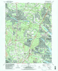 1989 Lakewood1989 Print · USGSCoastal New Jersey suburban life is in full bloom during the late eighties as residential developments spread across Ocean County. Researchers can trace the layout of Leisure Village, locate family plots in Evergreen Cem, or follow the industrial sites near Seven Stars.2 unique versions available
 - 1995 Map of Lakewood, 2000 Print
 1995 Lakewood2000 Print · USGSOcean County's suburban expansion is in full view during the mid-1990s as retirement communities and educational centers grow around the Metedeconk River. Genealogists and local historians can trace landmarks like St Marys Cem, the grounds of Georgian Court College, and early settlements like Seven Stars.
 - 2011 Map of Lakewood, 2011 Print
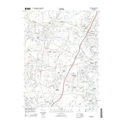
 2011 Lakewood2011 Print · USGSCovers Coventry Square, including Toms River, Lakewood Township, and other nearby areas
 - 2014 Map of Lakewood, 2014 Print
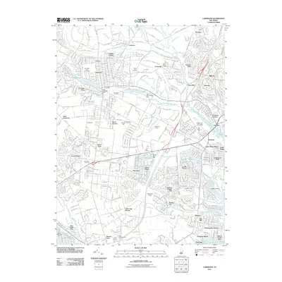
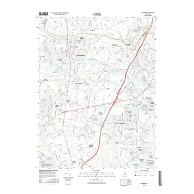
 2014 Lakewood2014 Print · USGSCovers Coventry Square, including Toms River, Lakewood Township, and other nearby areas
 - 2016 Map of Lakewood, 2016 Print
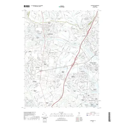
 2016 Lakewood2016 Print · USGSCovers Coventry Square, including Toms River, Lakewood Township, and other nearby areas
 - 2019 Map of Lakewood, 2019 Print
 2019 Lakewood2019 Print · USGSCovers Coventry Square, including Toms River, Lakewood Township, and other nearby areas
 - 2023 Map of Lakewood, 2023 Print
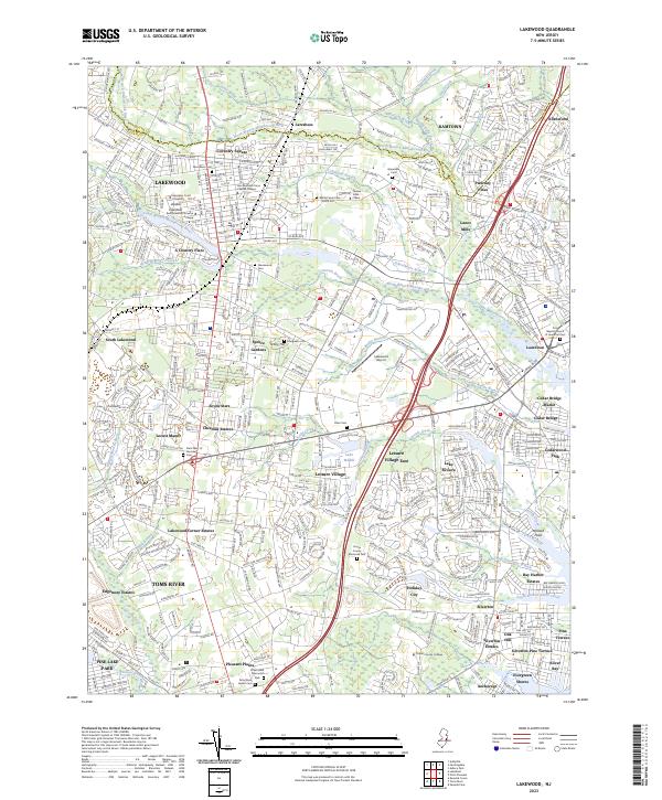 2023 Lakewood2023 Print · USGSOcean County's suburban and educational landscape comes into sharp focus in this recent survey of the Jersey Shore's interior. Researchers can trace the footprints of Georgian Court University, the Lakewood Airport, and dozens of distinct neighborhoods from South Lakewood to Silverton.
End of results
Showing maps 1-22 of 22
Top cities near Coventry Square
- Toms River historical maps
- Lakewood Township historical maps
- Brick Township historical maps
- Middletown Township historical maps
- Old Bridge Township historical maps
- Howell Township historical maps
See more
Frequently asked questions
- What are the different types of historical maps available for Coventry Square?
- What is the oldest map of Coventry Square?
- Where can I purchase historical maps of Coventry Square for my home or office?
- Where can I download high-res historical maps of Coventry Square?
- Are there historical topographic maps available for Coventry Square?
- Is there historical aerial imagery available for Coventry Square?
- Where are historical maps of Coventry Square sourced from?