Old Maps of Warbasse, Lafayette Township for Metal Detecting
Plan your next treasure hunt with 17 historic maps of Warbasse. Find old homesites, ghost towns, trails, and gathering spots that may be lost to time — perfect for identifying promising metal detecting locations.
- Locate forgotten sites: Uncover places like long-lost settlements, abandoned rail lines, or gathering spots.
- Plan better hunts: Use map overlays combined with LiDAR or satellite views to narrow in on historically rich areas.
- Made for detectorists: Thousands of hobbyists use these maps to discover relics, coins, and hidden history.
Use these historic maps to boost your research and find new opportunities beneath the surface of Warbasse.
Warbasse, Lafayette Township maps
(17)- 1888 Map of Franklin
 1888 Franklin1888 Print · USGSSussex County was a thriving hub of iron mining and rail commerce in the late nineteenth century. Genealogists and historians can trace the early industrial layout of Franklin Furnace, the remote Ogden Mine, and rural junctions like Branchville Junction.
 - 1894 Map of Franklin
 1894 Franklin1894 Print · USGSSussex County was a thriving industrial hub in the late nineteenth century, driven by the iron and zinc deposits of the Highlands. Genealogists and historians can trace the rail-to-mine connections between Franklin Furnace, Ogden Mine, and Deckertown.
 - 1897 Map of Franklin
 1897 Franklin1897 Print · USGSSussex County’s industrial and agricultural heartlands are captured in the late 1890s, centered on the vital mining district and its complex rail network. Genealogists and historians can trace the footprint of early iron and zinc works at Franklin Furnace or locate family homesteads near Branchville and Papakating.
 - 1903 Map of Franklin Furnace
 1903 Franklin Furnace1903 Print · USGSSussex County at the turn of the century is a landscape shaped by iron mining and a bustling rail network. Genealogists and historians can trace the early industrial roots of Franklin Furnace, locate rural landmarks like North Church, and follow the path of the Lehigh and Hudson River Railroad.4 unique versions available
 - 1943 Map of Newton East
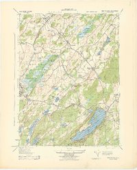 1943 Newton East1943 Print · USGSSussex County was a hub of dairy production and rail transport during the early war years. Genealogists and historians can trace local family land at Ideal Farms or locate industrial sites like the Slate Quarry and Mulford Station.
 - 1950 Map of Scranton, 1952 Print
 1950 Scranton1952 Print · USGSMid-century Northeast Pennsylvania and the Hudson Valley come alive in this survey of the tri-state region. Genealogists and historians can trace the dense rail networks of the Erie RR and DL&W RR between industrial hubs like Scranton and Wilkes-Barre.
 - 1953 Map of Scranton
 1953 Scranton1953 Print · USGSNortheastern Pennsylvania and the Catskills are shown in great detail during the early fifties, a time when rail lines and river valleys dictated the region's growth. Genealogists and historians can trace the industrial hearts of Scranton and Wilkes-Barre or locate remote landmarks like High Point and Lake Wallenpaupack.
 - 1954 Map of Newton East, 1955 Print
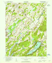 1954 Newton East1955 Print · USGSSussex County emerges in the mid-fifties as a landscape of established rail hubs and growing lakeside communities. Trace the vanished industrial footprints of Sussex Mills and Mulford Station or locate family roots near Vaughn Cem and Township Sch.6 unique versions available
 - 1959 Map of Scranton
 1959 Scranton1959 Print · USGSThe northern coalfields and the Hudson Valley meet in this mid-century survey of the Pennsylvania and New York borderlands. Genealogists and historians can trace the intricate rail networks of the Erie Railroad and the vast waters of Lake Wallenpaupack.2 unique versions available
 - 1962 Map of Scranton, 1977 Print
 1962 Scranton1977 Print · USGSThe industrial heart of eastern Pennsylvania and the New York Catskills are captured here in the early sixties. Genealogists and historians can trace the dense valley settlements from Scranton to Wilkes-Barre and the rail lines of the Erie Lackawanna Railroad.2 unique versions available
 - 1965 Map of Scranton
 1965 Scranton1965 Print · USGSThe tri-state highlands of Pennsylvania, New York, and New Jersey come alive in the mid-sixties as industry and recreation converge. Trace the intricate rail lines of the Erie Lackawanna RR or locate landmarks like the U S Military Academy.2 unique versions available
 - 1986 Map of Middletown
 1986 Middletown1986 Print · USGSThe Tri-State region comes alive in the mid-1980s, documenting the corridor from the Hudson River to the Delaware Water Gap. Researchers can trace the sprawling grounds of West Point, the extensive Conrail rail network, and early suburban growth around Middletown and Suffern.2 unique versions available
 - 2011 Map of Newton East, 2011 Print
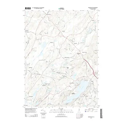
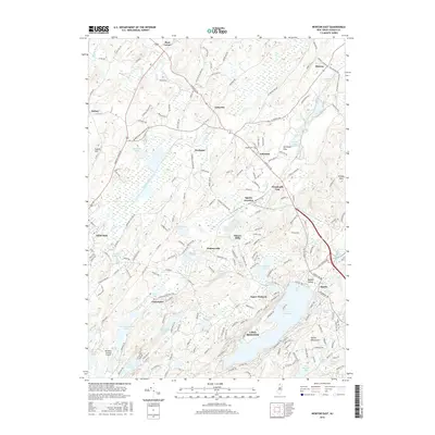
 2011 Newton East2011 Print · USGSCovers Warbasse, including Sparta Township, Newton, and other nearby areas
 - 2014 Map of Newton East, 2014 Print
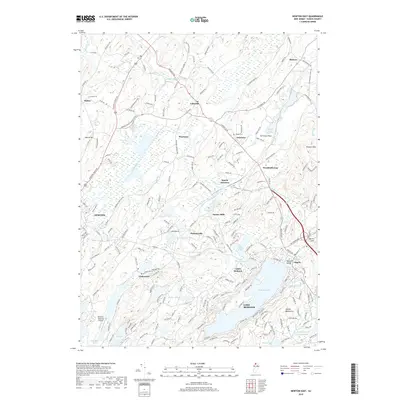
 2014 Newton East2014 Print · USGSCovers Warbasse, including Sparta Township, Newton, and other nearby areas
 - 2016 Map of Newton East, 2016 Print
 2016 Newton East2016 Print · USGSCovers Warbasse, including Sparta Township, Newton, and other nearby areas
 - 2019 Map of Newton East, 2019 Print
 2019 Newton East2019 Print · USGSCovers Warbasse, including Sparta Township, Newton, and other nearby areas
 - 2023 Map of Newton East, 2023 Print
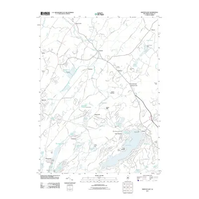
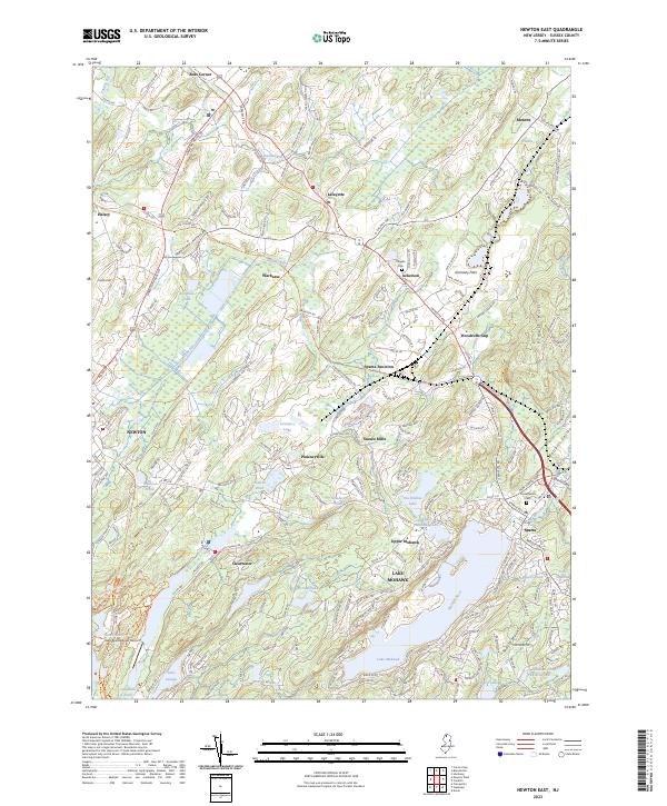 2023 Newton East2023 Print · USGSSussex County’s highlands and lake communities are captured here in the early twenty-first century, showing the evolution of the area’s rail and road networks. Researchers can trace old routes and family sites near Pinkneyville, Vaughn Cem, and Sussex Mills.
End of results
Showing maps 1-17 of 17
Top cities near Warbasse
- Parsippany-Troy Hills historical maps
- Warwick historical maps
- Mount Olive historical maps
- West Milford historical maps
- Vernon Township historical maps
- Rockaway Township historical maps
See more
Frequently asked questions
- What are the different types of historical maps available for Warbasse?
- What is the oldest map of Warbasse?
- Where can I purchase historical maps of Warbasse for my home or office?
- Where can I download high-res historical maps of Warbasse?
- Are there historical topographic maps available for Warbasse?
- Is there historical aerial imagery available for Warbasse?
- Where are historical maps of Warbasse sourced from?