1970s Maps of Blairstown, New Jersey
Explore 2 historic maps of Blairstown from the 1970s. These maps offer a rare glimpse into what life looked like during the 1970s — showing old roads, neighborhoods, homes, and landmarks that have changed or disappeared over time.
Whether you're researching your family's past, planning a metal detecting trip, or studying how Blairstown's landscape evolved across the 1970s, these high-resolution maps are a powerful tool for exploring the history of this region.
- Focus on a specific era: All maps on this page are from the 1970s, giving you a focused view of this time period.
- See what’s changed: Compare century-old streets, trails, and buildings to today's modern landscape using overlays and satellite layers.
- Research with precision: Use these maps for genealogy, historical research, land use analysis, or educational projects.
- View, download, or print: Maps are fully viewable online in high resolution, and can be downloaded or printed for your own records.
Start exploring Blairstown's history through authentic maps from the 1970s. This is your window into the past.
Blairstown, NJ maps
(2)- 1976 Map of Bushkill, 1978 Print
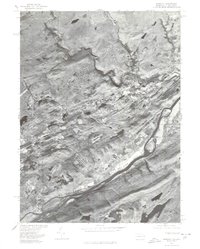 1976 Bushkill1978 Print · USGSThe Delaware River valley in the mid-seventies shows a landscape defined by its waterways and small riverside settlements. Trace the local geography around Bushkill and Shoemakers, or examine the early footprint of the Yards Creek Reservoir.
 - 1976 Map of Flatbrookville, 1978 Print
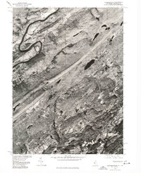 1976 Flatbrookville1978 Print · USGSThe Delaware River valley and Sussex County uplands are captured in this late-seventies aerial survey. Trace rural development and land use patterns around Flatbrookville, Stillwater, and the shores of Fairview Lake.
End of results
Showing maps 1-2 of 2
Top cities near Blairstown
- Mount Olive historical maps
- Hackettstown historical maps
- East Stroudsburg historical maps
- Newton historical maps
- Delaware historical maps
- Washington historical maps
See more
Top neighborhoods of Blairstown
- Paulina historical maps
- Hemlock Glen historical maps
- Vail historical maps
- Jacksonburg historical maps
- Kalarama historical maps
- Walnut Valley historical maps
See more
Frequently asked questions
- What are the different types of historical maps available for Blairstown?
- What is the oldest map of Blairstown?
- Where can I purchase historical maps of Blairstown for my home or office?
- Where can I download high-res historical maps of Blairstown?
- Are there historical topographic maps available for Blairstown?
- Is there historical aerial imagery available for Blairstown?
- Where are historical maps of Blairstown sourced from?