Old Maps of Juan Tabo Hills, Albuquerque
Explore 18 old maps of Juan Tabo Hills, spanning from 1888 to today. These high-resolution historic maps reveal how streets, neighborhoods, landmarks, and natural features evolved over time — perfect for genealogy, metal detecting, research, and local history exploration.
What you can do with these maps:
- See how Juan Tabo Hills changed over time: Compare historical maps to modern-day views to trace roads, homesites, rail lines & more.
- View detailed metadata: Each map includes creators, publishers, year, scale, and archive source.
- Overlay maps with satellite & LiDAR: Visualize the past alongside modern tools to explore terrain & human change.
- Trusted historical sources: Maps sourced from the USGS, Library of Congress, and other archives.
- Access maps your way: View online, download high-res files, or order prints for personal or research use.
Start exploring old maps of Juan Tabo Hills to uncover forgotten places, hidden landmarks, and the deep history beneath your feet.
Juan Tabo Hills, Albuquerque maps
(18)- 1888 Map of Bernalillo, 1951 Print
 1888 Bernalillo1951 Print · USGSThe Middle Rio Grande valley appears here in the late nineteenth century, just as the railroad began to reshape the high desert. Genealogists and historians can trace the early footprints of Albuquerque, Bernalillo, and traditional communities like Atrisco and Santa Ana.
 - 1889 Map of Albuquerque
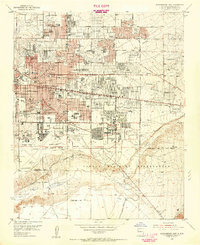
 1889 Albuquerque1889 Print · USGSAlbuquerque and the Rio Grande Valley appear here during the expansion of the territorial railroad system. Local historians can trace the early rail corridor of the Atchison Topeka and Santa Fe Railroad and find early river settlements like Bernalillo, Alameda, and Artisco.
 - 1893 Map of Albuquerque
 1893 Albuquerque1893 Print · USGSThe Rio Grande valley in the late nineteenth century is a study in river-fronting settlements and the emerging rail economy. Genealogists can trace the early footprints of Albuquerque, Bernalillo, and the traditional community at Artisco.5 unique versions available
 - 1934 Map of East Albuquerque
 1934 East Albuquerque1934 Print · USGSAlbuquerque's eastern reaches are captured in the mid-1930s just as federal and institutional growth began defining the city. Local historians can trace the early University of New Mexico campus and the original Albuquerque Landing Field.
 - 1938 Map of Albuquerque
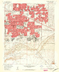
 1938 Albuquerque1938 Print · USGSAlbuquerque and the Rio Grande Valley are shown in the late 1930s, when irrigation ditches still defined the rural landscape between the river and the mountains. Researchers can trace ancestral lands through the Town of Atrisco Grant or locate landmarks like the U S Indian School and Old Albuquerque.
 - 1954 Map of Albuquerque East, 1955 Print
 1954 Albuquerque East1955 Print · USGSAlbuquerque’s post-war eastern expansion is documented here as neighborhoods rise toward the foothills and military installations. Trace mid-century landmarks like the Del Norte Airport, the University of New Mexico, and the Cactus Drive-in Theater.
 - 1958 Map of Albuquerque
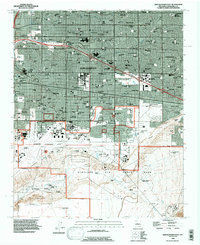
 1958 Albuquerque1958 Print · USGSAlbuquerque and the surrounding high desert are captured here during a period of massive federal expansion and postwar growth. Researchers can trace the development of Kirtland Air Force Base, find ancestral homes in Pueblo de Santa Ana, or locate industrial sites like the Jackpile Mine.
 - 1960 Map of Albuquerque East
 1960 Albuquerque East1960 Print · USGSAlbuquerque's eastern neighborhoods and the foothills of the Sandia Mountains are captured here during a decade of rapid growth. Researchers can locate mid-century schools and churches like Pius X High Sch and Queen of Heaven Ch, or trace the boundaries of the Sandia Military Reservation.3 unique versions available
 - 1962 Map of Albuquerque
 1962 Albuquerque1962 Print · USGSAlbuquerque and the surrounding high desert are captured here in the early 1960s during a period of intense mineral and military growth. Genealogists and historians can locate early schools like the Pueblo Pintado School, major industrial sites like the Jackpile Mine, and the sprawling Kirtland Air Force Base.
 - 1963 Map of Albuquerque, 1965 Print
 1963 Albuquerque1965 Print · USGSMid-century New Mexico unfolds across this map, showcasing the intersection of ancient pueblos, modern military bases, and historic mining districts. Trace family roots and local history through the Ortiz Mine, Seven Lakes Trading Post, and Alameda.3 unique versions available
 - 1978 Map of Albuquerque, 1986 Print
 1978 Albuquerque1986 Print · USGSGreater Albuquerque and the Rio Grande valley are captured here during a period of significant suburban expansion in the late seventies. Researchers can trace the early Subdivision Road Pattern near Rio Rancho and the historic footprints of Santa Ana Pueblo and Bernalillo.
 - 1983 Map of Albuquerque, 1984 Print
 1983 Albuquerque1984 Print · USGSCentral New Mexico in the early eighties shows a landscape where ancient pueblos and modern aerospace hubs meet. Trace the routes of the Atchison Topeka and Santa Fe RR or locate landmarks like Kirtland Air Force Base, Madrid, and the Sandia Mountains.
 - 1990 Map of Albuquerque East, 1996 Print
 1990 Albuquerque East1996 Print · USGSAlbuquerque and its eastern suburbs are captured here during a period of rapid 1990s growth. Researchers can trace the massive footprints of Kirtland Air Force Base, the University of New Mexico, and the State Fairground.
 - 2010 Map of Albuquerque East, 2010 Print
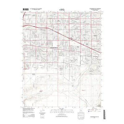
 2010 Albuquerque East2010 Print · USGSCovers Juan Tabo Hills, including Albuquerque, Enchanted Park, and other nearby areas
 - 2013 Map of Albuquerque East, 2013 Print
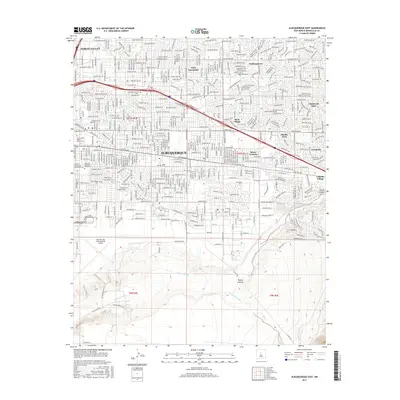
 2013 Albuquerque East2013 Print · USGSCovers Juan Tabo Hills, including Albuquerque, Enchanted Park, and other nearby areas
 - 2017 Map of Albuquerque East, 2017 Print
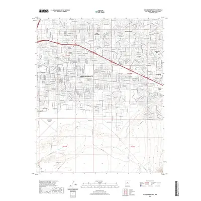
 2017 Albuquerque East2017 Print · USGSCovers Juan Tabo Hills, including Albuquerque, Enchanted Park, and other nearby areas
 - 2020 Map of Albuquerque East, 2020 Print
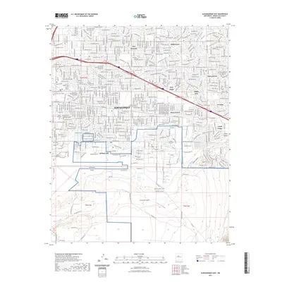
 2020 Albuquerque East2020 Print · USGSCovers Juan Tabo Hills, including Albuquerque, Enchanted Park, and other nearby areas
 - 2023 Map of Albuquerque East, 2023 Print
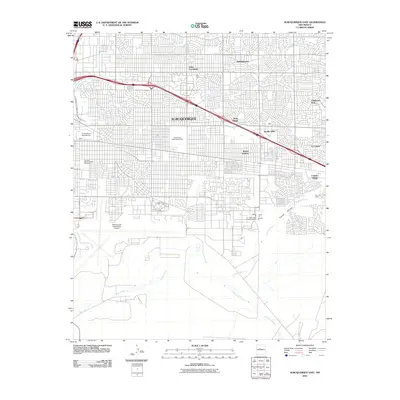
 2023 Albuquerque East2023 Print · USGSAlbuquerque's eastern neighborhoods and major military installations are captured here in the early twenty-first century. Researchers can locate family sites in Fairview Memorial Park Cem or trace the development of Mesa Village and Chelwood Park.
End of results
Showing maps 1-18 of 18
Top cities near Juan Tabo Hills
- Albuquerque historical maps
- Rio Rancho historical maps
- South Valley historical maps
- Los Lunas historical maps
- Corrales historical maps
- Los Ranchos de Albuquerque historical maps
See more
Frequently asked questions
- What are the different types of historical maps available for Juan Tabo Hills?
- What is the oldest map of Juan Tabo Hills?
- Where can I purchase historical maps of Juan Tabo Hills for my home or office?
- Where can I download high-res historical maps of Juan Tabo Hills?
- Are there historical topographic maps available for Juan Tabo Hills?
- Is there historical aerial imagery available for Juan Tabo Hills?
- Where are historical maps of Juan Tabo Hills sourced from?