1980s Maps of Old Horse Springs, New Mexico
Explore 2 historic maps of Old Horse Springs from the 1980s. These maps offer a rare glimpse into what life looked like during the 1980s — showing old roads, neighborhoods, homes, and landmarks that have changed or disappeared over time.
Whether you're researching your family's past, planning a metal detecting trip, or studying how Old Horse Springs's landscape evolved across the 1980s, these high-resolution maps are a powerful tool for exploring the history of this region.
- Focus on a specific era: All maps on this page are from the 1980s, giving you a focused view of this time period.
- See what’s changed: Compare century-old streets, trails, and buildings to today's modern landscape using overlays and satellite layers.
- Research with precision: Use these maps for genealogy, historical research, land use analysis, or educational projects.
- View, download, or print: Maps are fully viewable online in high resolution, and can be downloaded or printed for your own records.
Start exploring Old Horse Springs's history through authentic maps from the 1980s. This is your window into the past.
Old Horse Springs, NM maps
(2)- 1981 Map of Horse Mountain West
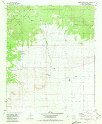 1981 Horse Mountain West1981 Print · USGSCatron County, New Mexico, appears in the early eighties as a landscape of remote ranching outposts and high-country forest. Genealogists can locate the distinct settlements of Old Horse Springs and New Horse Springs, along with family-named sites like Armijo Well and Sanchez Spring.
 - 1983 Map of Tularosa Mountains
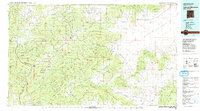 1983 Tularosa Mountains1983 Print · USGSCatron County in the early eighties is a landscape of high timber and remote river valleys shaped by the Apache and Gila National Forests. Local historians can trace the foundations of settlements like San Francisco Plaza and Old Horse Springs, or locate remote landmarks like the Negrito Airstrip.2 unique versions available
End of results
Showing maps 1-2 of 2
Frequently asked questions
- What are the different types of historical maps available for Old Horse Springs?
- What is the oldest map of Old Horse Springs?
- Where can I purchase historical maps of Old Horse Springs for my home or office?
- Where can I download high-res historical maps of Old Horse Springs?
- Are there historical topographic maps available for Old Horse Springs?
- Is there historical aerial imagery available for Old Horse Springs?
- Where are historical maps of Old Horse Springs sourced from?