Old Maps of Paxton Springs, New Mexico for Genealogy
Trace your family roots with 15 historic maps of Paxton Springs. These high-res maps reveal old neighborhoods, homesites, landmarks, and streets — helping you uncover where your ancestors lived and how the area evolved over time.
- Explore historic neighborhoods: Identify where your relatives may have lived in the 1800s or 1900s.
- Compare maps over time: Trace the changes in streets, buildings, and landmarks for multi-generational research.
- Perfect for genealogy & ancestry research: Used by family historians and researchers to map out lineage and migration.
These maps are an incredible resource for exploring your personal connection to Paxton Springs's past.
Paxton Springs, NM maps
(15)- 1886 Map of Wingate
 1886 Wingate1886 Print · USGSThe high deserts of western New Mexico are shown during the expansion of the rail era in the mid-1880s. Genealogists and historians can trace early settlements and vital water sources like Gallup, Old Zuñi, and the historic Fort Wingate along the Atlantic and Pacific Railroad.
 - 1892 Map of Wingate
 1892 Wingate1892 Print · USGSNorthwestern New Mexico territory comes to life during the expansion of the rail era, centered on the strategic military and trade routes of the high desert. Researchers can trace the path of the Atlantic and Pacific Railroad past Fort Wingate and through early settlements like Gallup and Old Zuni.4 unique versions available
 - 1952 Map of Paxton Springs, 1954 Print
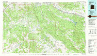
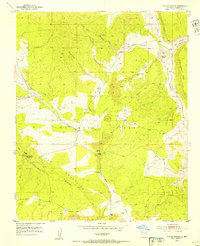 1952 Paxton Springs1954 Print · USGSThe Zuni Mountains high country comes into focus in the early fifties, capturing the remote landscapes of the Cibola National Forest. Trace the path of the Continental Divide past Paxton Springs and the Oso Ridge Lookout Tower.8 unique versions available
 - 1954 Map of Gallup, 1973 Print
 1954 Gallup1973 Print · USGSNative American tribal lands and the railroad corridor of the Southwest appear here at the midpoint of the century. Trace historic sites and remote settlements from Window Rock to the Fort Wingate Army Depot and Bibo.2 unique versions available
 - 1958 Map of Gallup
 1958 Gallup1958 Print · USGSThe high desert of Western New Mexico and Eastern Arizona is captured here in the late fifties, dominated by the Navajo and Zuni homelands. Researchers can trace the path of US 66 through Gallup or locate historic industry at the Navajo Coal Mine and Gibson Coal Mine.
 - 1959 Map of Gallup
 1959 Gallup1959 Print · USGSThe high desert corridor of northwestern New Mexico and eastern Arizona comes alive in the late fifties, following the path of Route 66 and the rail lines. Trace established landmarks like Zuni Pueblo, the Fort Wingate Military Reservation, and the Coolidge Post Office.
 - 1962 Map of Gallup
 1962 Gallup1962 Print · USGSThe high plateau and mountains surrounding Gallup in the early sixties reveal a landscape defined by tribal lands, coal mining, and the rail corridor. Researchers can locate remote trading posts, the Gibson Coal Mine, and the historic Window Rock capital.
 - 1967 Map of Gallup
 1967 Gallup1967 Print · USGSThe high desert of New Mexico and Arizona comes into focus in the mid-1960s, centered on the railroad and ranching hub of Gallup. Genealogists and historians can trace routes through Zuni Pueblo, identify old rail stops like Houck, or locate the Aqua Fria Post Office.
 - 1981 Map of Zuni
 1981 Zuni1981 Print · USGSThe high plateau and mountains of western New Mexico are captured here in the early eighties, showcasing the intersection of tribal lands and national forests. Genealogists and researchers can trace local landmarks from Upper Nutria to the Black Rock Hospital and the historic Fort Wingate.2 unique versions available
 - 1995 Map of Paxton Springs, 1998 Print
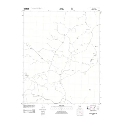
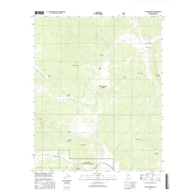
 1995 Paxton Springs1998 Print · USGSThe high Zuni Mountains and Continental Divide are captured here in the mid-1990s, revealing a landscape shaped by volcanic geology and forest management. Trace the Old Railroad Grade, locate the settlement at Paxton Springs, or find family sites like Arrosa Ranch.
 - 2011 Map of Paxton Springs, 2011 Print
 2011 Paxton Springs2011 Print · USGSCovers Paxton Springs, including Cibola County, United States, and other nearby areas
 - 2013 Map of Paxton Springs, 2013 Print
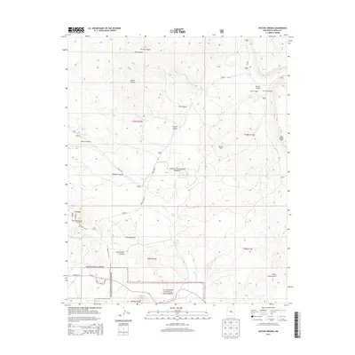 2013 Paxton Springs2013 Print · USGSCovers Paxton Springs, including Cibola County, United States, and other nearby areas
 - 2017 Map of Paxton Springs, 2017 Print
 2017 Paxton Springs2017 Print · USGSCovers Paxton Springs, including Cibola County, United States, and other nearby areas
 - 2020 Map of Paxton Springs, 2020 Print
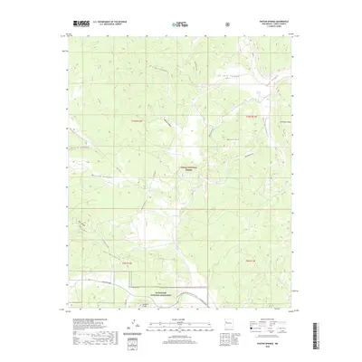 2020 Paxton Springs2020 Print · USGSCovers Paxton Springs, including Cibola County, United States, and other nearby areas
 - 2023 Map of Paxton Springs, 2023 Print
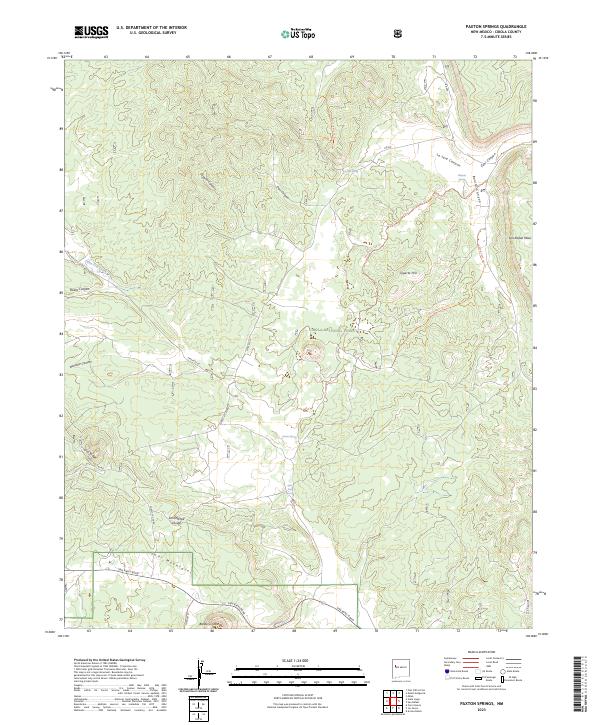 2023 Paxton Springs2023 Print · USGSCibola County high country in the early 2020s shows a landscape of volcanic craters and deep canyons within the Cibola National Forest. Researchers can trace the Continental Divide National Scenic Trail as it passes near Paxton Spring and the Bandera Crater.
End of results
Showing maps 1-15 of 15
Top cities near Paxton Springs
Frequently asked questions
- What are the different types of historical maps available for Paxton Springs?
- What is the oldest map of Paxton Springs?
- Where can I purchase historical maps of Paxton Springs for my home or office?
- Where can I download high-res historical maps of Paxton Springs?
- Are there historical topographic maps available for Paxton Springs?
- Is there historical aerial imagery available for Paxton Springs?
- Where are historical maps of Paxton Springs sourced from?