Old Maps of Sugarite, New Mexico
Explore 11 old maps of Sugarite, spanning from 1912 to today. These high-resolution historic maps reveal how streets, neighborhoods, landmarks, and natural features evolved over time — perfect for genealogy, metal detecting, research, and local history exploration.
What you can do with these maps:
- See how Sugarite changed over time: Compare historical maps to modern-day views to trace roads, homesites, rail lines & more.
- View detailed metadata: Each map includes creators, publishers, year, scale, and archive source.
- Overlay maps with satellite & LiDAR: Visualize the past alongside modern tools to explore terrain & human change.
- Trusted historical sources: Maps sourced from the USGS, Library of Congress, and other archives.
- Access maps your way: View online, download high-res files, or order prints for personal or research use.
Start exploring old maps of Sugarite to uncover forgotten places, hidden landmarks, and the deep history beneath your feet.
Sugarite, NM maps
(11)- 1912 Map of Raton, 1958 Print
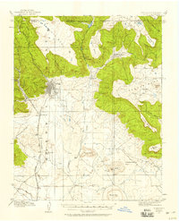 1912 Raton1958 Print · USGSRaton and the high mesas of the Colorado-New Mexico border are captured here just as the railroad era reached its peak. Researchers can trace the early industrial landscape of coal towns like Gardiner and Blossburg or locate the historic Clifton House and Raton Tunnel.2 unique versions available
 - 1914 Map of Raton
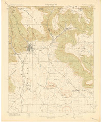 1914 Raton1914 Print · USGSRaton served as a vital mountain gateway during the early twentieth century as railroads and early highways crested the Colorado border. Researchers can trace the industrial spurs of the Wagon Mine or locate vanished stops like Blossburg, Gardiner, and Clifton House.5 unique versions available
 - 1954 Map of Raton, 1963 Print
 1954 Raton1963 Print · USGSNorthern New Mexico's high-country and plains are documented here in the early sixties, showing the region's ranching and mining infrastructure. Trace the legacy of the Maxwell Land Grant, locate remote rural sites like Tafoya School, and follow the Atchison Topeka and Santa Fe Railway through the heart of Raton.3 unique versions available
 - 1958 Map of Raton
 1958 Raton1958 Print · USGSNorthern New Mexico and the Colorado borderlands are mapped here in the late fifties, showcasing a landscape of high peaks and historic land grants. Genealogists and historians can trace families across Picuris Pueblo, find old schoolhouses like Piedra Lumbre School, or follow the Atchison Topeka and Santa Fe rail line.3 unique versions available
 - 1971 Map of Raton, 1974 Print
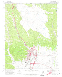 1971 Raton1974 Print · USGSRaton stood as a vital mountain transit hub in the early seventies, marking the high-altitude transition between New Mexico and Colorado. Genealogists and historians can trace the intersection of the Santa Fe Trail with coal-era landmarks like the Coke Ovens at Gardiner and Blossburg.
 - 1981 Map of Raton
 1981 Raton1981 Print · USGSNorthern New Mexico's high mesas and mining corridors are preserved here as they appeared in the early eighties. Genealogists and historians can trace the transit networks of the Santa Fe Trail and find company towns like Van Houten and Koehler.
 - 2010 Map of Raton, 2010 Print
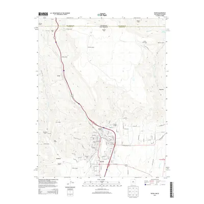
 2010 Raton2010 Print · USGSCovers Sugarite, including Raton, Keota, and other nearby areas
 - 2013 Map of Raton, 2013 Print
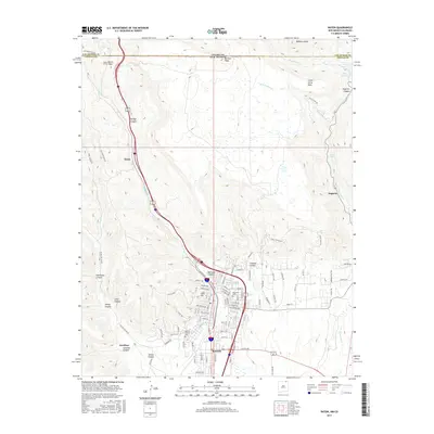
 2013 Raton2013 Print · USGSCovers Sugarite, including Raton, Keota, and other nearby areas
 - 2017 Map of Raton, 2017 Print
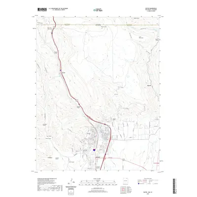
 2017 Raton2017 Print · USGSCovers Sugarite, including Raton, Keota, and other nearby areas
 - 2020 Map of Raton, 2020 Print
 2020 Raton2020 Print · USGSCovers Sugarite, including Raton, Keota, and other nearby areas
 - 2023 Map of Raton, 2023 Print
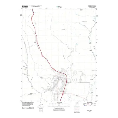
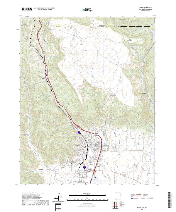 2023 Raton2023 Print · USGSRaton serves as the high-altitude gateway between New Mexico and Colorado at the foot of the mesas in the early twenty-first century. Genealogists and historians can locate Fairmont Cem, trace the Old Raton Pass Rd, and explore the canyon floor at Gardiner.
End of results
Showing maps 1-11 of 11
Top cities near Sugarite
Frequently asked questions
- What are the different types of historical maps available for Sugarite?
- What is the oldest map of Sugarite?
- Where can I purchase historical maps of Sugarite for my home or office?
- Where can I download high-res historical maps of Sugarite?
- Are there historical topographic maps available for Sugarite?
- Is there historical aerial imagery available for Sugarite?
- Where are historical maps of Sugarite sourced from?