1940s Maps of Redstone, New Mexico
Explore 2 historic maps of Redstone from the 1940s. These maps offer a rare glimpse into what life looked like during the 1940s — showing old roads, neighborhoods, homes, and landmarks that have changed or disappeared over time.
Whether you're researching your family's past, planning a metal detecting trip, or studying how Redstone's landscape evolved across the 1940s, these high-resolution maps are a powerful tool for exploring the history of this region.
- Focus on a specific era: All maps on this page are from the 1940s, giving you a focused view of this time period.
- See what’s changed: Compare century-old streets, trails, and buildings to today's modern landscape using overlays and satellite layers.
- Research with precision: Use these maps for genealogy, historical research, land use analysis, or educational projects.
- View, download, or print: Maps are fully viewable online in high resolution, and can be downloaded or printed for your own records.
Start exploring Redstone's history through authentic maps from the 1940s. This is your window into the past.
Redstone, NM maps
(2)- 1947 Map of Twin Sisters, 1963 Print
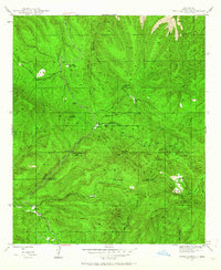 1947 Twin Sisters1963 Print · USGSThe high Gila National Forest country in the late 1940s was a landscape of remote camps and early logging. Historians can trace the legacy of local industry and recreation at Masons Mill, the Saw Mill Ruins, and the Gila Scout Camp.2 unique versions available
 - 1948 Map of Twin Sisters
 1948 Twin Sisters1948 Print · USGSThe Gila National Forest and the high ridges of the Continental Divide appear here as they were in the late 1940s. Local researchers can trace old timber and recreation sites like Masons Mill, the Saw Mill Ruins, and McMillan Forest Camp.
End of results
Showing maps 1-2 of 2
Top cities near Redstone
Frequently asked questions
- What are the different types of historical maps available for Redstone?
- What is the oldest map of Redstone?
- Where can I purchase historical maps of Redstone for my home or office?
- Where can I download high-res historical maps of Redstone?
- Are there historical topographic maps available for Redstone?
- Is there historical aerial imagery available for Redstone?
- Where are historical maps of Redstone sourced from?