Old Maps of Burns, New York for Metal Detecting
Plan your next treasure hunt with 21 historic maps of Burns. Find old homesites, ghost towns, trails, and gathering spots that may be lost to time — perfect for identifying promising metal detecting locations.
- Locate forgotten sites: Uncover places like long-lost settlements, abandoned rail lines, or gathering spots.
- Plan better hunts: Use map overlays combined with LiDAR or satellite views to narrow in on historically rich areas.
- Made for detectorists: Thousands of hobbyists use these maps to discover relics, coins, and hidden history.
Use these historic maps to boost your research and find new opportunities beneath the surface of Burns.
Burns, NY maps
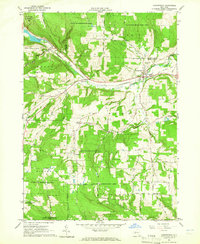
(21)- 1915 Map of Hornell, 1962 Print
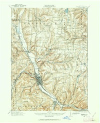 1915 Hornell1962 Print · USGSSteuben County was a bustling rail hub when this survey was conducted, featuring a dense network of steam and electric lines. Genealogists can locate dozens of country schoolhouses like Babcock School and Eells School, alongside rural settlements such as Arkport and Haskinville.
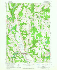
 - 1916 Map of Canaseraga
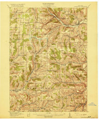 1916 Canaseraga1916 Print · USGSAllegany and Livingston counties appear in the decade before the Great War, during the peak of the local rail era. Genealogists can locate dozens of numbered schoolhouses and family-named landmarks like Whitney Crossings, Karrdale, and the Jersey Hill School.4 unique versions available
 - 1918 Map of Hornell
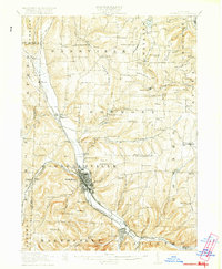 1918 Hornell1918 Print · USGSThe rail-and-river corridor of Steuben County comes alive in the years following the Great War. Genealogists can trace family footprints across dozens of country school sites like Dutch Street School and rail hubs from Arkport to Canisteo.6 unique versions available
 - 1940 Map of Canaseraga
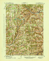 1940 Canaseraga1940 Print · USGSAllegany County's rural township structure is captured here just before the mid-century, showing a landscape tied together by local district schools and the Erie railroad. Researchers can locate early homesteads near Brewer Corners, trace the rail sidings at Garwoods Sta, or find ancestral landmarks like the County House and Jersey Hill School.2 unique versions available
 - 1950 Map of Elmira
 1950 Elmira1950 Print · USGSThe Finger Lakes region thrived in the late 1940s as a hub of industry and transport. Trace family roots and vanished landmarks near Seneca Lake or explore the rail lines of the Erie RR and the sprawling Seneca Ordnance Depot.2 unique versions available
 - 1958 Map of Elmira
 1958 Elmira1958 Print · USGSThe New York Finger Lakes during the late fifties reveal a complex landscape of glacial geology and industrial growth. Researchers can trace historic transport corridors like the Erie Canal and Erie RR, or locate institutional landmarks like Cornell University.2 unique versions available
 - 1962 Map of Elmira, 1969 Print
 1962 Elmira1969 Print · USGSThe Finger Lakes region and Southern Tier are captured here during a period of industrial maturity and highway expansion. Researchers can trace the path of the Erie Canal, the footprint of the Seneca Army Depot, and legacy rail lines through Elmira and Ithaca.4 unique versions available
 - 1964 Map of Canaseraga, 1965 Print
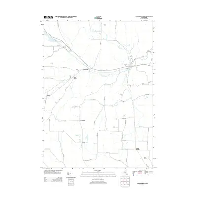
 1964 Canaseraga1965 Print · USGSThe village of Canaseraga and its surrounding ridges appear in detail during the early 1960s, showing a valley shaped by the Erie-Lackawanna Railroad. Researchers can trace old family-named landmarks like Swain Hill and locate rural burial sites such as Bailey Hill Cem.
 - 1965 Map of Elmira
 1965 Elmira1965 Print · USGSThe Finger Lakes and Southern Tier regions are captured in the mid-sixties, showcasing a landscape of deep glacial valleys and heavy rail infrastructure. Trace old railroad corridors like the Pennsylvania RR or visit landmarks like Letchworth State Park and the Seneca Army Depot.
 - 1965 Map of Arkport, 1967 Print
 1965 Arkport1967 Print · USGSThe northern reaches of the Canisteo River valley come to life in the mid-1960s, showing a landscape shaped by rail transport and flood control. Genealogists and historians can trace family locations near Dotys Corners, the Grange Hall, and the marshy expanse of The Muck.3 unique versions available
 - 1986 Map of Hornell
 1986 Hornell1986 Print · USGSThe Southern Tier and Finger Lakes region thrive in the 1980s as rail and river corridors link Hornell to Corning. Trace local heritage through landmarks like Alfred University, the Veterans Adm Center, and the shores of Keuka Lake.2 unique versions available
 - 2010 Map of Canaseraga, 2010 Print
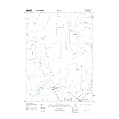
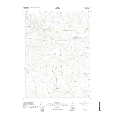
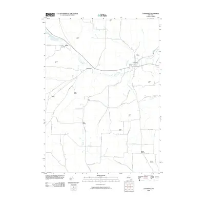 2010 Canaseraga2010 Print · USGSCovers Burns, including Almond, Ossian, and other nearby areas
 - 2010 Map of Arkport, 2010 Print
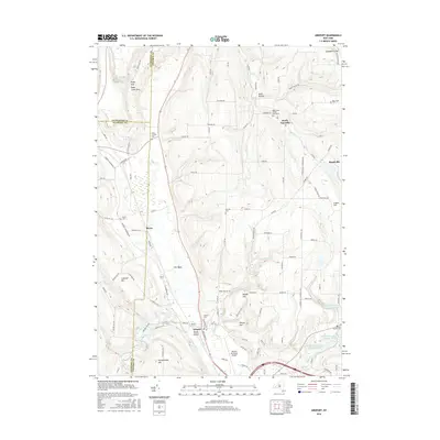
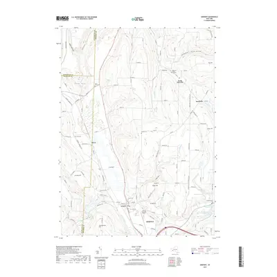
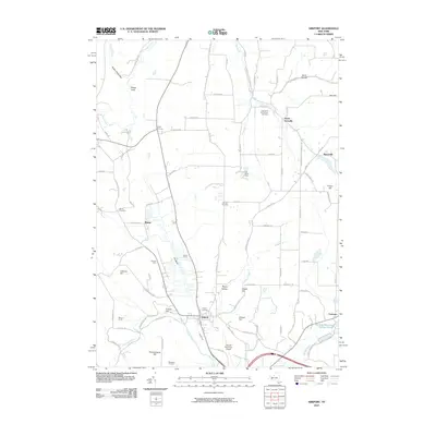 2010 Arkport2010 Print · USGSCovers Burns, including Hornell, Hornellsville, and other nearby areas
 - 2013 Map of Arkport, 2013 Print
 2013 Arkport2013 Print · USGSCovers Burns, including Hornell, Hornellsville, and other nearby areas
 - 2013 Map of Canaseraga, 2013 Print
 2013 Canaseraga2013 Print · USGSCovers Burns, including Almond, Ossian, and other nearby areas
 - 2016 Map of Canaseraga, 2016 Print
 2016 Canaseraga2016 Print · USGSCovers Burns, including Almond, Ossian, and other nearby areas
 - 2016 Map of Arkport, 2016 Print
 2016 Arkport2016 Print · USGSCovers Burns, including Hornell, Hornellsville, and other nearby areas
 - 2019 Map of Canaseraga, 2019 Print
 2019 Canaseraga2019 Print · USGSCovers Burns, including Almond, Ossian, and other nearby areas
 - 2019 Map of Arkport, 2019 Print
 2019 Arkport2019 Print · USGSCovers Burns, including Hornell, Hornellsville, and other nearby areas
 - 2023 Map of Arkport, 2023 Print
 2023 Arkport2023 Print · USGSSteuben County and the surrounding uplands are mapped here in the early twenty-first century, showing a landscape of deep hollows and high ridges. Genealogists can locate several historic burial sites, including Doty's Corners Cem, Burns Cem, and Oak Hill Cem.
 - 2023 Map of Canaseraga, 2023 Print
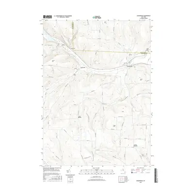
 2023 Canaseraga2023 Print · USGSThe Canaseraga Creek valley in the western Southern Tier is documented here in the early twenty-first century. Genealogists and hikers can trace old family burial grounds like Swain Hill Cem or follow the North Country National Scenic Trl over North Hill.
End of results
Showing maps 1-21 of 21
Top cities near Burns
- Hornell historical maps
- North Dansville historical maps
- Alfred historical maps
- Mount Morris historical maps
- Dansville historical maps
- Hornellsville historical maps
See more
Top neighborhoods of Burns
Frequently asked questions
- What are the different types of historical maps available for Burns?
- What is the oldest map of Burns?
- Where can I purchase historical maps of Burns for my home or office?
- Where can I download high-res historical maps of Burns?
- Are there historical topographic maps available for Burns?
- Is there historical aerial imagery available for Burns?
- Where are historical maps of Burns sourced from?