Old Maps of Perrysburg, New York
Explore 43 old maps of Perrysburg, spanning from 1899 to today. These high-resolution historic maps reveal how streets, neighborhoods, landmarks, and natural features evolved over time — perfect for genealogy, metal detecting, research, and local history exploration.
What you can do with these maps:
- See how Perrysburg changed over time: Compare historical maps to modern-day views to trace roads, homesites, rail lines & more.
- View detailed metadata: Each map includes creators, publishers, year, scale, and archive source.
- Overlay maps with satellite & LiDAR: Visualize the past alongside modern tools to explore terrain & human change.
- Trusted historical sources: Maps sourced from the USGS, Library of Congress, and other archives.
- Access maps your way: View online, download high-res files, or order prints for personal or research use.
Start exploring old maps of Perrysburg to uncover forgotten places, hidden landmarks, and the deep history beneath your feet.
Perrysburg, NY maps
(43)- 1899 Map of Silver Creek
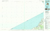
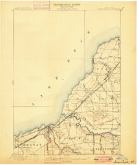 1899 Silver Creek1899 Print · USGSThe Lake Erie shoreline and its industrial rail corridors are captured here at the close of the nineteenth century. Researchers can trace the early layout of Angola and Silver Creek or locate landmarks within the Cattaraugus Indian Reservation.7 unique versions available
 - 1900 Map of Cherry Creek
 1900 Cherry Creek1900 Print · USGSWestern New York near the turn of the century shows a landscape of developing rail hubs and managed wetlands. Genealogists can trace family roots through settlements like Forestville, South Dayton, and Leon, or locate vanished stations like Smiths Mills Sta. and the rural crossroads at Charlotte Center.6 unique versions available
 - 1905 Map of Eden, 1961 Print
 1905 Eden1961 Print · USGSWestern New York at the turn of the century reveals a landscape of growing rail towns and lakefront retreats. Genealogists can trace family roots in North Collins or follow the early tracks of the Lake Shore and Michigan Southern.
 - 1907 Map of Eden
 1907 Eden1907 Print · USGSSouthern Erie County at the turn of the century reveals a landscape of growing towns and busy rail lines carving through deep creek valleys. Genealogists and historians can trace family locations in North Collins, Eden Valley, and the Cattaraugus Indian Reservation.4 unique versions available
 - 1923 Map of Cattaraugus
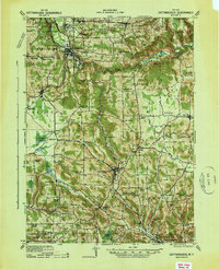
 1923 Cattaraugus1923 Print · USGSWestern New York's rugged hill country is captured here during the early twenties, showing a landscape defined by deep creek valleys and a dense network of country schools. Genealogists can trace family locations near landmarks like the State Asylum, Judd Corners, or the dozens of rural schoolhouses such as Rosenburg School.4 unique versions available
 - 1938 Map of Cattaraugus
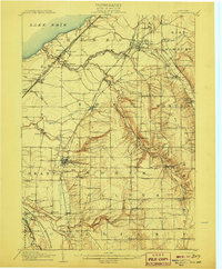
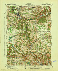
 1938 Cattaraugus1938 Print · USGSWestern New York in the late thirties is captured here during a transition to modern mapping, anchored by the Erie railroad and the Cattaraugus Indian Reservation. Researchers can trace dozens of local landmarks like the State Asylum, Zoar Bridge, and the Poverty Hill School.
 - 1941 Map of Cattaraugus
 1941 Cattaraugus1941 Print · USGSWestern New York’s rural townships are captured here just before the mid-century, from the Cattaraugus Indian Reservation to the valley of Little Valley. Genealogists can trace dozens of early schoolhouses and local hamlets like Bagdad, Eddyville, and Five Points.
 - 1941 Map of Cherry Creek
 1941 Cherry Creek1941 Print · USGSChautauqua and Cattaraugus counties are captured here at the dawn of the 1940s, when the Erie railroad still bound these rural townships together. Genealogists can trace family footprints through numerous small villages like Forestville, South Dayton, and Charlotte Center.
 - 1944 Map of Eden
 1944 Eden1944 Print · USGSCoastal Lake Erie and the inland valleys of Erie County are seen here during the mid-1940s. Genealogists can trace family footprints through the Cattaraugus Indian Reservation or old rail stops like Idlewood Sta and Lawton Sta.
 - 1944 Map of North Collins
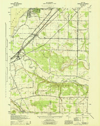
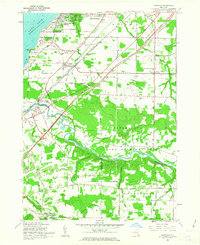
 1944 North Collins1944 Print · USGSSouthern Erie County is captured here in the mid-1940s, showing the intersection of rail infrastructure and the rural landscape. Genealogists can trace family locations along Mile Strip Road and explore sites like the Thomas Indian School or the Cem near North Collins.
 - 1944 Map of Farnham
 1944 Farnham1944 Print · USGSWestern New York at the height of the war years shows a landscape of busy rail corridors and developing lakeside communities. Genealogists and local historians can trace family locations near Farnham, the borders of the Cattaraugus Indian Reservation, and the small settlement of Smiths Mills.
 - 1954 Map of Perrysburg, 1956 Print
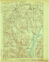
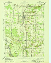
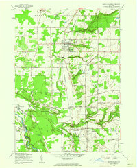
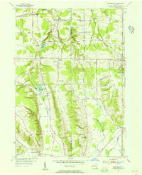 1954 Perrysburg1956 Print · USGSChautauqua County in the mid-fifties is seen here through its network of small hamlets and the critical Erie RR line. Genealogists can trace family names through landmarks like Wrights Corners, Villenova Cem, and School No 1.4 unique versions available
 - 1960 Map of Buffalo
 1960 Buffalo1960 Print · USGSWestern New York and the Niagara Peninsula thrive during the mid-twentieth century industrial peak. Genealogists and historians can trace family-named points and early settlements from Dunkirk Light to the Allegany Indian Reservation.
 - 1960 Map of North Collins, 1962 Print
 1960 North Collins1962 Print · USGSWestern New York at the start of the sixties shows a landscape of deep creek gulfs, active rail lines, and Seneca territory. Genealogists can locate the Friends Meetinghouse Burial Grounds, Cattaraugus Long House Ch, and the Gowanda State Hospital Annex.2 unique versions available
 - 1960 Map of Farnham, 1963 Print
 1960 Farnham1963 Print · USGSCoastal Erie County and the northern reaches of Chautauqua County are captured here in the early sixties, showing the intersection of new expressways and established lakeside communities. Researchers can trace family history through sites like St Anthonys Ch and the Rathburn Cem or explore the boundaries of the Cattaraugus Indian Reservation.2 unique versions available
 - 1962 Map of Buffalo, 1980 Print
 1962 Buffalo1980 Print · USGSThe Niagara Frontier and Western New York are captured here in the early sixties, showing the vital industrial and maritime nexus between the U.S. and Canada. Researchers can trace the path of the Welland Canal, locate the Allegany Indian Reservation, or find family sites near Chautauqua Lake.2 unique versions available
 - 1963 Map of Gowanda, 1964 Print
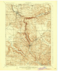
 1963 Gowanda1964 Print · USGSThe Erie and Cattaraugus county line comes alive in the early 1960s, showing the bustling village of Gowanda and the Erie-Lackawanna rail corridor. Trace family roots at Pine Grove Cem, the Pine Woods Ch, and the Gowanda State Hospital grounds.2 unique versions available
 - 1967 Map of Buffalo
 1967 Buffalo1967 Print · USGSWestern New York and the Lake Erie shoreline are shown here during the mid-1960s industrial peak. Researchers can trace the massive rail networks of the Erie Railroad, locate the Cattaraugus Indian Reservation, or find historic sites like Fort Erie.
 - 1973 Map of Buffalo
 1973 Buffalo1973 Print · USGSWestern New York and Ontario's Golden Horseshoe meet in the early seventies, spanning from the industrial waterfronts of Buffalo to the hills of Allegany State Park. Trace the paths of the Welland Canal and Erie Lackawanna railroad through the lakefront towns of Dunkirk and Port Colborne.
 - 1984 Map of Buffalo, 1985 Print
 1984 Buffalo1985 Print · USGSWestern New York's industrial and transport hubs are in full view during the mid-eighties, from the Lake Erie waterfront to the Genesee Valley. Researchers can trace the legacy of the Erie Canal, find ancestral sites like Mount Calvary Cem, or locate the Attica Correctional Facility.2 unique versions available
 - 1986 Map of Olean
 1986 Olean1986 Print · USGSThe Southern Tier and northern Pennsylvania border are captured here in the mid-1980s as the regional rail and river economy evolved. Genealogists and local historians can trace family-named sites across the Allegany Indian Reservation, identify old Oil Field tracts, or locate landmarks like St Bonaventure University and the Tannery.2 unique versions available
 - 1986 Map of Jamestown
 1986 Jamestown1986 Print · USGSChautauqua County and the Lake Erie shoreline are captured in the mid-eighties as the region balanced its industrial rail hubs with lakeside culture. Local historians can trace the grounds of the Chautauqua Institution, the expansion of Jamestown, and rural landmarks like Sunset Hill Cemetery.2 unique versions available
 - 1986 Map of Silver Creek
 1986 Silver Creek1986 Print · USGSThe Lake Erie shoreline of Chautauqua and Erie Counties is shown here in the mid-eighties as a network of rail-side towns and coastal parks. Researchers can trace the layout of the Cattaraugus Indian Reservation or locate landmarks like Sturgeon Point and Jerusalem Corners.2 unique versions available
 - 2010 Map of Gowanda, 2010 Print
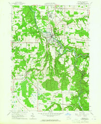
 2010 Gowanda2010 Print · USGSCovers Perrysburg, including Collins, Gowanda, and other nearby areas
 - 2010 Map of North Collins, 2010 Print
 2010 North Collins2010 Print · USGSCovers Perrysburg, including Evans, Eden, and other nearby areas
Showing maps 1-25 of 43
Top cities near Perrysburg
- Hamburg historical maps
- Orchard Park historical maps
- Evans historical maps
- Hamburg historical maps
- Concord historical maps
- Boston historical maps
See more
Top neighborhoods of Perrysburg
- Burning Springs historical maps
- Indian Hill historical maps
- West Perrysburg historical maps
- Versailles historical maps
- Perrysburg historical maps
Frequently asked questions
- What are the different types of historical maps available for Perrysburg?
- What is the oldest map of Perrysburg?
- Where can I purchase historical maps of Perrysburg for my home or office?
- Where can I download high-res historical maps of Perrysburg?
- Are there historical topographic maps available for Perrysburg?
- Is there historical aerial imagery available for Perrysburg?
- Where are historical maps of Perrysburg sourced from?