Old Maps of Horseheads, New York for Academic Research
Study the evolution of Horseheads with 33 high-resolution historic maps. Whether you're teaching, researching, or modeling changes in land use, these maps provide essential visual documentation of urban, environmental, and geographic change.
- Analyze long-term change: Track patterns in development, transportation, and natural features.
- Ideal for environmental or urban studies: Support academic projects with primary historical map data.
- Use in the classroom or lab: Educators and researchers rely on these maps to bring historical context to life.
These maps are a powerful tool for teaching, research, and visualizing how Horseheads has changed over the decades.
Horseheads, NY maps
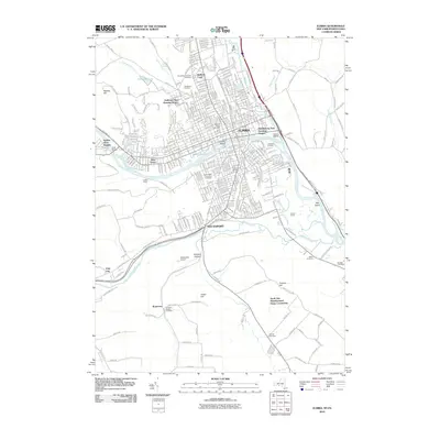
(33)- 1895 Map of Elmira
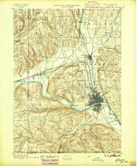 1895 Elmira1895 Print · USGSChemung County and the northern Pennsylvania border appear as a thriving rail hub in the 1890s. Genealogists and local historians can trace the early grids of Elmira, the important rail junctions at State Line Junction, and family-named landmarks like Hawley Hill.10 unique versions available
 - 1902 Map of Waverly
 1902 Waverly1902 Print · USGSThe Chemung River valley and the Pennsylvania borderlands come alive in this turn-of-the-century survey of Tioga and Chemung counties. Genealogists and rail historians can trace defunct stations and crossroads like Van Etten Junction, Owens Mills, and the village of Wellsburg.7 unique versions available
 - 1905 Map of Watkins Glen
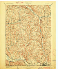
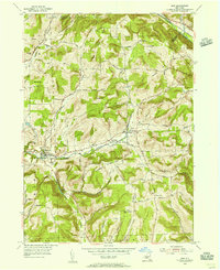
 1905 Watkins Glen1905 Print · USGSThe Finger Lakes and Southern Tier regions are captured at the start of the century, showing a landscape defined by deep glens and heavy rail. Genealogists and historians can trace the paths of the Northern Central RR through Watkins or locate family sites near Burdett and Horseheads.4 unique versions available
 - 1950 Map of Elmira
 1950 Elmira1950 Print · USGSThe Finger Lakes region thrived in the late 1940s as a hub of industry and transport. Trace family roots and vanished landmarks near Seneca Lake or explore the rail lines of the Erie RR and the sprawling Seneca Ordnance Depot.2 unique versions available
 - 1953 Map of Horseheads, 1955 Print
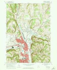
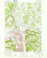
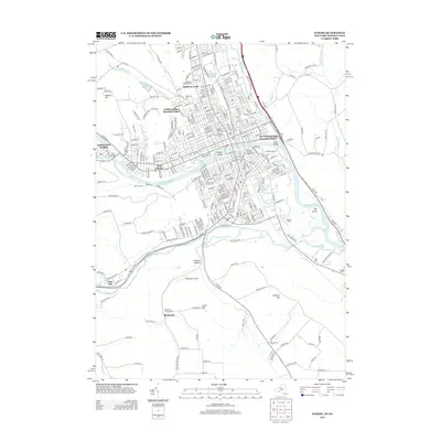
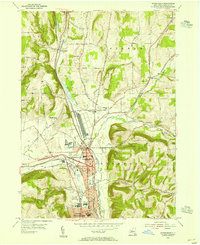 1953 Horseheads1955 Print · USGSChemung County thrived as a vital railroad junction and industrial center in the years following the Second World War. Genealogists and local historians can trace the development of Horseheads through its numerous landmarks, including the County Fairgrounds, Maple Grove Cem, and several numbered country schools.2 unique versions available
 - 1953 Map of Elmira, 1955 Print
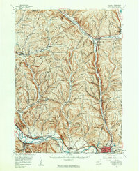
 1953 Elmira1955 Print · USGSThe Chemung River valley is shown at a mid-century peak of rail and institutional development. Researchers can trace the extensive Erie RR network and locate family plots in Woodlawn Cemetery or the Fulton Street Cem.2 unique versions available
 - 1953 Map of Elmira, 1961 Print
 1953 Elmira1961 Print · USGSChemung County and the Pennsylvania borderlands are captured here in the early fifties, showing the industrial pulse of the river valley. Trace family roots through numerous district schools like Quackenbush Sch and burial grounds such as Woodlawn Cem.2 unique versions available
 - 1954 Map of Erin, 1956 Print
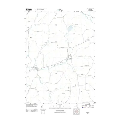
 1954 Erin1956 Print · USGSChemung County in the mid-fifties is a landscape of valley hamlets and family-named ridges like Laurel Hill. Genealogists and historians can trace local roots through several burial sites, including Old Scotchtown Cem and Hilltop Cem near Breesport.
 - 1954 Map of Waverly, 1961 Print
 1954 Waverly1961 Print · USGSThe Southern Tier's river valleys and rail networks are caught at a mid-century peak in this survey of Tioga and Chemung counties. Genealogists can trace family names through landmarks like Austin Hill Cem, the Double Mill Sch, and the historical Newtown Battlefield State Park.2 unique versions available
 - 1958 Map of Elmira
 1958 Elmira1958 Print · USGSThe New York Finger Lakes during the late fifties reveal a complex landscape of glacial geology and industrial growth. Researchers can trace historic transport corridors like the Erie Canal and Erie RR, or locate institutional landmarks like Cornell University.2 unique versions available
 - 1962 Map of Elmira, 1969 Print
 1962 Elmira1969 Print · USGSThe Finger Lakes region and Southern Tier are captured here during a period of industrial maturity and highway expansion. Researchers can trace the path of the Erie Canal, the footprint of the Seneca Army Depot, and legacy rail lines through Elmira and Ithaca.4 unique versions available
 - 1965 Map of Elmira
 1965 Elmira1965 Print · USGSThe Finger Lakes and Southern Tier regions are captured in the mid-sixties, showcasing a landscape of deep glacial valleys and heavy rail infrastructure. Trace old railroad corridors like the Pennsylvania RR or visit landmarks like Letchworth State Park and the Seneca Army Depot.
 - 1969 Map of Elmira
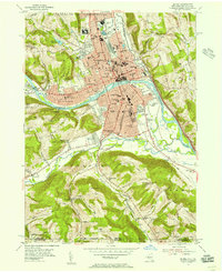
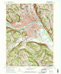 1969 Elmira1969 Print · USGSElmira and the Chemung River valley are shown at a peak of mid-century industrial and civic development. Researchers can trace family sites at Woodlawn National Cem, locate the Elmira Reformatory, or explore neighborhoods near Elmira Heights.3 unique versions available
 - 1969 Map of Erin, 1971 Print
 1969 Erin1971 Print · USGSChemung County hills and valleys are captured here in the late sixties, showcasing the rural character of the region. Researchers can locate the County Home and Infirmary and several family burial grounds like Ennis Cem and Austin Hill Cem.2 unique versions available
 - 1969 Map of Horseheads, 1971 Print
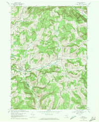
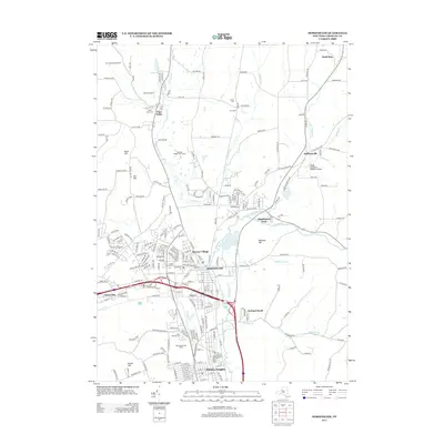
 1969 Horseheads1971 Print · USGSChemung County underwent significant development in the late sixties as industrial hubs like Horseheads and Elmira Heights expanded along major rail lines. Researchers can trace family sites at Maple Grove Cem, locate the Army and Navy Reserve Center, or explore the transit network of the Penn Central and Erie-Lackawanna railroads.
 - 1978 Map of Horseheads, 1979 Print
 1978 Horseheads1979 Print · USGSChemung County during the late seventies shows a period of significant suburban and industrial density between Horseheads and Elmira Heights. Researchers can trace local roots through landmarks like St Marys Cem, the County Fairgrounds, and the CONRAIL rail corridor.2 unique versions available
 - 1986 Map of Elmira
 1986 Elmira1986 Print · USGSThe Southern Tier and Finger Lakes regions meet in this mid-eighties survey of the river valleys and high ridges. Genealogists can trace family names at Forest Lawn Memorial Park or locate homesteads near Breesport and Newark Valley.
 - 1992 Map of Elmira, 1993 Print
 1992 Elmira1993 Print · USGSThe Finger Lakes and Southern Tier regions are captured in the early nineties as industrial hubs like Elmira and Endicott thrived alongside university life in Ithaca. Genealogists and researchers can trace the CONRAIL rail corridors, family hilltops such as Hornby Hill, and the extensive Newtown Battlefield Reservation.
 - 2010 Map of Horseheads, 2010 Print
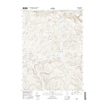
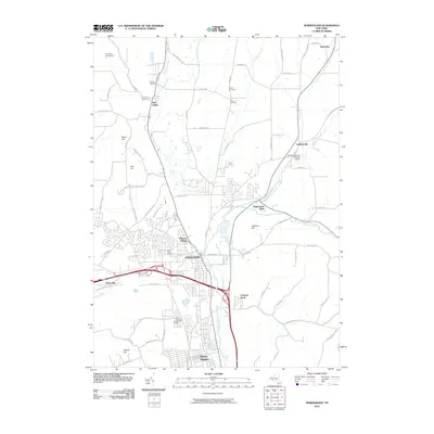 2010 Horseheads2010 Print · USGSCovers Horseheads, including Big Flats, Elmira, and other nearby areas
 - 2010 Map of Erin, 2010 Print
 2010 Erin2010 Print · USGSCovers Horseheads, including Elmira, Veteran, and other nearby areas
 - 2010 Map of Elmira, 2010 Print
 2010 Elmira2010 Print · USGSCovers Horseheads, including Elmira, Southport, and other nearby areas
 - 2013 Map of Horseheads, 2013 Print
 2013 Horseheads2013 Print · USGSCovers Horseheads, including Big Flats, Elmira, and other nearby areas
 - 2013 Map of Erin, 2013 Print
 2013 Erin2013 Print · USGSCovers Horseheads, including Elmira, Veteran, and other nearby areas
 - 2013 Map of Elmira, 2013 Print
 2013 Elmira2013 Print · USGSCovers Horseheads, including Elmira, Southport, and other nearby areas
 - 2016 Map of Erin, 2016 Print
 2016 Erin2016 Print · USGSCovers Horseheads, including Elmira, Veteran, and other nearby areas
Showing maps 1-25 of 33
Top cities near Horseheads
- Elmira historical maps
- Southport historical maps
- Big Flats historical maps
- Elmira historical maps
- Southport historical maps
- Horseheads historical maps
See more
Top neighborhoods of Horseheads
- Orchard Knoll historical maps
- Horseheads historical maps
- Horseheads North historical maps
- Breesport historical maps
Frequently asked questions
- What are the different types of historical maps available for Horseheads?
- What is the oldest map of Horseheads?
- Where can I purchase historical maps of Horseheads for my home or office?
- Where can I download high-res historical maps of Horseheads?
- Are there historical topographic maps available for Horseheads?
- Is there historical aerial imagery available for Horseheads?
- Where are historical maps of Horseheads sourced from?