Old Maps of Silvernails, Gallatin for Academic Research
Study the evolution of Silvernails with 15 high-resolution historic maps. Whether you're teaching, researching, or modeling changes in land use, these maps provide essential visual documentation of urban, environmental, and geographic change.
- Analyze long-term change: Track patterns in development, transportation, and natural features.
- Ideal for environmental or urban studies: Support academic projects with primary historical map data.
- Use in the classroom or lab: Educators and researchers rely on these maps to bring historical context to life.
These maps are a powerful tool for teaching, research, and visualizing how Silvernails has changed over the decades.
Silvernails, Gallatin maps
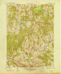
(15)- 1902 Map of Copake, 1954 Print
 1902 Copake1954 Print · USGSColumbia County at the turn of the century shows a landscape defined by industry and iron, before modern highways bypassed these hillside hamlets. Trace the rail-and-mine economy through Copake Ironworks, the Weed Mines, and the busy junction at Boston Corners.
 - 1904 Map of Copake
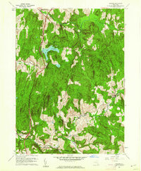
 1904 Copake1904 Print · USGSColumbia County at the turn of the century shows a landscape defined by deep-rooted industry and an extensive rail network. Researchers can trace the legacy of mining and milling at Ancram Leadmines, Weed Mines, and the Spaulding Furnace along the Roeliff Jansen Kill.7 unique versions available
 - 1948 Map of Ancram
 1948 Ancram1948 Print · USGSColumbia County in the late 1940s remained a landscape of dispersed hamlets and rural school districts. Researchers can trace historic industry at Spaulding Furnace and locate family landmarks like Vedder Ch, Silvernails, and New Forge.2 unique versions available
 - 1948 Map of Albany, 1951 Print
 1948 Albany1951 Print · USGSThe Hudson and Connecticut River valleys are captured here in the late 1940s, showing the vital rail and water corridors of the Northeast. You can trace the Boston and Maine tracks past Mt Greylock or locate early settlements like Great Barrington and Bennington.
 - 1956 Map of Albany, 1968 Print
 1956 Albany1968 Print · USGSThe industrial heart of the Northeast is revealed in the mid-1950s, from the Hudson Valley to the Connecticut River. Researchers can trace the legacy of the Quabbin Reservoir, locate Westover Air Force Base, or follow the Rutland RR through the Green Mountains.2 unique versions available
 - 1957 Map of Albany
 1957 Albany1957 Print · USGSThe Tri-State region and Connecticut River Valley are captured here during a period of significant postwar growth and infrastructure expansion. Genealogists and historians can trace the rail-and-river economy through landmarks like the Boston and Maine railroad, Quabbin Reservoir, and Westover Air Force Base.
 - 1959 Map of Albany
 1959 Albany1959 Print · USGSThe Hudson and Connecticut River valleys are captured here during the late fifties, showing the region's dense rail networks and massive water projects. Researchers can trace the New York State Thruway or locate local landmarks like Mt Greylock and the Quabbin Reservoir.
 - 1960 Map of Ancram, 1962 Print
 1960 Ancram1962 Print · USGSColumbia and Dutchess County rural life is detailed here as it stood in the early sixties, centered on the historic settlements and waterways of the Hudson Highlands. Genealogists and historians can trace family locations near Ancram Union Cem or locate old industrial sites like Spaulding Furnace and New Forge.4 unique versions available
 - 1962 Map of Albany
 1962 Albany1962 Print · USGSThe Hudson and Connecticut River valleys meet the Green Mountains and Berkshires in this mid-century overview of the Northeast. Genealogists and historians can trace the industrial hearts of Albany and Springfield or locate features like Quabbin Reservoir and Westover Air Force Base.
 - 1986 Map of Pittsfield
 1986 Pittsfield1986 Print · USGSThe Berkshires and the Hudson Valley meet in the mid-1980s, documenting a cross-border landscape of mountain forests and river towns. Genealogists and historians can trace the paths of Conrail and the Taconic State Parkway as they pass through Stockbridge, Great Barrington, and Kinderhook.2 unique versions available
 - 2010 Map of Ancram, 2010 Print
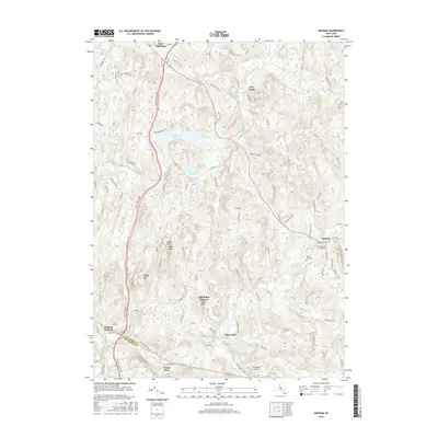
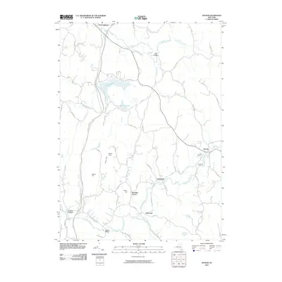 2010 Ancram2010 Print · USGSCovers Silvernails, including Livingston, Milan, and other nearby areas
 - 2013 Map of Ancram, 2013 Print
 2013 Ancram2013 Print · USGSCovers Silvernails, including Livingston, Milan, and other nearby areas
 - 2016 Map of Ancram, 2016 Print
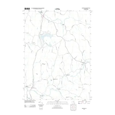
 2016 Ancram2016 Print · USGSCovers Silvernails, including Livingston, Milan, and other nearby areas
 - 2019 Map of Ancram, 2019 Print
 2019 Ancram2019 Print · USGSCovers Silvernails, including Livingston, Milan, and other nearby areas
 - 2023 Map of Ancram, 2023 Print
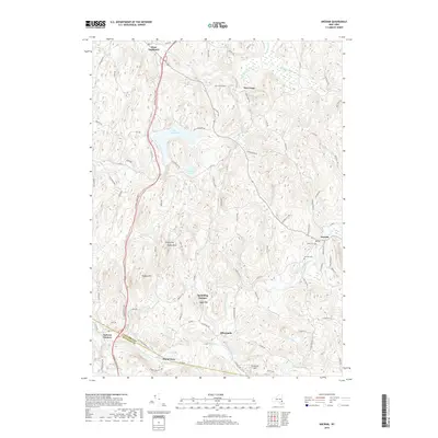
 2023 Ancram2023 Print · USGSSpanning the border of Columbia and Dutchess counties in 2023, this terrain shows the persistent rural character of the Hudson Highlands. Researchers can locate Union Cem, trace the Roeliff Jansen Kill, and explore historic hamlets like Spaulding Furnace.
End of results
Showing maps 1-15 of 15
Top cities near Silvernails
- Hyde Park historical maps
- Saugerties historical maps
- Catskill historical maps
- Red Hook historical maps
- Pleasant Valley historical maps
- Rhinebeck historical maps
See more
Frequently asked questions
- What are the different types of historical maps available for Silvernails?
- What is the oldest map of Silvernails?
- Where can I purchase historical maps of Silvernails for my home or office?
- Where can I download high-res historical maps of Silvernails?
- Are there historical topographic maps available for Silvernails?
- Is there historical aerial imagery available for Silvernails?
- Where are historical maps of Silvernails sourced from?