Old Maps of Clayton Center, Clayton for Hiking & Exploration
Hike through history with 12 historic maps of Clayton Center. Explore old trails, ghost towns, and forgotten backroads — perfect for outdoor adventurers and local explorers.
- Rediscover forgotten places: Map out old mining camps, roads, and footpaths that no longer exist on modern maps.
- Layer with modern tools: Combine with LiDAR or satellite views to plan hikes through historical terrain.
- Made for exploration: Popular among hikers, overlanders, and local history lovers.
Use these maps to find adventure and explore the hidden past of Clayton Center.
Clayton Center, Clayton maps
(12)- 1900 Map of Clayton, 1957 Print
 1900 Clayton1957 Print · USGSThe Thousand Islands region and the St. Lawrence riverfront are captured here at the turn of the century, showing a landscape defined by steam and rail. Genealogists can trace family roots in CLAYTON, Chaumont, and Depauville, or follow the path of the Electric R.R. near Dexter.
 - 1903 Map of Clayton
 1903 Clayton1903 Print · USGSJefferson County's Thousand Islands region and Lake Ontario shoreline are documented here just after the turn of the century. Genealogists and historians can trace the rail lines connecting Clayton and Chaumont, or locate old post offices in Depauville and Rosiere.6 unique versions available
 - 1942 Map of Clayton, 1957 Print
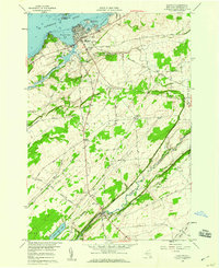
 1942 Clayton1957 Print · USGSThe Thousand Islands region appears at a mid-century peak in this survey of the riverfront and agricultural interior. Local historians can trace the foundations of the community through its many numbered rural schools and family burial sites like Corbin Cem and Dutch Cem.
 - 1943 Map of Clayton
 1943 Clayton1943 Print · USGSThe Thousand Islands region and the St. Lawrence riverfront are captured here in the early 1940s. Genealogists and local historians can trace the rural school system and family burial grounds, including School No 2, Dutch Cem, and the village of Depauville.
 - 1954 Map of Kingston
 1954 Kingston1954 Print · USGSThe international border at the head of the St. Lawrence comes alive in the mid-fifties, showing the interconnected rail and river systems of Ontario and New York. Trace historical routes like the Canadian National RR or find local landmarks such as Thousand Island Park and Tyendinaga Ind. Res.4 unique versions available
 - 1958 Map of Clayton, 1960 Print
 1958 Clayton1960 Print · USGSJefferson County’s riverfront and agricultural interior are captured here in the late fifties, showcasing the transition from the St Lawrence River docks to rural townships. Genealogists and local historians can trace the New York Central Railroad line or locate the Weaver Cem and Corbin Cem.2 unique versions available
 - 1985 Map of Cape Vincent
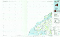 1985 Cape Vincent1985 Print · USGSThe Thousand Islands and the Jefferson County shoreline are documented in the mid-1980s as the river meets the lake. Genealogists and local historians can trace an Old Railroad Grade and explore settlements like Cape Vincent, Clayton, and Rosiere.2 unique versions available
 - 2010 Map of Clayton, 2010 Print
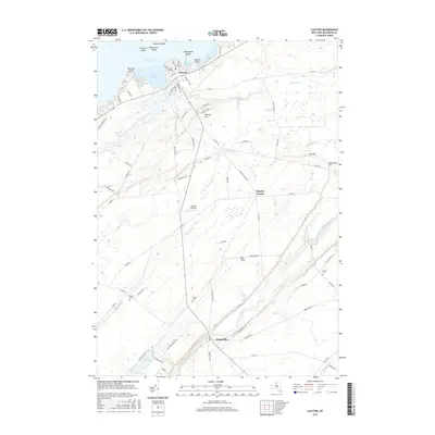
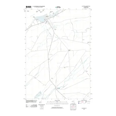 2010 Clayton2010 Print · USGSCovers Clayton Center, including Clayton, Orleans, and other nearby areas
 - 2013 Map of Clayton, 2013 Print
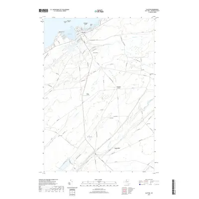
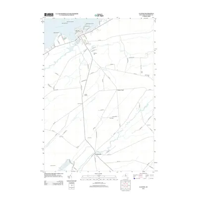 2013 Clayton2013 Print · USGSCovers Clayton Center, including Clayton, Orleans, and other nearby areas
 - 2016 Map of Clayton, 2016 Print
 2016 Clayton2016 Print · USGSCovers Clayton Center, including Clayton, Orleans, and other nearby areas
 - 2019 Map of Clayton, 2019 Print
 2019 Clayton2019 Print · USGSCovers Clayton Center, including Clayton, Orleans, and other nearby areas
 - 2023 Map of Clayton, 2023 Print
 2023 Clayton2023 Print · USGSJefferson County's northern riverfront and rural interior are captured here in the early twenty-first century. Genealogists and local historians can locate several family burial grounds, including Weaver Cem and Dutch Cem, alongside the village of Depauville.
End of results
Showing maps 1-12 of 12
Top cities near Clayton Center
- Le Ray historical maps
- Watertown historical maps
- Watertown historical maps
- Brownville historical maps
- Clayton historical maps
- Alexandria historical maps
See more
Frequently asked questions
- What are the different types of historical maps available for Clayton Center?
- What is the oldest map of Clayton Center?
- Where can I purchase historical maps of Clayton Center for my home or office?
- Where can I download high-res historical maps of Clayton Center?
- Are there historical topographic maps available for Clayton Center?
- Is there historical aerial imagery available for Clayton Center?
- Where are historical maps of Clayton Center sourced from?