1950s Maps of Floyd, New York
Explore 7 historic maps of Floyd from the 1950s. These maps offer a rare glimpse into what life looked like during the 1950s — showing old roads, neighborhoods, homes, and landmarks that have changed or disappeared over time.
Whether you're researching your family's past, planning a metal detecting trip, or studying how Floyd's landscape evolved across the 1950s, these high-resolution maps are a powerful tool for exploring the history of this region.
- Focus on a specific era: All maps on this page are from the 1950s, giving you a focused view of this time period.
- See what’s changed: Compare century-old streets, trails, and buildings to today's modern landscape using overlays and satellite layers.
- Research with precision: Use these maps for genealogy, historical research, land use analysis, or educational projects.
- View, download, or print: Maps are fully viewable online in high resolution, and can be downloaded or printed for your own records.
Start exploring Floyd's history through authentic maps from the 1950s. This is your window into the past.
Floyd, NY maps
(7)- 1950 Map of Utica, 1951 Print
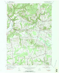
 1950 Utica1951 Print · USGSCentral New York in the post-war era showcases the industrial Mohawk Valley and the pristine Adirondack interior. Researchers can trace transportation networks like the New York Central Railroad and find early Cold War sites such as Griffiss Air Force Base.
 - 1955 Map of North Western, 1957 Print
 1955 North Western1957 Print · USGSOneida County's rural uplands are shown in detail during the mid-1950s, highlighting the transition between valley farms and state woodlands. You can locate family burial grounds like Carmichael Hill Cem and Steuben Cem or trace old school sites such as Gifford Hill Sch.2 unique versions available
 - 1955 Map of Westernville, 1957 Print
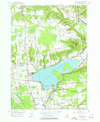 1955 Westernville1957 Print · USGSOneida County in the mid-fifties is captured here as a landscape of highland farms and state forests surrounding the expansive Delta Reservoir. Genealogists and local historians can trace rural schoolhouses like Lorena Sch, family cemeteries such as Welsh Cem, and the early footprint of the Jervis Test Site.5 unique versions available
 - 1955 Map of Rome, 1957 Print
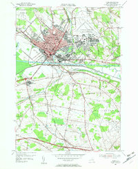 1955 Rome1957 Print · USGSMid-century Rome and its surrounding Oneida County townships are shown here during a period of significant military and industrial expansion. Genealogists and historians can trace local landmarks like Ft Stanwix, the sprawling Griffiss Air Force Base, and rural communities such as Spencer Settlement.4 unique versions available
 - 1955 Map of Oriskany, 1957 Print
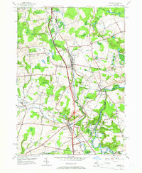
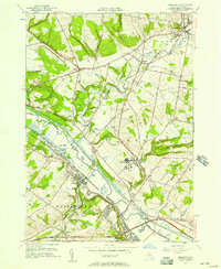 1955 Oriskany1957 Print · USGSThe Mohawk Valley in the mid-1950s shows a dense intersection of industrial history and Cold War-era expansion. Local historians can trace the path of the Erie Canal past Oriskany or locate the U S Mil Res Floyd Test Site and the State Hospital.2 unique versions available
 - 1955 Map of Remsen, 1957 Print
 1955 Remsen1957 Print · USGSOneida County's landscape is captured here in the mid-fifties, showing the intersection of the New York Central rail lines and the waters of West Canada Creek. Genealogists can locate many local burial sites and churches, including Capel Isaf Cemetery, Enlli Ch Cemetery, and Penn-Y-Bryn Church.4 unique versions available
 - 1957 Map of Utica
 1957 Utica1957 Print · USGSCentral New York and the Adirondack foothills are captured here in the mid-fifties, showing a landscape defined by the Mohawk River corridor and the growing highway system. Genealogists and researchers can trace the rail lines of the New York Central and locate communities from Lowville to Gloversville.
End of results
Showing maps 1-7 of 7
Top cities near Floyd
- Utica historical maps
- Rome historical maps
- New Hartford historical maps
- Whitestown historical maps
- Kirkland historical maps
- Marcy historical maps
See more
Top neighborhoods of Floyd
Frequently asked questions
- What are the different types of historical maps available for Floyd?
- What is the oldest map of Floyd?
- Where can I purchase historical maps of Floyd for my home or office?
- Where can I download high-res historical maps of Floyd?
- Are there historical topographic maps available for Floyd?
- Is there historical aerial imagery available for Floyd?
- Where are historical maps of Floyd sourced from?