Old Maps of Valois Point, Hector for Genealogy
Trace your family roots with 13 historic maps of Valois Point. These high-res maps reveal old neighborhoods, homesites, landmarks, and streets — helping you uncover where your ancestors lived and how the area evolved over time.
- Explore historic neighborhoods: Identify where your relatives may have lived in the 1800s or 1900s.
- Compare maps over time: Trace the changes in streets, buildings, and landmarks for multi-generational research.
- Perfect for genealogy & ancestry research: Used by family historians and researchers to map out lineage and migration.
These maps are an incredible resource for exploring your personal connection to Valois Point's past.
Valois Point, Hector maps
(13)- 1902 Map of Ovid
 1902 Ovid1902 Print · USGSThe Finger Lakes region at the turn of the century shows a landscape tied together by steamboats and competing rail lines. Genealogists and historians can trace the industrial footprints of Cascade Mills or follow the path of the Lehigh Valley R. R. through villages like Ovid and Lodi.9 unique versions available
 - 1942 Map of Dundee, 1957 Print
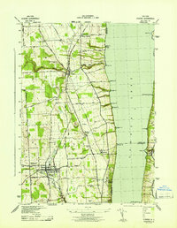
 1942 Dundee1957 Print · USGSThe western shores of Seneca Lake appear in the early 1940s, revealing a landscape defined by parallel rail lines and lakeside landings. Genealogists and local historians can trace the foundations of Dundee, the grounds of Lakemont Academy, and the routes of the New York Central Railroad.3 unique versions available
 - 1943 Map of Dundee
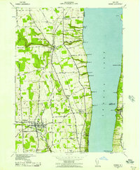
 1943 Dundee1943 Print · USGSThe western shores of Seneca Lake and the village of Dundee are captured here during the Second World War. Genealogists can trace family names and properties near Lakemont Academy, Hillside Cemetery, and the rail stops at Randall Crossing.
 - 1950 Map of Elmira
 1950 Elmira1950 Print · USGSThe Finger Lakes region thrived in the late 1940s as a hub of industry and transport. Trace family roots and vanished landmarks near Seneca Lake or explore the rail lines of the Erie RR and the sprawling Seneca Ordnance Depot.2 unique versions available
 - 1958 Map of Elmira
 1958 Elmira1958 Print · USGSThe New York Finger Lakes during the late fifties reveal a complex landscape of glacial geology and industrial growth. Researchers can trace historic transport corridors like the Erie Canal and Erie RR, or locate institutional landmarks like Cornell University.2 unique versions available
 - 1962 Map of Elmira, 1969 Print
 1962 Elmira1969 Print · USGSThe Finger Lakes region and Southern Tier are captured here during a period of industrial maturity and highway expansion. Researchers can trace the path of the Erie Canal, the footprint of the Seneca Army Depot, and legacy rail lines through Elmira and Ithaca.4 unique versions available
 - 1965 Map of Elmira
 1965 Elmira1965 Print · USGSThe Finger Lakes and Southern Tier regions are captured in the mid-sixties, showcasing a landscape of deep glacial valleys and heavy rail infrastructure. Trace old railroad corridors like the Pennsylvania RR or visit landmarks like Letchworth State Park and the Seneca Army Depot.
 - 1986 Map of Auburn
 1986 Auburn1986 Print · USGSThe Finger Lakes region in the mid-eighties shows a landscape of deep glacial waters and significant military sites. Trace the layout of the Seneca Army Depot, find the campus of Wells College, and follow the historic Lehigh Valley RR lines.2 unique versions available
 - 2010 Map of Dundee, 2010 Print
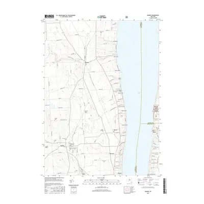
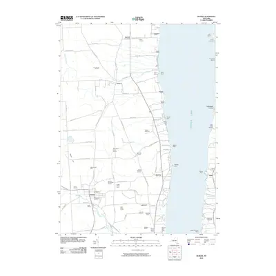 2010 Dundee2010 Print · USGSCovers Valois Point, including Milo, Hector, and other nearby areas
 - 2013 Map of Dundee, 2013 Print
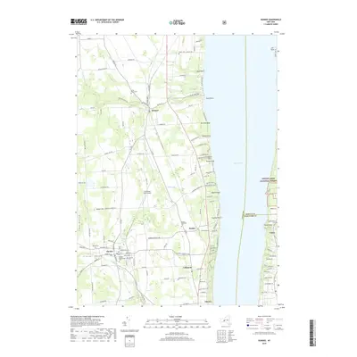
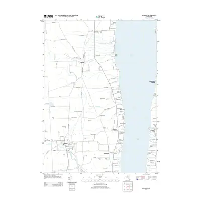 2013 Dundee2013 Print · USGSCovers Valois Point, including Milo, Hector, and other nearby areas
 - 2016 Map of Dundee, 2016 Print
 2016 Dundee2016 Print · USGSCovers Valois Point, including Milo, Hector, and other nearby areas
 - 2019 Map of Dundee, 2019 Print
 2019 Dundee2019 Print · USGSCovers Valois Point, including Milo, Hector, and other nearby areas
 - 2023 Map of Dundee, 2023 Print
 2023 Dundee2023 Print · USGSThe western shores of Seneca Lake are documented here in the early 2020s, showing the settled landscape between the Finger Lakes and the National Forest. Genealogists can locate several historic burial grounds including Dundee Presbyterian Cem and Raplee Cem near the village of Dundee.
End of results
Showing maps 1-13 of 13
Frequently asked questions
- What are the different types of historical maps available for Valois Point?
- What is the oldest map of Valois Point?
- Where can I purchase historical maps of Valois Point for my home or office?
- Where can I download high-res historical maps of Valois Point?
- Are there historical topographic maps available for Valois Point?
- Is there historical aerial imagery available for Valois Point?
- Where are historical maps of Valois Point sourced from?