Old Maps of Seneca County, New York
Explore 133 old maps of Seneca County, spanning from 1899 to today. These high-resolution historic maps reveal how streets, neighborhoods, landmarks, and natural features evolved over time — perfect for genealogy, metal detecting, research, and local history exploration.
What you can do with these maps:
- See how Seneca County changed over time: Compare historical maps to modern-day views to trace roads, homesites, rail lines & more.
- View detailed metadata: Each map includes creators, publishers, year, scale, and archive source.
- Overlay maps with satellite & LiDAR: Visualize the past alongside modern tools to explore terrain & human change.
- Trusted historical sources: Maps sourced from the USGS, Library of Congress, and other archives.
- Access maps your way: View online, download high-res files, or order prints for personal or research use.
Start exploring old maps of Seneca County to uncover forgotten places, hidden landmarks, and the deep history beneath your feet.
Seneca County, NY maps
(133)- 1899 Map of Auburn
 1899 Auburn1899 Print · USGSThe Finger Lakes region thrived at the close of the nineteenth century as a hub of rail and water transport. Genealogists can trace family names at Coonley Corners or locate early industrial sites like Howard Mill and the State Dam.
 - 1902 Map of Geneva
 1902 Geneva1902 Print · USGSThe Finger Lakes region at the dawn of the twentieth century was a bustling corridor of canals and competing railroads. Trace the intricate Steamboat Route on Seneca Lake and locate old stations like Billsboro Sta. and Reeder.7 unique versions available
 - 1902 Map of Clyde
 1902 Clyde1902 Print · USGSUpper New York state at the turn of the century shows a dense network of competing rail and water routes. Trace the path of the Erie Canal and find defunct stretches like the Erie Canal (Abandoned) alongside the Clyde River.8 unique versions available
 - 1902 Map of Genoa
 1902 Genoa1902 Print · USGSThe Finger Lakes region thrived on water and rail transport at the turn of the century, centered on the transit hub of Cayuga Lake. Genealogists and historians can trace the early Steamboat Route and find historic sites like Wells College and Taughannic Falls.8 unique versions available
 - 1902 Map of Ovid
 1902 Ovid1902 Print · USGSThe Finger Lakes region at the turn of the century shows a landscape tied together by steamboats and competing rail lines. Genealogists and historians can trace the industrial footprints of Cascade Mills or follow the path of the Lehigh Valley R. R. through villages like Ovid and Lodi.9 unique versions available
 - 1902 Map of Weedsport
 1902 Weedsport1902 Print · USGSCentral New York at the turn of the century reveals a landscape shaped by the Erie Canal and a dense network of early railroads. Genealogists and historians can trace the foundations of Weedsport and Port Byron, or locate landmarks like the Brick Church and the Canal Basin at Montezuma.10 unique versions available
 - 1902 Map of Auburn
 1902 Auburn1902 Print · USGSThe Finger Lakes region thrived at the turn of the century as a hub of rail lines and canal traffic. Genealogists and historians can trace old homesteads and landings from Union Springs to Throopsville, including the complex rail junctions at Cayuga Junction and Aurelius Sta.9 unique versions available
 - 1942 Map of Ovid
 1942 Ovid1942 Print · USGSSeneca County's transition into the early war years is visible here, centered on the village of OVID between the Finger Lakes. Researchers can trace the extensive LEHIGH VALLEY RAILROAD line and locate family sites like Willard State Hospital, School No 1, and Union Cem.3 unique versions available
 - 1942 Map of Ludlowville, 1956 Print
 1942 Ludlowville1956 Print · USGSCayuga Lake and its dramatic ravines are captured here in the early 1940s, showing the intersection of lakeside industry and rural life. Researchers can trace the Lehigh Valley rail line past the Salt Works or find family roots near Ludlowville and German Cem.3 unique versions available
 - 1942 Map of Dundee, 1957 Print
 1942 Dundee1957 Print · USGSThe western shores of Seneca Lake appear in the early 1940s, revealing a landscape defined by parallel rail lines and lakeside landings. Genealogists and local historians can trace the foundations of Dundee, the grounds of Lakemont Academy, and the routes of the New York Central Railroad.3 unique versions available
 - 1942 Map of Lodi, 1960 Print
 1942 Lodi1960 Print · USGSSeneca and Schuyler counties are seen here in the early 1940s, as the rural Finger Lakes landscape was defined by family-named crossroads and lakeside rail depots. Researchers can trace ancestral farmstead locations near Cat Elbow Corner, Bumpus Corners, and the historic Round Sch.2 unique versions available
 - 1942 Map of Sheldrake, 1960 Print
 1942 Sheldrake1960 Print · USGSThe shores of Cayuga Lake are captured here during the early 1940s, showcasing a rural landscape of crossroads hamlets and lakeside points. Genealogists can locate family landmarks like Parker Cem, Wells College, and the rail depot at King Ferry Sta.
 - 1942 Map of Trumansburg, 1960 Print
 1942 Trumansburg1960 Print · USGSThe western shore of Cayuga Lake during the early years of the war shows a landscape of busy rail lines and lakeside landings. Researchers can trace family roots at Grove Cemetery or explore the rural layout of Trumansburg, Podunk, and Halseyville.
 - 1943 Map of Dresden
 1943 Dresden1943 Print · USGSDuring the early years of the Second World War, the Seneca Lake shore underwent a massive transformation with the establishment of the Naval Training Station. Researchers can trace the layout of the station and Sampson (PO), or locate historic mills like Mays Mills and Cascade Mills.4 unique versions available
 - 1943 Map of Ludlowville
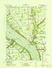 1943 Ludlowville1943 Print · USGSThe Finger Lakes region during the early war years reveals a landscape of industrial lakeside sites and quiet upland farm districts. Genealogists and researchers can trace local roots through numerous landmarks like Pine Grove Cem, Jacksonville, and the Salt Works at Myers.
 - 1943 Map of Lyons
 1943 Lyons1943 Print · USGSThe village of Lyons and its neighboring hamlets are captured in the early 1940s during a period of transition for the historic Erie Canal. Researchers can trace old family sites at Fergusons Corners, local schoolhouses, and several burial grounds including Rural Cem.
 - 1943 Map of Geneva North
 1943 Geneva North1943 Print · USGSThe rural landscape north of Geneva is captured here in the early 1940s, showing a network of crossroads settlements and small-scale farms. Researchers can trace ancestral locations at Dobbins Corner, identify several local burying grounds like Quaker Cem, and locate numerous district schools such as School No 5.
 - 1943 Map of Geneva South
 1943 Geneva South1943 Print · USGSGeneva and the shores of Seneca Lake are captured here during the early 1940s, highlighting the region's academic and maritime identity. Researchers can trace the footprints of Hobart College, find local family names along Snell Road, or locate rail stops like Billsboro Sta.
 - 1943 Map of Montezuma
 1943 Montezuma1943 Print · USGSThe Cayuga County marshlands are captured here during the Second World War as the region’s massive river and canal systems were being managed for conservation. You can trace the early path of the Erie Canal (Abandoned) or find family sites near Port Byron and Murray Cem.
 - 1943 Map of Trumansburg
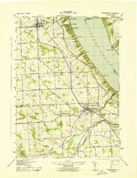 1943 Trumansburg1943 Print · USGSThe western shores of Cayuga Lake come alive in this wartime survey, showing the agricultural heartland between Seneca and Tompkins Counties. Genealogists and local historians can trace family roots through sites like St James Cem, School No 24, and the lakeside landings at Bergen Beach.
 - 1943 Map of Dundee
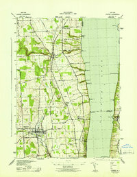 1943 Dundee1943 Print · USGSThe western shores of Seneca Lake and the village of Dundee are captured here during the Second World War. Genealogists can trace family names and properties near Lakemont Academy, Hillside Cemetery, and the rail stops at Randall Crossing.
 - 1943 Map of Cayuga
 1943 Cayuga1943 Print · USGSThe northern reaches of Cayuga Lake and the Montezuma wetlands are captured here during the early 1940s. Genealogists can locate family-named landmarks like Farnam Cem and Polk Corners, alongside the tracks of the New York Central Railroad.
 - 1943 Map of Romulus
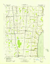 1943 Romulus1943 Print · USGSSeneca County's lakefront and agricultural heartland are captured during the Second World War as military and civilian life intersected. Researchers can trace family-named crossroads like Clemsons Corners, visit numerous district schools, and locate historic burials at Oak Hill Cem or Greenlawn Cem.
 - 1943 Map of Savannah
 1943 Savannah1943 Print · USGSThe marshlands and waterways of Wayne County are captured here in the 1940s, highlighting the vital corridor of the Erie Canal and Clyde River. Family historians can trace old homesteads near Hunt Corners, Lockpit Cem, and several numbered schoolhouses.
 - 1943 Map of Sheldrake
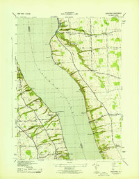 1943 Sheldrake1943 Print · USGSCayuga Lake's eastern and western shores are captured here in the early 1940s, showing a landscape of deep gullies and lakeside rail stations. Genealogists can trace family names at Quaker Cem or locate former hubs like Kings Ferry Station and Wells College.
Showing maps 1-25 of 133
Top cities of Seneca County
- Seneca Falls historical maps
- Waterloo historical maps
- Waterloo historical maps
- Fayette historical maps
- Romulus historical maps
- Ovid historical maps
See more
Frequently asked questions
- What are the different types of historical maps available for Seneca County?
- What is the oldest map of Seneca County?
- Where can I purchase historical maps of Seneca County for my home or office?
- Where can I download high-res historical maps of Seneca County?
- Are there historical topographic maps available for Seneca County?
- Is there historical aerial imagery available for Seneca County?
- Where are historical maps of Seneca County sourced from?