1950s Maps of Canisteo, New York
Explore 6 historic maps of Canisteo from the 1950s. These maps offer a rare glimpse into what life looked like during the 1950s — showing old roads, neighborhoods, homes, and landmarks that have changed or disappeared over time.
Whether you're researching your family's past, planning a metal detecting trip, or studying how Canisteo's landscape evolved across the 1950s, these high-resolution maps are a powerful tool for exploring the history of this region.
- Focus on a specific era: All maps on this page are from the 1950s, giving you a focused view of this time period.
- See what’s changed: Compare century-old streets, trails, and buildings to today's modern landscape using overlays and satellite layers.
- Research with precision: Use these maps for genealogy, historical research, land use analysis, or educational projects.
- View, download, or print: Maps are fully viewable online in high resolution, and can be downloaded or printed for your own records.
Start exploring Canisteo's history through authentic maps from the 1950s. This is your window into the past.
Canisteo, NY maps
(6)- 1950 Map of Elmira
 1950 Elmira1950 Print · USGSThe Finger Lakes region thrived in the late 1940s as a hub of industry and transport. Trace family roots and vanished landmarks near Seneca Lake or explore the rail lines of the Erie RR and the sprawling Seneca Ordnance Depot.2 unique versions available
 - 1953 Map of Cameron, 1954 Print
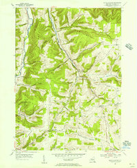
 1953 Cameron1954 Print · USGSSteuben County's river-cut valleys and upland farms are captured in the mid-fifties during a period of rural stability. Researchers can trace the path of the Erie RR along the Canisteo River and locate numerous local burial sites like Eight Square Cem and Lower Swale Cem.3 unique versions available
 - 1953 Map of Towlesville, 1955 Print
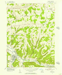
 1953 Towlesville1955 Print · USGSSteuben County in the mid-1950s is a landscape of high summits and deeply cut creek valleys as the regional rail economy persists. Researchers can trace historic family names at Knight Settlement, locate rural landmarks like Lake Demons, and find dozens of small family plots such as Dublin Cem.2 unique versions available
 - 1954 Map of South Canisteo, 1956 Print
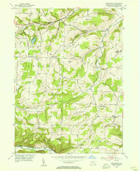
 1954 South Canisteo1956 Print · USGSThe hills of Steuben County in the mid-fifties reveal a rural landscape of small crossroads hamlets and family farmsteads. Genealogists and local historians can trace ancestral sites like West Jasper Ch or locate family plots at Hampshire Cem and Carter Cem.2 unique versions available
 - 1954 Map of Canisteo, 1956 Print
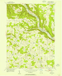
 1954 Canisteo1956 Print · USGSSteuben County rural life in the mid-fifties centered on the river valley and the vital transit corridor of the Erie RR. Researchers can trace old family lineages through numerous remote burial sites like Nicholson Cem and Johnson Cem or locate the industrial footprint of local Gas Wells.3 unique versions available
 - 1958 Map of Elmira
 1958 Elmira1958 Print · USGSThe New York Finger Lakes during the late fifties reveal a complex landscape of glacial geology and industrial growth. Researchers can trace historic transport corridors like the Erie Canal and Erie RR, or locate institutional landmarks like Cornell University.2 unique versions available
End of results
Showing maps 1-6 of 6
Top cities near Canisteo
- Bath historical maps
- Hornell historical maps
- Bath historical maps
- Alfred historical maps
- Hornellsville historical maps
- Wayland historical maps
See more
Top neighborhoods of Canisteo
- South Canisteo historical maps
- Adrian historical maps
- Canisteo Center historical maps
- Browns Crossing historical maps
- Canisteo historical maps
Frequently asked questions
- What are the different types of historical maps available for Canisteo?
- What is the oldest map of Canisteo?
- Where can I purchase historical maps of Canisteo for my home or office?
- Where can I download high-res historical maps of Canisteo?
- Are there historical topographic maps available for Canisteo?
- Is there historical aerial imagery available for Canisteo?
- Where are historical maps of Canisteo sourced from?