Old Maps of Fire Island, New York for Academic Research
Study the evolution of Fire Island with 82 high-resolution historic maps. Whether you're teaching, researching, or modeling changes in land use, these maps provide essential visual documentation of urban, environmental, and geographic change.
- Analyze long-term change: Track patterns in development, transportation, and natural features.
- Ideal for environmental or urban studies: Support academic projects with primary historical map data.
- Use in the classroom or lab: Educators and researchers rely on these maps to bring historical context to life.
These maps are a powerful tool for teaching, research, and visualizing how Fire Island has changed over the decades.
Fire Island, NY maps
(82)- 1901 Map of Babylon, 1958 Print
 1901 Babylon1958 Print · USGSThe South Shore of Long Island at the turn of the century shows a landscape of rail-linked villages and tidal marshes. Trace early transit hubs like Bethpage Junc. and maritime outposts such as the Zachs Inlet L.S.S. along the coast.
 - 1902 Map of Fire Island, 1962 Print
 1902 Fire Island1962 Print · USGSThe South Shore of Long Island is captured here at the dawn of the twentieth century, anchored by the Montauk Division rail line. Genealogists and maritime historians can locate early settlements like Oakdale and trace the vital network of Life-Saving Stations including Point O'Woods L.S.S. and Blue Point L.S.S. along the barrier beach.
 - 1903 Map of Babylon
 1903 Babylon1903 Print · USGSSouthern Suffolk County coastal life and rail expansion are captured here at the turn of the century. Genealogists and historians can trace early residential clusters around Amityville or locate coastal landmarks like Oak Island L.S.S. and Bethpage Junc.8 unique versions available
 - 1903 Map of Fire Island
 1903 Fire Island1903 Print · USGSLong Island's southern shore and the outer barrier beach are captured here at the turn of the century. You can trace early coastal infrastructure through the Fire Island Lighthouse and life-saving stations like Lone Hill L.S.S. and Blue Point L.S.S..6 unique versions available
 - 1903 Map of Riverhead, 1963 Print
 1903 Riverhead1963 Print · USGSThe forks of Long Island come alive in this early 1900s survey of the bustling rail and maritime corridor. Researchers can trace the Long Island Railroad through historic hamlets like Good Ground, Aquebogue, and the early shoreline of Shinnecock Bay.
 - 1904 Map of Islip
 1904 Islip1904 Print · USGSSuffolk County at the start of the century reveals a landscape defined by deep north-shore harbors and the expansive Great South Bay. Genealogists and local historians can trace early rail lines through Kings Park and Stony Brook, or locate the sprawling State Hospital and St. Dominic Convent.5 unique versions available
 - 1904 Map of Riverhead
 1904 Riverhead1904 Print · USGSEastern Long Island at the turn of the century shows a landscape of rail-connected hamlets and coastal vigilance. Researchers can trace the early layout of Riverhead or locate historic life-saving outposts like Tiana L.S.S. and Potunk L.S.S. along the barrier beaches.9 unique versions available
 - 1904 Map of Moriches, 1912 Print
 1904 Moriches1912 Print · USGSCoastal Suffolk County at the start of the century shows a landscape of quiet maritime landings and early railroad hamlets. Genealogists can trace the early footprints of Wardenclyffe, Middle Island, and the Life-Saving Stations protecting Fire Island.2 unique versions available
 - 1919 Map of Babylon
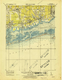 1919 Babylon1919 Print · USGSThe South Shore of Long Island is captured here during a period of steady growth between the world wars. Genealogists and local historians can trace early transportation routes like the Motor Parkway and locate coastal landmarks such as the Oak Island L.S.S. and St. Dominic Convent.
 - 1941 Map of Bay Shore West
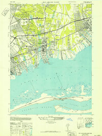 1941 Bay Shore West1941 Print · USGSCoastal Suffolk County comes to life during the early 1940s, showing the South Shore villages as the Long Island suburb began to take shape. Researchers can trace the layout of early school districts like the Union Free Sch or find local landmarks such as the Babylon Yacht Club and St Patricks Ch.
 - 1942 Map of Islip, 1943 Print
 1942 Islip1943 Print · USGSCentral Suffolk County is shown during the early years of the war, as the automobile began to reshape the distance between historic North Shore harbors and the South Shore bays. Researchers can trace the path of the Long Island Motor Parkway, locate family plots at Pinelawn Cem, and identify coastal landmarks like Eaton Neck L H.
 - 1943 Map of Riverhead
 1943 Riverhead1943 Print · USGSLong Island's eastern forks appear here in the early twentieth century as a landscape of coastal hamlets and maritime commerce. Trace the path of the Montauk Division railroad through RIVERHEAD or locate family roots in Mattituck, Speonk, and Good Ground.
 - 1944 Map of Bay Shore East
 1944 Bay Shore East1944 Print · USGSThe Long Island shoreline near Bay Shore and Islip is captured here during the 1940s. Researchers can trace the development of barrier island communities like Ocean Beach and Point O' Woods or locate the historic Fire Island Coast Guard station.
 - 1947 Map of Howells Point
 1947 Howells Point1947 Print · USGSThe South Shore of Long Island is documented here in the late forties, showing the vulnerable barrier beach system before modern development. Researchers can trace the early residential layout of Brookhaven and the natural state of Great South Beach and Ridge Island.
 - 1947 Map of Sayville
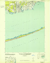 1947 Sayville1947 Print · USGSThe South Shore of Long Island is captured here in the late 1940s, showing a landscape of maritime villages and coastal retreats. Researchers can trace the development of Sayville and Bayport or locate remote landmarks like Cherry Grove and the Blue Point CG on the barrier beach.
 - 1947 Map of Eastport
 1947 Eastport1947 Print · USGSCoastal Suffolk County thrives along the Atlantic shore in the years following World War II, when rail and road first began to transform these fishing and farming hamlets. Genealogists and historians can trace the early layouts of Eastport, Speonk, and Westhampton Beach alongside the Long Island Railroad.
 - 1949 Map of New York, 1951 Print
 1949 New York1951 Print · USGSLong Island and its surrounding waters are documented here in the late 1940s, just as the postwar suburban boom began to transform the region. Genealogists and historians can trace the early layouts of Idlewild Airport, Mitchell Field, and the established routes of the Long Island RR.
 - 1954 Map of New York
 1954 New York1954 Print · USGSLong Island and the New York metropolitan area are shown during the height of post-war suburbanization. Genealogists and historians can trace the growth of Levittown, the infrastructure of the Long Island Rail Road, and landmarks like Mitchel Afb.2 unique versions available
 - 1954 Map of Bay Shore West, 1956 Print
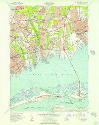 1954 Bay Shore West1956 Print · USGSMid-century Suffolk County is captured here during its post-war housing boom, from the growing suburbs of Wyandanch to the barrier beaches. Genealogists and local historians can trace old family plots at St Josephs Cem, explore the early footprint of Belmont Lake State Park, or follow the historic Long Island Railroad line.
 - 1955 Map of Sayville, 1957 Print
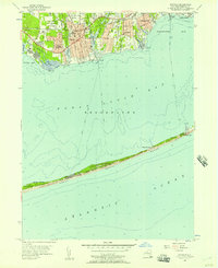 1955 Sayville1957 Print · USGSSouth Shore life in the mid-fifties centered on the connection between mainland villages and the emerging summer colonies of Fire Island. You can trace the Long Island Railroad corridor and locate local landmarks like Union Cem or the LaSalle Military Academy.
 - 1955 Map of Bay Shore East, 1957 Print
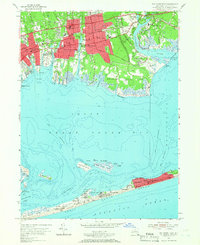 1955 Bay Shore East1957 Print · USGSCoastal Suffolk County thrives in the mid-fifties as mainland suburbs like East Islip and Brightwaters expand toward the Great South Bay. Researchers can trace ferry routes to seasonal colonies at Ocean Beach or locate local landmarks like Brookwood Hall Orphanage.2 unique versions available
 - 1956 Map of Howells Point, 1957 Print
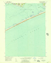 1956 Howells Point1957 Print · USGSThe South Shore of Long Island is captured here in the mid-fifties, showing the coastal developments of Bellport and Shirley along the bays. Researchers can trace the shifting sands of Fire Island Beach and find landmarks like Smith Point and Hospital Island.2 unique versions available
 - 1956 Map of Pattersquash Island, 1957 Print
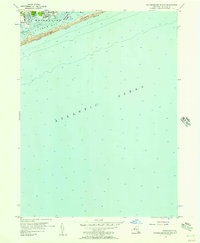 1956 Pattersquash Island1957 Print · USGSCoastal Suffolk County comes into focus in the mid-1950s, documenting the growing neighborhoods of Shirley and Mastic Beach. Trace the waterfront along Moriches Bay and Narrow Bay, or locate landmarks like Pattersquash Island and Smith Pt.
 - 1956 Map of Eastport, 1958 Print
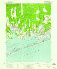 1956 Eastport1958 Print · USGSThe South Shore of Long Island in the mid-fifties reveals a coastal landscape of growing summer colonies and a significant military presence. Genealogists and historians can trace family-named necks and points or locate landmarks like the Westhampton Ch and Suffolk County Air Force Base.2 unique versions available
 - 1957 Map of Moriches, 1958 Print
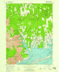 1957 Moriches1958 Print · USGSThe south shore of Long Island undergoes rapid mid-century expansion in this detailed record of the Moriches area. Researchers can trace the early residential grids of Shirley and Mastic Beach alongside traditional sites like the Church in the Wildwood and Floyd Cemetery.
Showing maps 1-25 of 82
Top cities near Fire Island
- Brookhaven historical maps
- Islip historical maps
- Smithtown historical maps
- Brentwood historical maps
- Coram historical maps
- Central Islip historical maps
See more
Top neighborhoods of Fire Island
- Kismet historical maps
- Lonelyville historical maps
- Robbins Rest historical maps
- Seaview historical maps
- Atlantique historical maps
- Fair Harbor historical maps
See more
Frequently asked questions
- What are the different types of historical maps available for Fire Island?
- What is the oldest map of Fire Island?
- Where can I purchase historical maps of Fire Island for my home or office?
- Where can I download high-res historical maps of Fire Island?
- Are there historical topographic maps available for Fire Island?
- Is there historical aerial imagery available for Fire Island?
- Where are historical maps of Fire Island sourced from?