Old Maps of Kerhonkson, New York for Genealogy
Trace your family roots with 25 historic maps of Kerhonkson. These high-res maps reveal old neighborhoods, homesites, landmarks, and streets — helping you uncover where your ancestors lived and how the area evolved over time.
- Explore historic neighborhoods: Identify where your relatives may have lived in the 1800s or 1900s.
- Compare maps over time: Trace the changes in streets, buildings, and landmarks for multi-generational research.
- Perfect for genealogy & ancestry research: Used by family historians and researchers to map out lineage and migration.
These maps are an incredible resource for exploring your personal connection to Kerhonkson's past.
Kerhonkson, NY maps
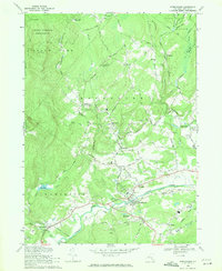
(25)- 1903 Map of Slide Mountain, 1961 Print
 1903 Slide Mountain1961 Print · USGSThe high peaks and deep hollows of Ulster County are captured here at the dawn of the reservoir era. Genealogists and hikers can trace old homesteads and roads near Sundown, Lackawack, and the isolated Peekamoose Lodge.
 - 1904 Map of Ellenville, 1956 Print
 1904 Ellenville1956 Print · USGSThe Shawangunk Mountains and Wallkill Valley are captured here at the start of the twentieth century, showing a landscape of high ridges and industrial valleys. Researchers can trace the D. & H. Canal (Abandoned), the New York Ontario and Western RR, and historic centers like Ellenville or Wurtsboro.
 - 1905 Map of Slide Mountain
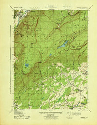
 1905 Slide Mountain1905 Print · USGSThe Catskill high peaks meet the industrializing Rondout valley in the early twentieth century. Researchers can trace old mountain outposts like Peekamoose Lodge and Sundown, or follow the New York Ontario and Western RR through Kerhonkson.8 unique versions available
 - 1906 Map of Ellenville
 1906 Ellenville1906 Print · USGSThe Shawangunk ridge and Mamakating Hollow are captured here in the early 1900s, showing the region's shift from canal to rail transport. Genealogists can locate family homes and landmarks across Ellenville, Cragsmoor, and Wurtsboro, or trace the Delaware and Hudson Canal.7 unique versions available
 - 1942 Map of Kerhonkson, 1959 Print
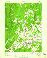 1942 Kerhonkson1959 Print · USGSUlster County's transport and settlement patterns are frozen in time during the early 1940s. Genealogists and historians can trace the New York Ontario and Western line, the old Rondout and Western Canal, and local landmarks like Soccanissing Sch.
 - 1943 Map of Napanoch
 1943 Napanoch1943 Print · USGSThe Shawangunk Mountains and the valley of the Rondout Creek are captured here in the early 1940s. Genealogists and historians can trace family properties like V Mahon and H Hall or locate rural landmarks such as Crawford Church and the Union District School.
 - 1943 Map of Kerhonkson
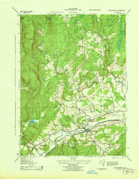 1943 Kerhonkson1943 Print · USGSMid-century Ulster County comes to life through this survey of the Rondout Valley and the Ontario and Western rail corridor. Genealogists can trace family holdings and local schools like Wawarsing School, Cherrytown, and the Frank Utter Colony Farm.
 - 1950 Map of Scranton, 1952 Print
 1950 Scranton1952 Print · USGSMid-century Northeast Pennsylvania and the Hudson Valley come alive in this survey of the tri-state region. Genealogists and historians can trace the dense rail networks of the Erie RR and DL&W RR between industrial hubs like Scranton and Wilkes-Barre.
 - 1953 Map of Scranton
 1953 Scranton1953 Print · USGSNortheastern Pennsylvania and the Catskills are shown in great detail during the early fifties, a time when rail lines and river valleys dictated the region's growth. Genealogists and historians can trace the industrial hearts of Scranton and Wilkes-Barre or locate remote landmarks like High Point and Lake Wallenpaupack.
 - 1956 Map of Napanoch, 1958 Print
 1956 Napanoch1958 Print · USGSThe Shawangunk Mountains define the landscape of Ulster County in the mid-fifties, separating the industrial valley from upland summer camps. Researchers can trace the New York Ontario and Western rail line through Napanoch or locate landmarks like Red Mills and the State Institution for Male Defective Delinquents.4 unique versions available
 - 1959 Map of Scranton
 1959 Scranton1959 Print · USGSThe northern coalfields and the Hudson Valley meet in this mid-century survey of the Pennsylvania and New York borderlands. Genealogists and historians can trace the intricate rail networks of the Erie Railroad and the vast waters of Lake Wallenpaupack.2 unique versions available
 - 1962 Map of Scranton, 1977 Print
 1962 Scranton1977 Print · USGSThe industrial heart of eastern Pennsylvania and the New York Catskills are captured here in the early sixties. Genealogists and historians can trace the dense valley settlements from Scranton to Wilkes-Barre and the rail lines of the Erie Lackawanna Railroad.2 unique versions available
 - 1965 Map of Scranton
 1965 Scranton1965 Print · USGSThe tri-state highlands of Pennsylvania, New York, and New Jersey come alive in the mid-sixties as industry and recreation converge. Trace the intricate rail lines of the Erie Lackawanna RR or locate landmarks like the U S Military Academy.2 unique versions available
 - 1969 Map of Kerhonkson, 1971 Print
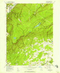
 1969 Kerhonkson1971 Print · USGSThe Rondout Valley in the late sixties reveals a landscape of enduring hamlets and mid-century utility. Genealogists and historians can trace family locations near the Liebhardt Sch, Sages Airfield, and the Delaware Aqueduct.2 unique versions available
 - 1986 Map of Monticello
 1986 Monticello1986 Print · USGSThe Catskills and Shawangunk Ridge meet in the mid-eighties, showing a landscape defined by massive reservoirs and valley towns. Genealogists and researchers can trace the growth of Monticello, Ellenville, and New Paltz alongside landmarks like Mohonk Preserve and Stewart Airport.2 unique versions available
 - 2010 Map of Kerhonkson, 2010 Print
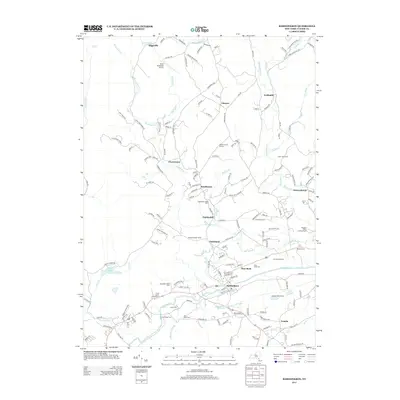
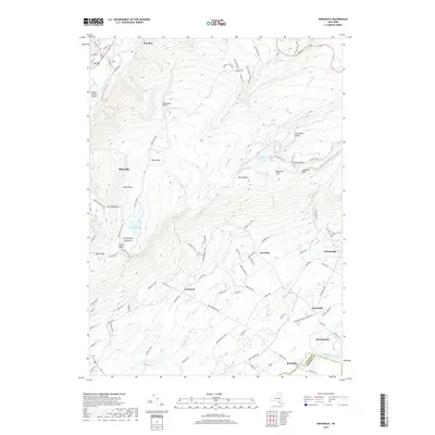
 2010 Kerhonkson2010 Print · USGSCovers Kerhonkson, including Wawarsing, Rochester, and other nearby areas
 - 2010 Map of Napanoch, 2010 Print
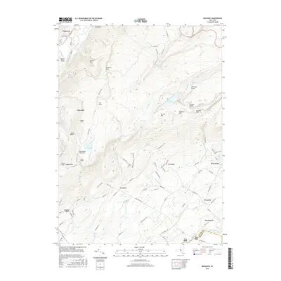
 2010 Napanoch2010 Print · USGSCovers Kerhonkson, including Shawangunk, Wawarsing, and other nearby areas
 - 2013 Map of Napanoch, 2013 Print
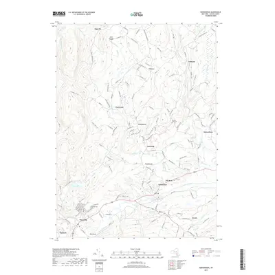
 2013 Napanoch2013 Print · USGSCovers Kerhonkson, including Shawangunk, Wawarsing, and other nearby areas
 - 2013 Map of Kerhonkson, 2013 Print
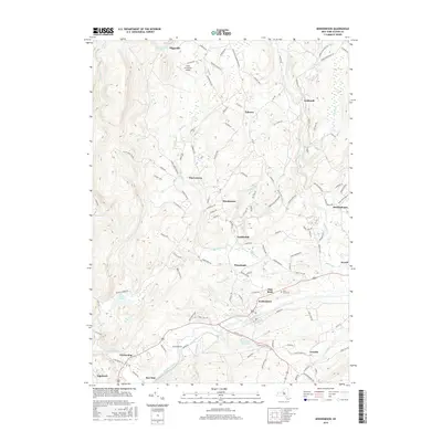
 2013 Kerhonkson2013 Print · USGSCovers Kerhonkson, including Wawarsing, Rochester, and other nearby areas
 - 2016 Map of Napanoch, 2016 Print
 2016 Napanoch2016 Print · USGSCovers Kerhonkson, including Shawangunk, Wawarsing, and other nearby areas
 - 2016 Map of Kerhonkson, 2016 Print
 2016 Kerhonkson2016 Print · USGSCovers Kerhonkson, including Wawarsing, Rochester, and other nearby areas
 - 2019 Map of Kerhonkson, 2019 Print
 2019 Kerhonkson2019 Print · USGSCovers Kerhonkson, including Wawarsing, Rochester, and other nearby areas
 - 2019 Map of Napanoch, 2019 Print
 2019 Napanoch2019 Print · USGSCovers Kerhonkson, including Shawangunk, Wawarsing, and other nearby areas
 - 2023 Map of Kerhonkson, 2023 Print
 2023 Kerhonkson2023 Print · USGSKerhonkson and the Rondout Creek valley are captured here in the early twenty-first century, showing a landscape of dispersed hamlets and mountain waterways. Researchers can locate family landmarks at Rochester Center Cem or trace the path of the Delaware Aqueduct past Pataukunk.
 - 2023 Map of Napanoch, 2023 Print
 2023 Napanoch2023 Print · USGSThe Shawangunk ridge and the Rondout valley define this Ulster County landscape in the early twenty-first century. Researchers can trace the path of the Delaware Aqueduct or locate family-named landmarks like Losees Hill, Sams Point, and the Verkeerder Kill Falls.
End of results
Showing maps 1-25 of 25
Top cities near Kerhonkson
- Newburgh historical maps
- Wallkill historical maps
- Montgomery historical maps
- New Paltz historical maps
- Fallsburg historical maps
- Shawangunk historical maps
See more
Top neighborhoods of Kerhonkson
Frequently asked questions
- What are the different types of historical maps available for Kerhonkson?
- What is the oldest map of Kerhonkson?
- Where can I purchase historical maps of Kerhonkson for my home or office?
- Where can I download high-res historical maps of Kerhonkson?
- Are there historical topographic maps available for Kerhonkson?
- Is there historical aerial imagery available for Kerhonkson?
- Where are historical maps of Kerhonkson sourced from?