Old Maps of Yorktown, New York
Explore 32 old maps of Yorktown, spanning from 1892 to today. These high-resolution historic maps reveal how streets, neighborhoods, landmarks, and natural features evolved over time — perfect for genealogy, metal detecting, research, and local history exploration.
What you can do with these maps:
- See how Yorktown changed over time: Compare historical maps to modern-day views to trace roads, homesites, rail lines & more.
- View detailed metadata: Each map includes creators, publishers, year, scale, and archive source.
- Overlay maps with satellite & LiDAR: Visualize the past alongside modern tools to explore terrain & human change.
- Trusted historical sources: Maps sourced from the USGS, Library of Congress, and other archives.
- Access maps your way: View online, download high-res files, or order prints for personal or research use.
Start exploring old maps of Yorktown to uncover forgotten places, hidden landmarks, and the deep history beneath your feet.
Yorktown, NY maps
(32)- 1892 Map of West Point
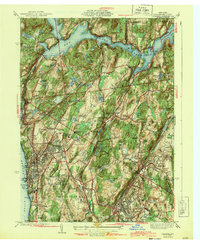
 1892 West Point1892 Print · USGSThe Hudson Highlands and river valley are captured here in the early 1890s, when iron mining and river-side rail travel defined the region. Trace ancestral roots and old landmarks from the military grounds at West Point to the iron operations at Mahopac Mine and the rail hub at Peekskill.
 - 1892 Map of Tarrytown
 1892 Tarrytown1892 Print · USGSThe Hudson River valley in the late nineteenth century was a corridor of engineering and industrial growth. Researchers can trace the path of the Croton Aqueduct, locate the State Prison at Sing Sing, or find family names near Merritts Corners and Samsondale.
 - 1893 Map of Tarrytown
 1893 Tarrytown1893 Print · USGSThe Hudson Valley was a powerhouse of transit and utility in the late 1800s, serving as the corridor for New York’s water and rail networks. Genealogists can trace family names and old landings from Haverstraw to Tarrytown, including features like the State Prison and the massive Croton Dam.3 unique versions available
 - 1894 Map of West Point
 1894 West Point1894 Print · USGSThe Hudson Highlands in the late nineteenth century were a hub of river commerce and rail expansion. Genealogists and local historians can trace the footprint of the West Point military grounds, the industrial Mahopac Mines, and early settlements like Yorktown Heights.3 unique versions available
 - 1899 Map of West Point
 1899 West Point1899 Print · USGSThe Hudson Highlands and military grounds at West Point are detailed in this survey from the closing years of the nineteenth century. Genealogists can trace old family-named sites like Mc Keel Corners or Travis Corners, while historians can locate the Mahopac Mines and the Albany Post Road.
 - 1901 Map of West Point
 1901 West Point1901 Print · USGSThe Hudson Highlands and West Point are shown at the turn of the century, when river railroads and mountain mines defined the local economy. Genealogists can trace family landmarks and hamlets like Nelsonville, Mahopac Mines, and Yorktown Heights.12 unique versions available
 - 1902 Map of Tarrytown
 1902 Tarrytown1902 Print · USGSThe Hudson River valley at the turn of the century shows a landscape of busy river landings and nascent suburbs. Genealogists and historians can trace old homesteads and landmarks like Waldberg Landing, the State Prison at Ossining, and the Croton Aqueduct.11 unique versions available
 - 1936 Map of West Point
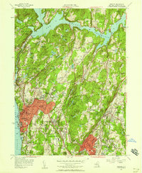
 1936 West Point1936 Print · USGSThe Hudson Highlands in the mid-1930s reveal a landscape of strategic military grounds and evolving state parks. Genealogists and historians can trace old family burial grounds like Halstead Cem, the workings of the Mahopac Mines, and the early layout of West Point.2 unique versions available
 - 1936 Map of Ossining
 1936 Ossining1936 Print · USGSWestchester County in the mid-thirties exhibits a landscape of growing suburban centers and massive public works. Genealogists and historians can trace the foundations of Briarcliff Manor and Pleasantville, alongside landmarks like Sing Sing State Prison and the Croton Dam.
 - 1937 Map of Tarrytown
 1937 Tarrytown1937 Print · USGSThe Hudson River valley during the 1930s serves as a busy corridor of rail, water, and infrastructure. Genealogists and local historians can trace the old landings at Waldberg Landing, the grounds of the State Prison in Ossining, and the rail lines through Nyack.
 - 1941 Map of West Point
 1941 West Point1941 Print · USGSThe Hudson Highlands were undergoing significant change in the years leading up to the war, blending heavy industry with expanding military installations. Genealogists can trace family lines through Continental Village, Hillside Cem, and the various schools like Manitou Sch.3 unique versions available
 - 1943 Map of Ossining
 1943 Ossining1943 Print · USGSMid-century Westchester County comes into focus as the riverfront villages expand into the surrounding hills. Genealogists and historians can trace the grounds of Sing Sing Prison, the Maryknoll Seminary, and the storied Sleepy Hollow Country Club.4 unique versions available
 - 1947 Map of West Point
 1947 West Point1947 Print · USGSThe Hudson Highlands and the Peekskill waterfront are captured just before the post-war boom, showing the critical junction of river, rail, and early parkways. Genealogists can trace family landmarks and burial sites like Cold Spring Cem, Amawalk Cem, and the historic Mahopac Mines.
 - 1947 Map of Hartford, 1955 Print
 1947 Hartford1955 Print · USGSSouthern New England and the Hudson Valley are shown in detail during the post-war expansion era. Genealogists and researchers can trace local landmarks from the State Capitol and Yale University to the Stratford Lighthouse and Woodlawn Cem.2 unique versions available
 - 1948 Map of Hartford
 1948 Hartford1948 Print · USGSSouthern New England is captured here in the late 1940s, showcasing a landscape of thriving industrial cities and developing parkways. Genealogists and historians can trace the rail networks of the New York New Haven and Hartford RR or locate coastal defense sites like Fort Terry and Camp Shanks.2 unique versions available
 - 1955 Map of Ossining, 1958 Print
 1955 Ossining1958 Print · USGSWestchester County's riverfront and wooded interior are shown here during the mid-fifties, just as suburban expansion began to accelerate. Researchers can trace the grounds of Sing Sing Prison, local family landmarks like Barnum Cem, and the historic campus of Briarcliff Manor.2 unique versions available
 - 1956 Map of Mohegan Lake, 1958 Print
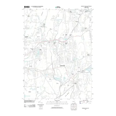
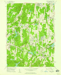 1956 Mohegan Lake1958 Print · USGSWestchester and Putnam counties are captured in the mid-fifties during a period of steady suburban growth around traditional hamlets. Researchers can trace family roots at the Amawalk Hill Cem, locate the Loyola Seminary, or follow the New York Central Railroad.5 unique versions available
 - 1961 Map of Hartford
 1961 Hartford1961 Print · USGSSouthern New England and the Hudson Valley are shown here in the mid-fifties, capturing a landscape of booming coastal cities and interior hill towns. Researchers can trace the legacy of the New York New Haven and Hartford rail corridor and find strategic sites like Camp Shanks and Fort Michie.
 - 1962 Map of Hartford, 1971 Print
 1962 Hartford1971 Print · USGSSouthern New England and the Hudson Valley are shown in the early sixties, as suburban growth reached into the foothills. Trace the path of the New York New Haven & Hartford RR and find landmarks like Camp Nathan Hale and Gillette Castle State Park.3 unique versions available
 - 1965 Map of Hartford
 1965 Hartford1965 Print · USGSSouthern New England and the Hudson Valley are shown here during the mid-sixties expansion of the Interstate era. Trace the path of the New York New Haven & Hartford RR or locate historic landmarks like West Point Military Reservation and the Merritt Parkway.2 unique versions available
 - 1967 Map of Ossining, 1969 Print
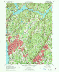 1967 Ossining1969 Print · USGSWestchester County in the mid-sixties reveals a landscape of massive civil engineering and academic institutions. Trace the historic Old Croton Aqueduct, locate the riverside Sing Sing Prison, and explore old landmarks like Maryknoll Seminary and the Emery Mines.4 unique versions available
 - 1986 Map of Bridgeport
 1986 Bridgeport1986 Print · USGSSpanning the New York and Connecticut border in the mid-eighties, this survey shows the dense rail and parkway network connecting the Hudson to the Sound. Researchers can trace the massive New Croton Reservoir system or locate landmarks like the West Point U.S. Military Academy.3 unique versions available
 - 2010 Map of Mohegan Lake, 2010 Print
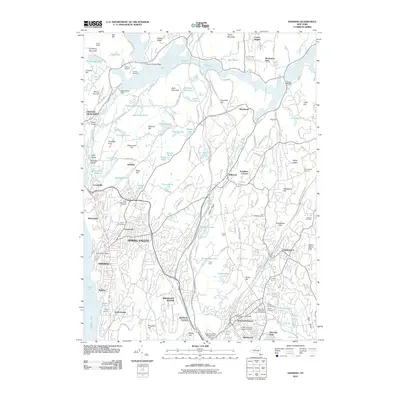
 2010 Mohegan Lake2010 Print · USGSCovers Yorktown, including Cortlandt, Carmel, and other nearby areas
 - 2010 Map of Ossining, 2010 Print
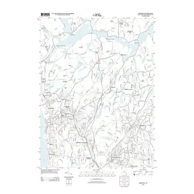
 2010 Ossining2010 Print · USGSCovers Yorktown, including Mount Pleasant, Cortlandt, and other nearby areas
 - 2013 Map of Ossining, 2013 Print
 2013 Ossining2013 Print · USGSCovers Yorktown, including Mount Pleasant, Cortlandt, and other nearby areas
Showing maps 1-25 of 32
Top cities near Yorktown
- Ramapo historical maps
- Stamford historical maps
- Greenburgh historical maps
- Clarkstown historical maps
- Greenwich historical maps
- White Plains historical maps
See more
Top neighborhoods of Yorktown
- Oceola Lake historical maps
- Manhattan Park historical maps
- Croton Heights historical maps
- Kitchawan historical maps
- Jefferson Valley historical maps
- Jefferson Village historical maps
See more
Frequently asked questions
- What are the different types of historical maps available for Yorktown?
- What is the oldest map of Yorktown?
- Where can I purchase historical maps of Yorktown for my home or office?
- Where can I download high-res historical maps of Yorktown?
- Are there historical topographic maps available for Yorktown?
- Is there historical aerial imagery available for Yorktown?
- Where are historical maps of Yorktown sourced from?