Old Maps of South Creek, North Carolina for Metal Detecting
Plan your next treasure hunt with 10 historic maps of South Creek. Find old homesites, ghost towns, trails, and gathering spots that may be lost to time — perfect for identifying promising metal detecting locations.
- Locate forgotten sites: Uncover places like long-lost settlements, abandoned rail lines, or gathering spots.
- Plan better hunts: Use map overlays combined with LiDAR or satellite views to narrow in on historically rich areas.
- Made for detectorists: Thousands of hobbyists use these maps to discover relics, coins, and hidden history.
Use these historic maps to boost your research and find new opportunities beneath the surface of South Creek.
South Creek, NC maps
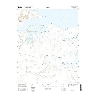
(10)- 1950 Map of South Creek, 1952 Print
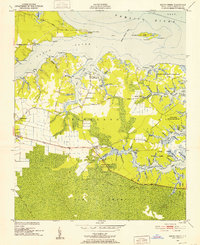 1950 South Creek1952 Print · USGSCoastal Beaufort County at the start of the 1950s reveals a landscape of tidal guts, remote landings, and small rural parishes. Genealogists and local researchers can locate family landmarks such as Alliance Ldg or trace the early boundaries of the Goose Creek State Game Refuge.4 unique versions available
 - 1953 Map of Rocky Mount, 1964 Print
 1953 Rocky Mount1964 Print · USGSEastern North Carolina in the mid-fifties is defined by its deep river basins and the vast wetlands of the Tidewater. Genealogists can trace family roots through hubs like Kinston and New Bern or explore the wilderness of Pettigrew State Park and Lake Mattamuskeet.4 unique versions available
 - 1954 Map of Rocky Mount
 1954 Rocky Mount1954 Print · USGSEastern North Carolina is mapped in the mid-fifties, showing a landscape of sounds, swamps, and steam-era rail lines. Genealogists can trace the rural road networks and rail spurs connecting towns like Tarboro, Greenville, and the remote Columbia.
 - 1985 Map of Bayboro, 1990 Print
 1985 Bayboro1990 Print · USGSCoastal Pamlico and Beaufort counties are shown in the mid-eighties as a maritime landscape of protected wetlands and river-mouth settlements. Researchers can trace the layout of waterfront towns like Oriental, Bayboro, and the historic village of Bath amidst the Pamlico Sound.
 - 2000 Map of South Creek, 2001 Print
 2000 South Creek2001 Print · USGSThe Pamlico River shoreline near the mouth of the South Creek reflects a long history of maritime living at the turn of the millennium. Genealogists can trace family landmarks and river landings like Alliance Ldg, Reads Chapel, and Sandy Landing.
 - 2010 Map of South Creek, 2010 Print
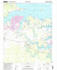
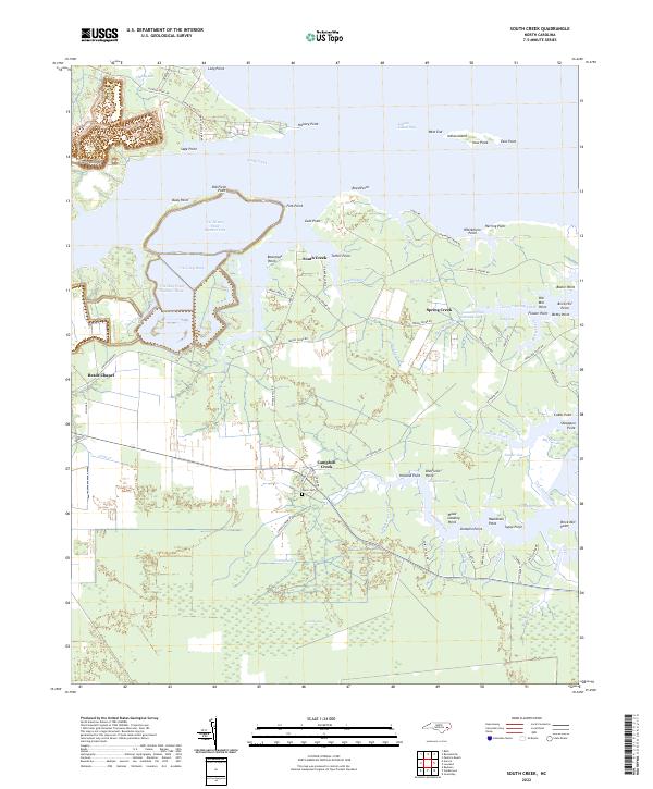
 2010 South Creek2010 Print · USGSCovers South Creek, including Campbell Creek, Reads Chapel, and other nearby areas
 - 2013 Map of South Creek, 2013 Print
 2013 South Creek2013 Print · USGSCovers South Creek, including Campbell Creek, Reads Chapel, and other nearby areas
 - 2016 Map of South Creek, 2016 Print
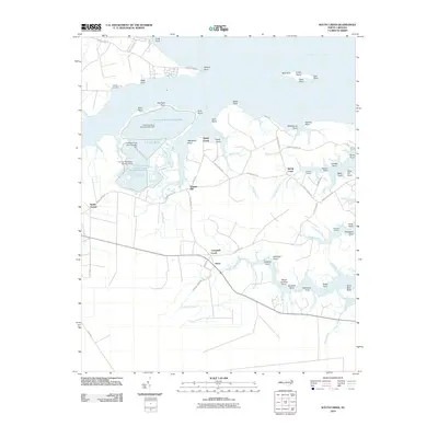
 2016 South Creek2016 Print · USGSCovers South Creek, including Campbell Creek, Reads Chapel, and other nearby areas
 - 2019 Map of South Creek, 2019 Print
 2019 South Creek2019 Print · USGSCovers South Creek, including Campbell Creek, Reads Chapel, and other nearby areas
 - 2022 Map of South Creek, 2022 Print
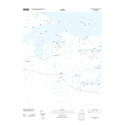
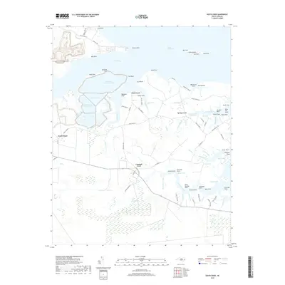
 2022 South Creek2022 Print · USGSCoastal Beaufort County's intricate network of tidal creeks and points is documented here in the early twenty-first century. Researchers can trace family sites like Mixon Cem and Reads Chapel alongside historic landing spots such as Old Mill Point.
End of results
Showing maps 1-10 of 10
Top cities near South Creek
- Belhaven historical maps
- Bayboro historical maps
- Alliance historical maps
- Grantsboro historical maps
- Aurora historical maps
- Stonewall historical maps
See more
Frequently asked questions
- What are the different types of historical maps available for South Creek?
- What is the oldest map of South Creek?
- Where can I purchase historical maps of South Creek for my home or office?
- Where can I download high-res historical maps of South Creek?
- Are there historical topographic maps available for South Creek?
- Is there historical aerial imagery available for South Creek?
- Where are historical maps of South Creek sourced from?