Old Maps of Heritage Heights, North Carolina
Explore 14 old maps of Heritage Heights, spanning from 1948 to today. These high-resolution historic maps reveal how streets, neighborhoods, landmarks, and natural features evolved over time — perfect for genealogy, metal detecting, research, and local history exploration.
What you can do with these maps:
- See how Heritage Heights changed over time: Compare historical maps to modern-day views to trace roads, homesites, rail lines & more.
- View detailed metadata: Each map includes creators, publishers, year, scale, and archive source.
- Overlay maps with satellite & LiDAR: Visualize the past alongside modern tools to explore terrain & human change.
- Trusted historical sources: Maps sourced from the USGS, Library of Congress, and other archives.
- Access maps your way: View online, download high-res files, or order prints for personal or research use.
Start exploring old maps of Heritage Heights to uncover forgotten places, hidden landmarks, and the deep history beneath your feet.
Heritage Heights, NC maps
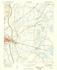
(14)- 1948 Map of Fayetteville, 1954 Print
 1948 Fayetteville1954 Print · USGSFayetteville and its sprawling military neighbor are caught here just after the war, showing the area's mix of urban growth and rural heritage. Genealogists can locate family landmarks like Bonnie Doone and Magnolia Ch, or trace the rails of the Atlantic Coast Line.
 - 1949 Map of Vander
 1949 Vander1949 Print · USGSCumberland County just after the war reveals a landscape of rural schoolhouses and busy rail junctions east of the Cape Fear River. Researchers can locate family landmarks like Armstrong School, Lebanon Missionary Church, and the timber works at Vander.2 unique versions available
 - 1953 Map of Raleigh, 1965 Print
 1953 Raleigh1965 Print · USGSCentral North Carolina in the early sixties shows a landscape of growing towns and military hubs before the full expansion of the interstate system. Genealogists can trace family footprints across the Piedmont through Wake Forest, Siler City, and the large Fort Bragg Military Reservation.4 unique versions available
 - 1954 Map of Raleigh
 1954 Raleigh1954 Print · USGSThe North Carolina Piedmont and Sandhills are captured in the mid-fifties during a period of steady regional growth. Genealogists and historians can trace the development of towns like Siler City or locate landmarks such as Falls of Neuse and Camp Mackall.
 - 1957 Map of Vander, 1960 Print
 1957 Vander1960 Print · USGSCumberland County eastward from the river during the late fifties reveals a landscape of growing suburbs and traditional crossroads. Genealogists can locate family landmarks like Locks Creek Ch, Armstrong Sch, and the community of Eastover.4 unique versions available
 - 1957 Map of Fayetteville, 1961 Print
 1957 Fayetteville1961 Print · USGSThe Cape Fear River valley and Fayetteville's growing suburbs are captured here in the late fifties, showing the expanding footprint of the Fort Bragg Military Reservation. Genealogists can trace early neighborhood development and rural landmarks like Lakedale, Manchester, and Central High Sch.2 unique versions available
 - 1976 Map of Vander, 1978 Print
 1976 Vander1978 Print · USGSFayetteville and its eastern outskirts are captured in the mid-seventies, showing the intersection of urban growth and rural landscapes. Researchers can trace land use patterns and property boundaries near Fayetteville and the settlement of Vander.
 - 1986 Map of Fayetteville
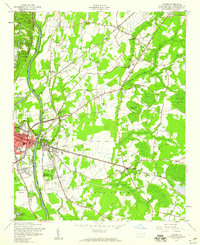
 1986 Fayetteville1986 Print · USGSThe North Carolina coastal plain appears in the mid-1980s as a bustling corridor of military installations and historic tobacco towns. Genealogists and historians can trace the footprints of Fort Bragg Military Reservation, Campbell University, and the rail lines of the Seaboard Coast Line RR.2 unique versions available
 - 1997 Map of Vander, 2000 Print
 1997 Vander2000 Print · USGSThe eastern outskirts of Fayetteville and the community of Vander are shown in the late 1990s as modern highway interchanges began to reshape the landscape. Local historians can trace established landmarks like Cape Fear High School, St Lukes Ch, and the many cemeteries dotting the rural areas of Eastover and Beard.
 - 2010 Map of Vander, 2010 Print
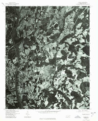
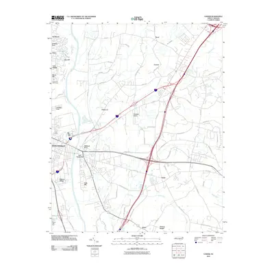 2010 Vander2010 Print · USGSCovers Heritage Heights, including Fayetteville, Beard, and other nearby areas
 - 2013 Map of Vander, 2013 Print
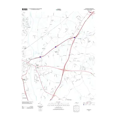 2013 Vander2013 Print · USGSCovers Heritage Heights, including Fayetteville, Beard, and other nearby areas
 - 2016 Map of Vander, 2016 Print
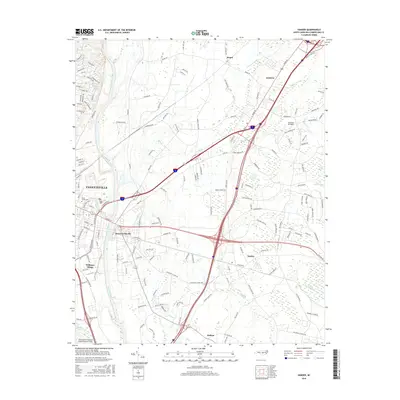 2016 Vander2016 Print · USGSCovers Heritage Heights, including Fayetteville, Beard, and other nearby areas
 - 2019 Map of Vander, 2019 Print
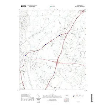 2019 Vander2019 Print · USGSCovers Heritage Heights, including Fayetteville, Beard, and other nearby areas
 - 2022 Map of Vander, 2022 Print
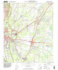
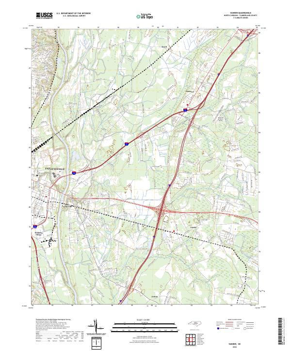 2022 Vander2022 Print · USGSCumberland County at the start of the 2020s shows the expansion of eastern Fayetteville toward Vander and Eastover. Genealogists and local historians can trace the community's roots through Cross Creek Cem, Sunnyside School, and Macedonia Church.
End of results
Showing maps 1-14 of 14
Top cities near Heritage Heights
- Fayetteville historical maps
- Hope Mills historical maps
- Spring Lake historical maps
- Stedman historical maps
- Wade historical maps
- Parkton historical maps
See more
Frequently asked questions
- What are the different types of historical maps available for Heritage Heights?
- What is the oldest map of Heritage Heights?
- Where can I purchase historical maps of Heritage Heights for my home or office?
- Where can I download high-res historical maps of Heritage Heights?
- Are there historical topographic maps available for Heritage Heights?
- Is there historical aerial imagery available for Heritage Heights?
- Where are historical maps of Heritage Heights sourced from?