1970s Maps of Fairmont, Clemmons
Explore 2 historic maps of Fairmont from the 1970s. These maps offer a rare glimpse into what life looked like during the 1970s — showing old roads, neighborhoods, homes, and landmarks that have changed or disappeared over time.
Whether you're researching your family's past, planning a metal detecting trip, or studying how Fairmont's landscape evolved across the 1970s, these high-resolution maps are a powerful tool for exploring the history of this region.
- Focus on a specific era: All maps on this page are from the 1970s, giving you a focused view of this time period.
- See what’s changed: Compare century-old streets, trails, and buildings to today's modern landscape using overlays and satellite layers.
- Research with precision: Use these maps for genealogy, historical research, land use analysis, or educational projects.
- View, download, or print: Maps are fully viewable online in high resolution, and can be downloaded or printed for your own records.
Start exploring Fairmont's history through authentic maps from the 1970s. This is your window into the past.
Fairmont, Clemmons maps
(2)- 1977 Map of Clemmons, 1979 Print
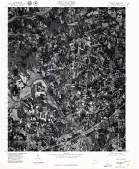 1977 Clemmons1979 Print · USGSThe northern Piedmont and the winding Yadkin River appear in detailed aerial photography from the late seventies. Researchers can trace property lines and the early footprints of settlements like Lewisville, Grapewood, and Hillsdale.
 - 1977 Map of Winston-Salem West, 1979 Print
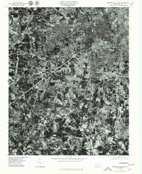 1977 Winston-Salem West1979 Print · USGSWinston-Salem and its western suburbs appear in striking detail during the late seventies as the city expanded toward the outskirts. Genealogists and local researchers can trace specific street layouts and property boundaries in neighborhoods like Ardmore, Clemmons, and Reynolda.
End of results
Showing maps 1-2 of 2
Frequently asked questions
- What are the different types of historical maps available for Fairmont?
- What is the oldest map of Fairmont?
- Where can I purchase historical maps of Fairmont for my home or office?
- Where can I download high-res historical maps of Fairmont?
- Are there historical topographic maps available for Fairmont?
- Is there historical aerial imagery available for Fairmont?
- Where are historical maps of Fairmont sourced from?