1990s Maps of Cherryville, North Carolina
Explore 3 historic maps of Cherryville from the 1990s. These maps offer a rare glimpse into what life looked like during the 1990s — showing old roads, neighborhoods, homes, and landmarks that have changed or disappeared over time.
Whether you're researching your family's past, planning a metal detecting trip, or studying how Cherryville's landscape evolved across the 1990s, these high-resolution maps are a powerful tool for exploring the history of this region.
- Focus on a specific era: All maps on this page are from the 1990s, giving you a focused view of this time period.
- See what’s changed: Compare century-old streets, trails, and buildings to today's modern landscape using overlays and satellite layers.
- Research with precision: Use these maps for genealogy, historical research, land use analysis, or educational projects.
- View, download, or print: Maps are fully viewable online in high resolution, and can be downloaded or printed for your own records.
Start exploring Cherryville's history through authentic maps from the 1990s. This is your window into the past.
Cherryville, NC maps
(3)- 1991 Map of Gastonia
 1991 Gastonia1991 Print · USGSThe Piedmont region along the North Carolina and South Carolina border shows a bustling industrial and transit corridor in the early nineties. Researchers can trace the sprawling footprints of Gastonia and Shelby or explore the grounds of Kings Mountain National Military Park and Lake Wylie.
 - 1993 Map of Bessemer City, 1996 Print
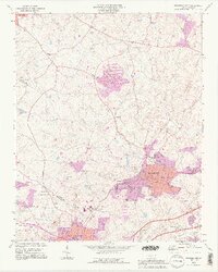 1993 Bessemer City1996 Print · USGSGaston and Cleveland counties are captured in the early nineties, showcasing the industrial growth of Bessemer City and its surrounding rural communities. Genealogists can trace family roots through numerous country churches like Mt Pisgah Ch and Hephzibah Ch or locate the Rhynes Airfield and local mines.2 unique versions available
 - 1993 Map of Lincolnton West, 1996 Print
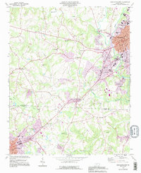 1993 Lincolnton West1996 Print · USGSLincoln County and the surrounding countryside appear in the early 1990s as the urban center of Lincolnton expands toward its rural neighbors. Trace family roots at Howards Creek Ch, explore the industrial history of Laboratory, or locate vanished landmarks like Bethphage Ch and Crouse.
End of results
Showing maps 1-3 of 3
Top cities near Cherryville
- Gastonia historical maps
- Shelby historical maps
- Lincolnton historical maps
- Kings Mountain historical maps
- Bessemer City historical maps
- Dallas historical maps
See more
Top neighborhoods of Cherryville
Frequently asked questions
- What are the different types of historical maps available for Cherryville?
- What is the oldest map of Cherryville?
- Where can I purchase historical maps of Cherryville for my home or office?
- Where can I download high-res historical maps of Cherryville?
- Are there historical topographic maps available for Cherryville?
- Is there historical aerial imagery available for Cherryville?
- Where are historical maps of Cherryville sourced from?