Old Maps of Cove, North Carolina for Genealogy
Trace your family roots with 16 historic maps of Cove. These high-res maps reveal old neighborhoods, homesites, landmarks, and streets — helping you uncover where your ancestors lived and how the area evolved over time.
- Explore historic neighborhoods: Identify where your relatives may have lived in the 1800s or 1900s.
- Compare maps over time: Trace the changes in streets, buildings, and landmarks for multi-generational research.
- Perfect for genealogy & ancestry research: Used by family historians and researchers to map out lineage and migration.
These maps are an incredible resource for exploring your personal connection to Cove's past.
Cove, NC maps
(16)- 1894 Map of Asheville
 1894 Asheville1894 Print · USGSAsheville and the French Broad River valley are shown here in the 1890s, when rail travel was transforming the Southern Appalachians. Genealogists can locate family landmarks like Gudgers Mill, Pendletons Mill, and the early development of Biltmore.2 unique versions available
 - 1901 Map of Asheville
 1901 Asheville1901 Print · USGSWestern North Carolina at the turn of the century shows a mountain landscape adapting to the arrival of major railroads. Genealogists and historians can trace family-named peaks and early communities like Mars Hill, Hot Springs, and the estates at Biltmore.9 unique versions available
 - 1936 Map of Hepco
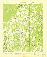 1936 Hepco1936 Print · USGSHaywood and Madison counties are captured here in the mid-1930s, showing a landscape of high ridges and rural valley communities. Genealogists can trace family roots through landmarks like James Chapel Sch, Belmont Ch, and the settlement of Hepco near the Hepco Dam.
 - 1941 Map of Hepco, 1957 Print
 1941 Hepco1957 Print · USGSWestern North Carolina's high country during the early 1940s shows a landscape of isolated mountain coves and tight-knit communities. Researchers can locate the early centers of local life at Fines Creek Ch, the settlement of Hepco, and the high ridges of Sandymush Bald.
 - 1942 Map of Hepco
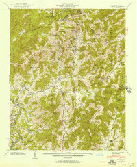
 1942 Hepco1942 Print · USGSNorth Carolina's high mountain hollows are documented here during the early 1940s, showing the intersection of three counties and the Pisgah National Forest. Genealogists can locate community centers like Fines Creek Sch, James Chapel, and the isolated Pine Grove Cem.2 unique versions available
 - 1955 Map of Knoxville
 1955 Knoxville1955 Print · USGSThe Southern Appalachians and the Smoky Mountains are shown here at a peak of mid-century development and conservation. Genealogists and historians can trace the early road networks connecting Gatlinburg, Waynesville, and the Cherokee Indian Reservation across the high ridges.
 - 1957 Map of Knoxville, 1966 Print
 1957 Knoxville1966 Print · USGSThe Southern Appalachians of Tennessee and North Carolina are mapped here during the mid-twentieth century as new highways reached the high country. Genealogists and historians can trace the topography between Knoxville and Asheville, locating family landmarks near Fontana Lake or along the Blue Ridge Parkway.4 unique versions available
 - 1960 Map of Knoxville
 1960 Knoxville1960 Print · USGSThe Southern Appalachians come alive in the 1950s, showing the intersection of new national park tourism and deep-rooted mountain industry. Trace old rail lines like the Clinchfield RR and find high-altitude landmarks from Mt Le Conte to the Cherokee Indian Reservation.2 unique versions available
 - 1964 Map of Knoxville
 1964 Knoxville1964 Print · USGSThe Southern Appalachians and Great Smokies are captured here during the mid-sixties, showing the rugged borderlands of Tennessee and North Carolina. Researchers can trace historic mountain routes like U S 441, the expanse of Pisgah National Forest, and the growing footprints of Asheville and Knoxville.
 - 1967 Map of Fines Creek, 1970 Print
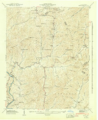
 1967 Fines Creek1970 Print · USGSThe mountain coves of Haywood and Madison counties are captured here in the late sixties, showcasing the deeply rooted communities of the Blue Ridge. Researchers can locate numerous family burial sites and country churches, including Belmont Ch Cem, James Chapel, and Fines Cem.3 unique versions available
 - 1985 Map of Asheville
 1985 Asheville1985 Print · USGSWestern North Carolina during the mid-eighties shows a region of deep mountain heritage and expanding highway networks. Genealogists and historians can trace the foundations of Asheville alongside older rail corridors like the Clinchfield Railroad and the high elevations of Mount Mitchell.2 unique versions available
 - 2011 Map of Fines Creek, 2011 Print
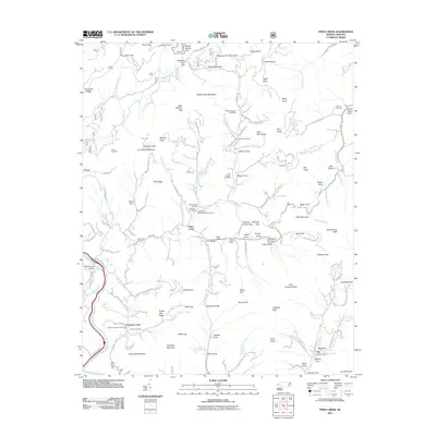 2011 Fines Creek2011 Print · USGSCovers Cove, including Fines Creek, Panther Creek, and other nearby areas
 - 2013 Map of Fines Creek, 2013 Print
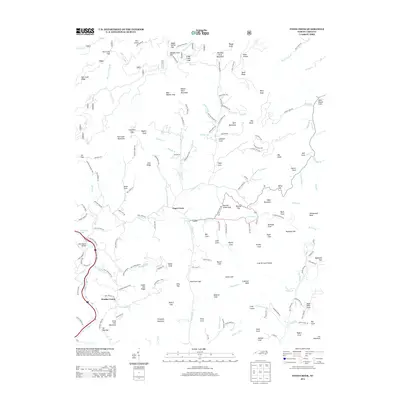 2013 Fines Creek2013 Print · USGSCovers Cove, including Fines Creek, Panther Creek, and other nearby areas
 - 2016 Map of Fines Creek, 2016 Print
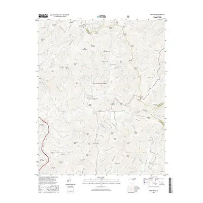 2016 Fines Creek2016 Print · USGSCovers Cove, including Fines Creek, Panther Creek, and other nearby areas
 - 2019 Map of Fines Creek, 2019 Print
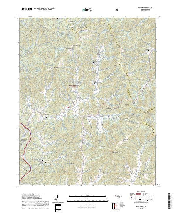
 2019 Fines Creek2019 Print · USGSCovers Cove, including Fines Creek, Panther Creek, and other nearby areas
 - 2022 Map of Fines Creek, 2022 Print
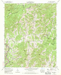
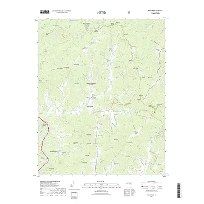
 2022 Fines Creek2022 Print · USGSHaywood County’s high-country settlements and family homesteads are documented here as they appeared in the early 2020s. Genealogists can locate numerous family burial grounds like the Woody Cem and Noland Cem alongside the historic Fines Creek community.
End of results
Showing maps 1-16 of 16
Top cities near Cove
- Waynesville historical maps
- Canton historical maps
- Clyde historical maps
- Maggie Valley historical maps
- Hot Springs historical maps
Frequently asked questions
- What are the different types of historical maps available for Cove?
- What is the oldest map of Cove?
- Where can I purchase historical maps of Cove for my home or office?
- Where can I download high-res historical maps of Cove?
- Are there historical topographic maps available for Cove?
- Is there historical aerial imagery available for Cove?
- Where are historical maps of Cove sourced from?