Old Maps of Clayton, North Carolina
Explore 35 old maps of Clayton, spanning from 1953 to today. These high-resolution historic maps reveal how streets, neighborhoods, landmarks, and natural features evolved over time — perfect for genealogy, metal detecting, research, and local history exploration.
What you can do with these maps:
- See how Clayton changed over time: Compare historical maps to modern-day views to trace roads, homesites, rail lines & more.
- View detailed metadata: Each map includes creators, publishers, year, scale, and archive source.
- Overlay maps with satellite & LiDAR: Visualize the past alongside modern tools to explore terrain & human change.
- Trusted historical sources: Maps sourced from the USGS, Library of Congress, and other archives.
- Access maps your way: View online, download high-res files, or order prints for personal or research use.
Start exploring old maps of Clayton to uncover forgotten places, hidden landmarks, and the deep history beneath your feet.
Clayton, NC maps
(35)- 1953 Map of Raleigh, 1965 Print
 1953 Raleigh1965 Print · USGSCentral North Carolina in the early sixties shows a landscape of growing towns and military hubs before the full expansion of the interstate system. Genealogists can trace family footprints across the Piedmont through Wake Forest, Siler City, and the large Fort Bragg Military Reservation.4 unique versions available
 - 1954 Map of Raleigh
 1954 Raleigh1954 Print · USGSThe North Carolina Piedmont and Sandhills are captured in the mid-fifties during a period of steady regional growth. Genealogists and historians can trace the development of towns like Siler City or locate landmarks such as Falls of Neuse and Camp Mackall.
 - 1964 Map of Garner, 1965 Print
 1964 Garner1965 Print · USGSGarner and the surrounding townships of Wake County are shown in the mid-sixties as the rail-side communities began to expand. Researchers can locate family landmarks and rural hubs like Hayes Chapel, Rand Cem, and the State Agriculture Experiment Station near Clayton.4 unique versions available
 - 1964 Map of Selma, 1965 Print
 1964 Selma1965 Print · USGSEastern Johnston County flourished as a rail and river hub in the mid-sixties, dominated by the crossing of the Neuse River. Researchers can trace old family sites and crossroads from Archers Lodge to Pine Level, including the Harrison High Sch and Branch Chapel.
 - 1964 Map of Clayton, 1965 Print
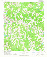
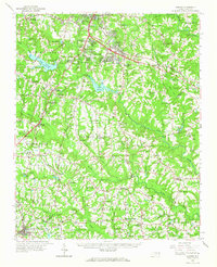
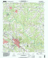
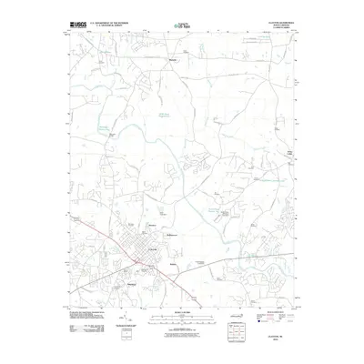
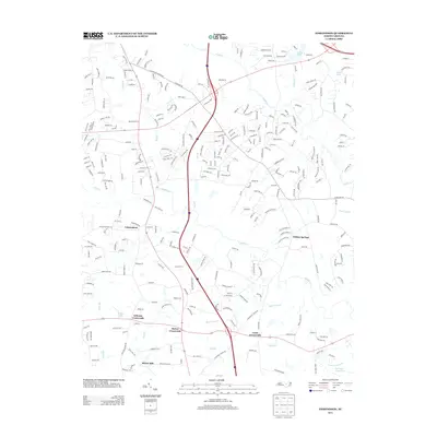
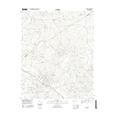
 1964 Clayton1965 Print · USGSThe Neuse River valley in Johnston and Wake Counties is captured here in the mid-1960s, showing the early expansion of the Clayton area. Researchers can locate numerous family burial sites like Stephenson Cem and rural centers such as Archers Lodge and Shotwell.3 unique versions available
 - 1964 Map of Edmondson, 1965 Print
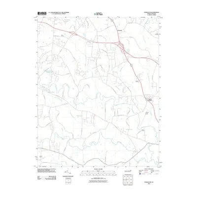
 1964 Edmondson1965 Print · USGSJohnston County in the early sixties was a landscape of crossroads communities and family-run mills. Genealogists can locate specific family landmarks such as Penny Cem, trace the waters near McGee Mill, and find vanished gathering spots like Drug Store.3 unique versions available
 - 1964 Map of Garner, 1965 Print
 1964 Garner1965 Print · USGSThe rural landscapes south of Raleigh were transitioning from farm to suburb in the mid-sixties. Researchers can trace family roots at numerous country churches like Wooten Chapel Ch or locate sites such as McCullers, Willow Springs, and the historic McGee Mill.
 - 1964 Map of Powhatan, 1965 Print
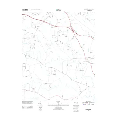
 1964 Powhatan1965 Print · USGSJohnston County's rural landscape is captured here in the mid-sixties, showing a community organized around country churches and winding creek bottoms. Researchers can trace family sites near Elizabeth Ch, Short Journey Sch, and the Southern railroad line.3 unique versions available
 - 1984 Map of Raleigh, 1985 Print
 1984 Raleigh1985 Print · USGSThe North Carolina Research Triangle is shown during a decade of rapid growth, from the sprawl of Raleigh to the expanding waters of Falls Lake. Genealogists and historians can trace rail lines like the Seaboard Coast Line or locate landmark sites like Dorothea Dix State Hospital and Fuquay-Varina.
 - 1990 Map of Raleigh, 1991 Print
 1990 Raleigh1991 Print · USGSGreater Raleigh and the Research Triangle entered a period of significant suburban growth during the 1990s. Researchers can trace the development of towns like Fuquay-Varina and Wake Forest or locate landmarks such as the State Prison and Harris Reservoir.2 unique versions available
 - 1993 Map of Edmondson, 1999 Print
 1993 Edmondson1999 Print · USGSJohnston County in the early nineties shows a landscape of traditional crossroads and family farms adapting to modern highway growth. Genealogists can locate numerous family burial sites like Penny Cem and Honeycutt Cem, or trace the rural economy at McGee Mill and Edmondson.
 - 1993 Map of Powhatan, 1999 Print
 1993 Powhatan1999 Print · USGSCoastal plain communities south of Powhatan are shown here in the 1990s as the area transitioned between rural farmland and suburban growth. Genealogists and historians can trace local landmarks like Short Journey Sch, Powhatan Ch, and Whitley Heights.
 - 1993 Map of Clayton, 1999 Print
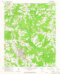
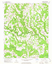
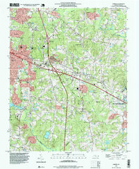
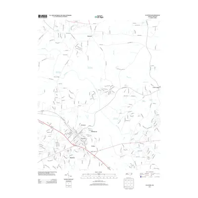
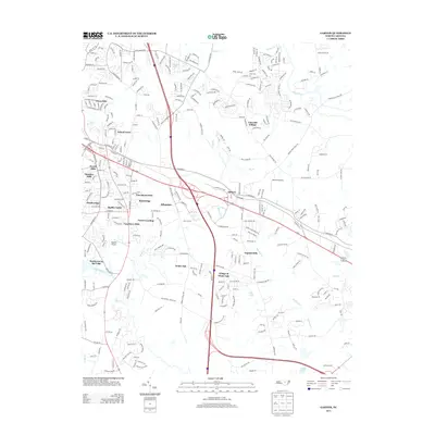
 1993 Clayton1999 Print · USGSMid-century Johnston and Wake counties come alive here, showing the river-and-rail economy as it stood before modern suburban expansion. Genealogists can trace family roots through numerous local landmarks, from Cooper High Sch to the quiet Stephenson Cem and Clydes Chapel.
 - 1993 Map of Garner, 1999 Print
 1993 Garner1999 Print · USGSWake County undergoes a period of rapid suburban expansion in the 1990s as the suburbs of the state capital extend southward. Genealogists and historians can trace numerous family landmarks like Mitchiner Cem and Sauls Cem or the local roots of Auburn and Emerald Village.
 - 2002 Map of Garner, 2004 Print
 2002 Garner2004 Print · USGSGarner and southeast Raleigh are shown here just after the turn of the millennium as modern subdivisions began to surround traditional agricultural research lands. Researchers can trace family history through local landmarks like Hayes Chapel, Smith Cem, and the settlement of Auburn.
 - 2010 Map of Garner, 2010 Print
 2010 Garner2010 Print · USGSCovers Clayton, including Raleigh, Garner, and other nearby areas
 - 2010 Map of Clayton, 2010 Print
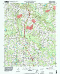
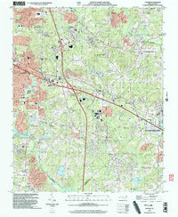
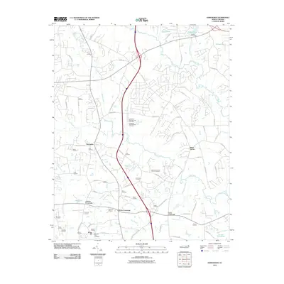
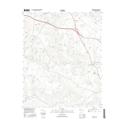
 2010 Clayton2010 Print · USGSCovers Clayton, including Archer Lodge, Shotwell, and other nearby areas
 - 2010 Map of Powhatan, 2010 Print
 2010 Powhatan2010 Print · USGSCovers Clayton, including Smithfield, Whitley Heights, and other nearby areas
 - 2010 Map of Edmondson, 2010 Print
 2010 Edmondson2010 Print · USGSCovers Clayton, including Johnson Crossroads, McGee Mill, and other nearby areas
 - 2013 Map of Clayton, 2013 Print
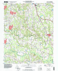
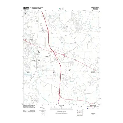
 2013 Clayton2013 Print · USGSCovers Clayton, including Archer Lodge, Shotwell, and other nearby areas
 - 2013 Map of Edmondson, 2013 Print
 2013 Edmondson2013 Print · USGSCovers Clayton, including Johnson Crossroads, McGee Mill, and other nearby areas
 - 2013 Map of Powhatan, 2013 Print
 2013 Powhatan2013 Print · USGSCovers Clayton, including Smithfield, Whitley Heights, and other nearby areas
 - 2013 Map of Garner, 2013 Print
 2013 Garner2013 Print · USGSCovers Clayton, including Raleigh, Garner, and other nearby areas
 - 2016 Map of Powhatan, 2016 Print
 2016 Powhatan2016 Print · USGSCovers Clayton, including Smithfield, Whitley Heights, and other nearby areas
 - 2016 Map of Clayton, 2016 Print
 2016 Clayton2016 Print · USGSCovers Clayton, including Archer Lodge, Shotwell, and other nearby areas
Showing maps 1-25 of 35
Top cities near Clayton
- Raleigh historical maps
- Garner historical maps
- Smithfield historical maps
- Wendell historical maps
- Zebulon historical maps
- Selma historical maps
See more
Top neighborhoods of Clayton
- Country Estates historical maps
- Rollingwood historical maps
- Stallings Mill Apartment Homes historical maps
- Walden historical maps
- Brigadoon historical maps
- Riverwood historical maps
See more
Frequently asked questions
- What are the different types of historical maps available for Clayton?
- What is the oldest map of Clayton?
- Where can I purchase historical maps of Clayton for my home or office?
- Where can I download high-res historical maps of Clayton?
- Are there historical topographic maps available for Clayton?
- Is there historical aerial imagery available for Clayton?
- Where are historical maps of Clayton sourced from?