
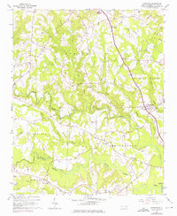
1964 Map of Powhatan
USGS Topo · Published 1965About this map
Swift Creek and Middle Creek wind through the heart of Johnston County in this mid-1960s survey, illustrating a landscape defined by small rural settlements and an extensive network of country churches. The area's social fabric is visible through landmarks such as Short Journey Sch and numerous congregations including Elizabeth Ch, Johnston Union Ch, and Sanders Grove Ch. The map captures the agricultural and residential transition of the region, where older family-named cemeteries like Barham Cem and Langdon Cem sit near the newer developments of Whitley Heights. Industrial infrastructure is represented by the Southern railroad line and a major pipeline corridor that cuts across the northern terrain. In the southeast, the confluence of several branches leads toward the Neuse River, near the established town boundaries of Smithfield.
Find a feature on this map
41 named features on this map. Tap any name to fly to it.
Don’t see what you’re looking for? This feature index may not catch every label — zoom into the map to look around manually.
Map Details
Editions of this 1964 Powhatan Map
3 editions found
Other maps of this area

1906 · Four Oaks
USGS Topo · 1:48,000

1908 · Four Oaks
USGS Topo · 1:62,500

1953 · Raleigh
USGS Topo · 1:250,000

1954 · Raleigh
USGS Topo · 1:250,000

1964 · Garner
USGS Topo · 1:24,000

1964 · Flowers
USGS Topo · 1:24,000

1964 · Selma
USGS Topo · 1:62,500

1964 · Clayton
USGS Topo · 1:24,000

1964 · Edmondson
USGS Topo · 1:24,000

1964 · Garner
USGS Topo · 1:62,500