
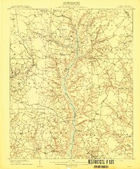
1906 Map of Four Oaks
USGS Topo · Published 1906About this map
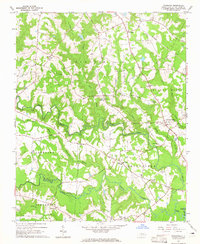
Smithfield serves as the northern anchor for this 1906 survey, which highlights the agrarian landscape of Johnston County before modern development. The Atlantic Coast Line Railroad cuts a diagonal path through the terrain, connecting Four Oaks to the regional rail network and defining the local shipping economy. Along the Neuse River, historic crossings like Pierce's Ferry and West Ferry remained vital links in an era when river transport still complemented the growing overland routes.
Find a feature on this map
69 named features on this map. Tap any name to fly to it.
Don’t see what you’re looking for? This feature index may not catch every label — zoom into the map to look around manually.
Map Details
Editions of this 1906 Four Oaks Map
This is the sole edition of this map. No revisions or reprints were ever made.
Other maps of this area

1902 · Kenly
USGS Topo · 1:62,500

1903 · Kenly
USGS Topo · 1:62,500

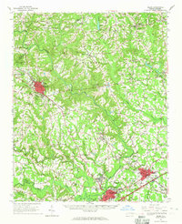
1908 · Four Oaks
USGS Topo · 1:62,500
1909 · Coharie
USGS Topo · 1:62,500

1953 · Raleigh
USGS Topo · 1:250,000

1954 · Raleigh
USGS Topo · 1:250,000
1964 · Selma
USGS Topo · 1:62,500
1964 · Edmondson
USGS Topo · 1:24,000
1964 · Garner
USGS Topo · 1:62,500
1964 · Powhatan
USGS Topo · 1:24,000