Old Maps of Newton Grove, North Carolina
Explore 34 old maps of Newton Grove, spanning from 1906 to today. These high-resolution historic maps reveal how streets, neighborhoods, landmarks, and natural features evolved over time — perfect for genealogy, metal detecting, research, and local history exploration.
What you can do with these maps:
- See how Newton Grove changed over time: Compare historical maps to modern-day views to trace roads, homesites, rail lines & more.
- View detailed metadata: Each map includes creators, publishers, year, scale, and archive source.
- Overlay maps with satellite & LiDAR: Visualize the past alongside modern tools to explore terrain & human change.
- Trusted historical sources: Maps sourced from the USGS, Library of Congress, and other archives.
- Access maps your way: View online, download high-res files, or order prints for personal or research use.
Start exploring old maps of Newton Grove to uncover forgotten places, hidden landmarks, and the deep history beneath your feet.
Newton Grove, NC maps
(34)- 1906 Map of Four Oaks
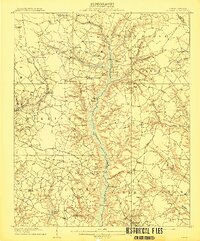
 1906 Four Oaks1906 Print · USGSCoastal plain farming and river commerce define Johnston County at the turn of the century. Genealogists can locate family landmarks like Tarts Store and Bentonville (Beasley PO), alongside historic river crossings at Pierce's Ferry.
 - 1908 Map of Four Oaks
 1908 Four Oaks1908 Print · USGSJohnston County’s agrarian landscape is captured here in the years following the turn of the century, centered on the rail commerce of Four Oaks. Researchers can trace the heritage of local families through landmarks like Peacocks Crossroads, Lees Mill, and Wentworth School.3 unique versions available
 - 1909 Map of Coharie
 1909 Coharie1909 Print · USGSSampson County at the turn of the century is a landscape of creek-side millponds and rural crossroads. Genealogists can trace family roots through numerous local landmarks like Owen Grove Church, Wilsons Store, and Enterprise School.3 unique versions available
 - 1953 Map of Raleigh, 1965 Print
 1953 Raleigh1965 Print · USGSCentral North Carolina in the early sixties shows a landscape of growing towns and military hubs before the full expansion of the interstate system. Genealogists can trace family footprints across the Piedmont through Wake Forest, Siler City, and the large Fort Bragg Military Reservation.4 unique versions available
 - 1954 Map of Raleigh
 1954 Raleigh1954 Print · USGSThe North Carolina Piedmont and Sandhills are captured in the mid-fifties during a period of steady regional growth. Genealogists and historians can trace the development of towns like Siler City or locate landmarks such as Falls of Neuse and Camp Mackall.
 - 1986 Map of Peacocks Crossroads
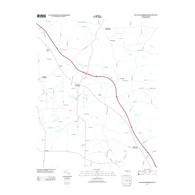
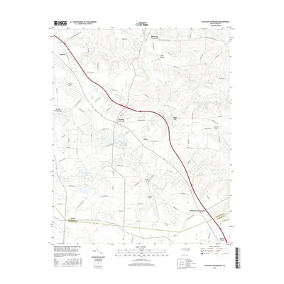
 1986 Peacocks Crossroads1986 Print · USGSCoastal plain farming and wetland communities thrive in Johnston County during the mid-1980s. Genealogists and local historians can trace family landmarks and rural congregations, including Barefoot Cem, Holly Grove Ch, and Peacocks Crossroads.2 unique versions available
 - 1986 Map of Timothy
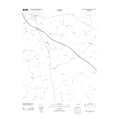
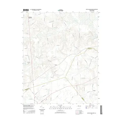
 1986 Timothy1986 Print · USGSSampson County's rural landscape is captured here in the mid-1980s, showcasing a network of family-named crossroads and country churches. Genealogists can trace local roots at Roanoke Chapel, Vann Crossroads, and the grounds of Midway High Sch.
 - 1986 Map of Newton Grove South
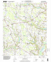
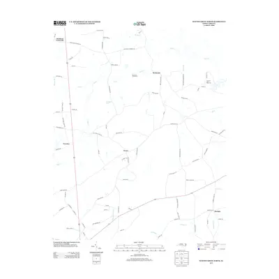
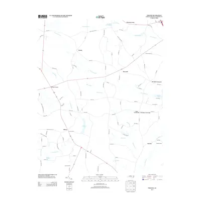
 1986 Newton Grove South1986 Print · USGSSampson County in the mid-1980s reveals a rural landscape shaped by ancient watercourses and deep-rooted church communities. Genealogists can trace family footprints through numerous crossroads and landmarks like Monks Crossroads, Hobbton, and Marys Chapel.
 - 1986 Map of Newton Grove North
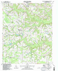
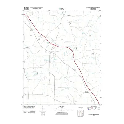
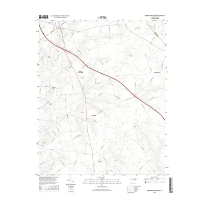
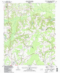 1986 Newton Grove North1986 Print · USGSCoastal Plain farmland meets civil war history in this mid-1980s survey of the Johnston and Sampson county border. Genealogists can trace family landmarks and rural congregations like Strickland Crossroads, Bentonville, and Antioch Ch.
 - 1986 Map of Fayetteville
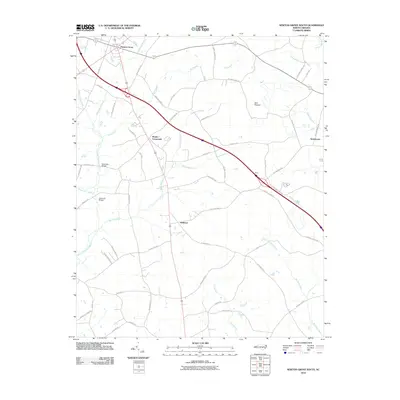
 1986 Fayetteville1986 Print · USGSThe North Carolina coastal plain appears in the mid-1980s as a bustling corridor of military installations and historic tobacco towns. Genealogists and historians can trace the footprints of Fort Bragg Military Reservation, Campbell University, and the rail lines of the Seaboard Coast Line RR.2 unique versions available
 - 1997 Map of Newton Grove North, 2000 Print
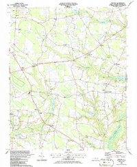
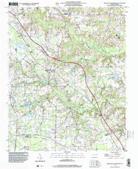
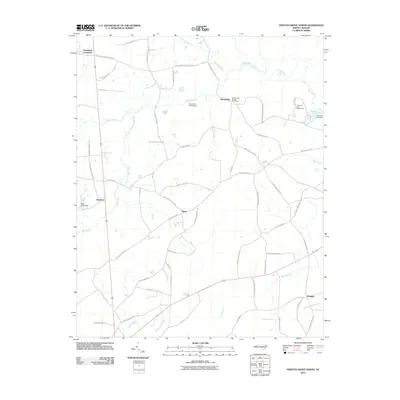
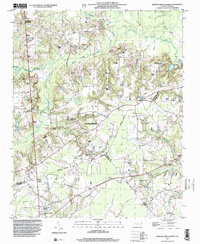 1997 Newton Grove North2000 Print · USGSThe rural borderlands of Johnston, Sampson, and Wayne counties are captured here in the late nineties, centered on the significant Bentonville Battleground. Researchers can trace the layout of Newton Grove or locate family-named landmarks and rural congregations like Ebenezer Ch and St John Ch.
 - 1997 Map of Timothy, 2000 Print
 1997 Timothy2000 Print · USGSSampson County's rural character and family-held lands are preserved in this late-nineties survey of the North Carolina coastal plain. Researchers can locate numerous small-town landmarks and cemeteries near Spiveys Corner, Midway, and Blackmans Grove Ch.
 - 1997 Map of Newton Grove South, 2000 Print
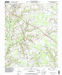 1997 Newton Grove South2000 Print · USGSSampson County settlement patterns are well-defined in the late nineties, centered on the crossroads at Newton Grove. Genealogists can trace family connections through numerous rural landmarks like St Matthew Ch, Hobton, and Marys Chapel.
 - 1997 Map of Peacocks Crossroads, 2000 Print
 1997 Peacocks Crossroads2000 Print · USGSCoastal plain crossroads and agricultural lands in the late nineties show a community woven through wetlands and family farms. Researchers can trace rural genealogy and landmarks through Peacocks Crossroads, the Meadow School, and Massengill Airport.
 - 2010 Map of Newton Grove North, 2010 Print
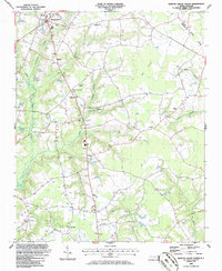
 2010 Newton Grove North2010 Print · USGSCovers Newton Grove, including Stricklands Crossroads, Overshot, and other nearby areas
 - 2010 Map of Newton Grove South, 2010 Print
 2010 Newton Grove South2010 Print · USGSCovers Newton Grove, including Monks Crossroads, Hobbton, and other nearby areas
 - 2010 Map of Timothy, 2010 Print
 2010 Timothy2010 Print · USGSCovers Newton Grove, including Vann Crossroads, Rosin Hill, and other nearby areas
 - 2010 Map of Peacocks Crossroads, 2010 Print
 2010 Peacocks Crossroads2010 Print · USGSCovers Newton Grove, including Peacocks Crossroads, Glenwood Crossroads, and other nearby areas
 - 2013 Map of Newton Grove North, 2013 Print
 2013 Newton Grove North2013 Print · USGSCovers Newton Grove, including Stricklands Crossroads, Overshot, and other nearby areas
 - 2013 Map of Peacocks Crossroads, 2013 Print
 2013 Peacocks Crossroads2013 Print · USGSCovers Newton Grove, including Peacocks Crossroads, Glenwood Crossroads, and other nearby areas
 - 2013 Map of Newton Grove South, 2013 Print
 2013 Newton Grove South2013 Print · USGSCovers Newton Grove, including Monks Crossroads, Hobbton, and other nearby areas
 - 2013 Map of Timothy, 2013 Print
 2013 Timothy2013 Print · USGSCovers Newton Grove, including Vann Crossroads, Rosin Hill, and other nearby areas
 - 2016 Map of Newton Grove South, 2016 Print
 2016 Newton Grove South2016 Print · USGSCovers Newton Grove, including Monks Crossroads, Hobbton, and other nearby areas
 - 2016 Map of Peacocks Crossroads, 2016 Print
 2016 Peacocks Crossroads2016 Print · USGSCovers Newton Grove, including Peacocks Crossroads, Glenwood Crossroads, and other nearby areas
 - 2016 Map of Newton Grove North, 2016 Print
 2016 Newton Grove North2016 Print · USGSCovers Newton Grove, including Stricklands Crossroads, Overshot, and other nearby areas
Showing maps 1-25 of 34
Top cities near Newton Grove
- Smithfield historical maps
- Dunn historical maps
- Clinton historical maps
- Benson historical maps
- Four Oaks historical maps
- Princeton historical maps
See more
Frequently asked questions
- What are the different types of historical maps available for Newton Grove?
- What is the oldest map of Newton Grove?
- Where can I purchase historical maps of Newton Grove for my home or office?
- Where can I download high-res historical maps of Newton Grove?
- Are there historical topographic maps available for Newton Grove?
- Is there historical aerial imagery available for Newton Grove?
- Where are historical maps of Newton Grove sourced from?